McKenzie County is a county in the U.S. state of North Dakota. As of the 2020 census, the population was 14,704. Its county seat is Watford City.

Dunn County is a county in the U.S. state of North Dakota. As of the 2020 census, the population was 4,095. Its county seat is Manning.

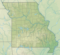
Wright County is a county located in the southern portion of the U.S. state of Missouri. As of the 2020 census, the population was 18,188. Its county seat is Hartville. The county was officially organized on January 29, 1841, and is named after Silas Wright, a former Congressman, U.S. Senator and Governor of New York.

St. Francois County is a county in the Lead Belt region in the U.S. state of Missouri. At the 2020 census, the population was 66,922. The largest city and county seat is Farmington. The county was officially organized on December 19, 1821. It was named after the St. Francis River. The origin of the river's name is unclear. It may refer to St. Francis of Assisi. Another possibility is that Jacques Marquette, a Jesuit who explored the region in 1673, named the river for the Jesuit missionary Francis Xavier; Marquette had spent some time at the mission of St. François Xavier before his voyage and, as a Jesuit, was unlikely to have given the river a name honoring the Franciscans.

Iron County is a county located in the Lead Belt region in the U.S. state of Missouri. As of the 2020 census, the population was 9,537. The largest city and county seat is Ironton. Iron County was officially organized on February 17, 1857, and was named after the abundance of iron ore found within its borders.

Howell County is in southern Missouri. As of the 2020 census, the population was 39,750. The largest city and county seat is West Plains. The county was officially organized on March 2, 1851, and is named after Josiah Howell, a pioneer settler in the Howell Valley.

Fredericktown is a city in and the county seat of Madison County, Missouri, United States, in the northeastern foothills of the St. Francois Mountains. The population was 4,429 at the 2020 census, up from 3,985 in 2010. The city is surrounded on three sides by the easternmost parcel of the Mark Twain National Forest.

The White River is a 722-mile (1,162 km) river that flows through the U.S. states of Arkansas and Missouri. Originating in the Boston Mountains of northwest Arkansas, it arcs northwards through southern Missouri before turning back into Arkansas, flowing southeast to its mouth at the Mississippi River.

The St. Francois Mountains in southeast Missouri are a mountain range of Precambrian igneous mountains rising over the Ozark Plateau. This range is one of the oldest exposures of igneous rock in North America. The name of the range is spelled out as Saint Francois Mountains in official GNIS sources, but it is sometimes misspelled in use as St. Francis Mountains to match the anglicized pronunciation of both the range and St. Francois County.

The North American Central Time Zone (CT) is a time zone in parts of Canada, the United States, Mexico, Central America and some Caribbean islands.

The Taum Sauk pumped storage plant is a power station in the St. Francois mountain region of Missouri, United States about 90 miles (140 km) south of St. Louis near Lesterville, Missouri, in Reynolds County. It is operated by Ameren Missouri.

Taum Sauk Mountain in the Saint Francois Mountains is the highest natural point in the U.S. state of Missouri at 1,772 feet . The topography of Taum Sauk is that of an elongated ridge with a NNW-SSE orientation rather than a peak.

Mark Twain National Forest (MTNF) is a U.S. National Forest located in the southern half of Missouri, composed of nine disconnected parcels. MTNF was established on September 11, 1939. It is named for author Mark Twain, a Missouri native. The MTNF covers 3,068,800 acres (12,419 km2) of which 1,506,100 acres (6,095 km2) is public owned, 78,000 acres (320 km2) of which are Wilderness, and National Scenic River area. MTNF spans 29 counties and represents 11% of all forested land in Missouri. MTNF's nine tracts are divided into six distinct ranger districts: Ava-Cassville-Willow Springs, Eleven Point, Houston-Rolla, Cedar Creek, Poplar Bluff, Potosi-Fredericktown, and the Salem. Its headquarters are in Rolla, Missouri.
George H. Proffit was an American lawyer who served two terms as a U.S. Representative from Indiana from 1839 to 1843.
Proffit is an unincorporated community in Albemarle County, Virginia. There is no commercial activity, with only houses lining the road and a bridge under which Norfolk Southern's Piedmont Division, Washington District line runs. It is recognized as a Virginia Landmark and the Proffit Historic District was listed on the National Register of Historic Places in 1999.
Stony Point is an unincorporated community in Albemarle County, Virginia. The region acknowledged as Stony Point includes the historical villages of Proffit and Rosena. The physical core of Stony Point is the Stony Point Volunteer Fire Company, Stony Point Elementary School, and several dozen surrounding homes. A general store is the sole public service. The nearest population centers of any size are Barboursville and Charlottesville, the county seat.

Mountain Grove is a city in Wright County and Texas County in the U.S. state of Missouri. It lies within the Ozarks in the south-central part of the state. The population was 4,313 at the 2020 census.