
The ancient Thracian city of Perperikon is located in the Eastern Rhodopes, 15 km northeast of the present-day town of Kardzhali, Bulgaria on a 470 m high rocky hill, which is thought to have been a sacred place. The village of Gorna krepost is located at the foot of the hill and the gold-bearing Perpereshka River flows nearby. Perperikon is the largest megalith ensemble site in the Balkans.

Perunika Glacier is an 8 km long and 3 km wide (average) roughly crescent-shaped glacier in eastern Livingston Island in the South Shetland Islands, Antarctica situated east of Pimpirev Glacier, south of Saedinenie Snowfield, southwest of Kaliakra Glacier, west of Huron Glacier, and north of Balkan Snowfield and the head of Huntress Glacier.

Delčevo is a small town in the eastern mountainous part of North Macedonia. It is the municipal seat of the eponymous municipality. A festival in celebration of revolutionary leader Gotse Delchev is held every year on August 2.
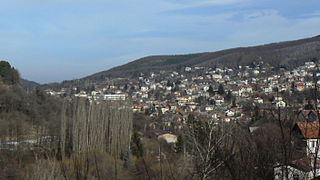
Vladaya is a village situated on the Vitosha and Lyulin mountains in western Bulgaria at an altitude of about 1000 m. In the 2011 census in Vladaya were counted 4043 residents, which makes it the 10th-largest village in Bulgaria.

Horia is a commune in Tulcea County, Northern Dobruja, Romania. It is composed of three villages: Cloșca, Florești and Horia.

Bailovo is a village in Western Bulgaria, 43 km east of Sofia, Bulgaria. It is the home village of the Bulgarian writer Elin Pelin ., and ascetic Dobri Dobrev.
Google Maps Navigation is a mobile application developed by Google for the Android and iOS operating systems that was later integrated into the Google Maps mobile app. The application uses an Internet connection to a GPS navigation system to provide turn-by-turn voice-guided instructions on how to arrive at a given destination. The application requires connection to Internet data and normally uses a GPS satellite connection to determine its location. A user can enter a destination into the application, which will plot a path to it. The app displays the user's progress along the route and issues instructions for each turn.

Irechek is a village in Kavarna Municipality, Dobrich Province, northeastern Bulgaria, located about 12 kilometres (7.5 mi) north of Kavarna. It lies to the west of Vranino, south of Vidno and to the northeast of Mogilishte. As of 2007 it had a population of 26 people, covering an area of 12.062 square kilometres (4.657 sq mi) The population is gradually decreasing as younger people move away to the cities.
In Europe, Google Street View began on 2 July 2008 with the route of Tour de France being covered in parts of France and Italy. The service has since expanded to many European countries, while at the same time has been controversial in some countries laws and privacy concerns.
Avramovo is a village in Ardino Municipality, Kardzhali Province, in southern-central Bulgaria. It is located 187.5 kilometres (116.5 mi) from Sofia, roughly 14 kilometres (8.7 mi) by road southwest of the city of Kardzhali, and roughly 20 kilometres (12 mi) by road east of the municipal town of Ardino.Boyno lies just to the east along the 865 road. It covers an area of 6.197 square kilometres (2.393 sq mi) and as of 2007 had a population of 6 people. Until 1934, the settlement had the name Ibrahimler.
Chubrika is a village in Ardino Municipality, Kardzhali Province, southern-central Bulgaria. It is located 199.97 kilometres (124.26 mi) from Sofia, roughly 21.3 kilometres (13.2 mi) by road southwest of the city of Kardzhali, and roughly 13 kilometres (8.1 mi) by road east of the municipal town of Ardino. To the north is Yabalkovets and to the northeast is Kobilyane, along the 865 road. It covers an area of 5.782 square kilometres (2.232 sq mi) and as of 2007 had a population of 153 people. It was formerly called Fakrŭ Bunar.
Yabalkovets is a mountain village in Ardino Municipality, Kardzhali Province, southern-central Bulgaria. It is located 199.97 kilometres (124.26 mi) from Sofia, and roughly 16 kilometres (9.9 mi) by road northeast of the municipal town of Ardino. To the southeast is Chubrika. It covers an area of 11.232 square kilometres and as of 2013 had a population of 204 people.
Mak is a small hamlet in Ardino Municipality, Kardzhali Province, southern-central Bulgaria. It is located 201.18 kilometres (125.01 mi) from Sofia. It lies at altitude of 561 metres (1,841 ft) to the southeast of Ardino and Sinchets, east of Gurbishte and southwest of Tsarkvitsa. It covers an area of 5.642 square kilometres and as of 2007 had a population of 1 person. The hamlet is dependent on Gurbishte for village functions, where there is also a village hall.
Sinchets is a small mountain village in Ardino Municipality, Kardzhali Province, southern-central Bulgaria. It is located 199.967 kilometres (124.254 mi) from Sofia. It lies at altitude of 770 metres (2,530 ft), 9.8 kilometres (6.1 mi) by winding road to the southeast of Ardino, and north of Tsarkvitsa. It covers an area of 8.602 square kilometres and as of 2007 had a population of 70 people.
Gurbishte is a mountain village in Ardino Municipality, Kardzhali Province, southern-central Bulgaria. It is located 196.78 kilometres (122.27 mi) from Sofia and 13.6 kilometres (8.5 mi) by winding road south of Ardino. It lies to the southwest of Sinchets, and northeast of Padina. It covers an area of 14.494 square kilometres and as of 2007 had a population of 183 people. The village contains a village hall.

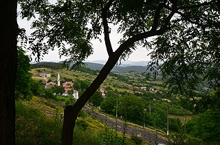
Padina is a village in Ardino Municipality, Kardzhali Province, southern-central Bulgaria, located in a valley at the foot of Mount St. Elias (1001m). It is located 195.32 kilometres (121.37 mi) from Sofia,14.8 kilometres (9.2 mi) southwest of Ardino, and 4.8 kilometres (3.0 mi) by road south of Byal izvor. It covers an area of 10.411 square kilometres and as of 2007 had a population of 1030 people, although the population is rapidly declining and 851 were reported in 2010.
Republic Road 11 is a 2nd class Bulgarian road spanning half of the Danube border with Romania.
Republic Road 12 is a short second-class road in the extreme north-west of Bulgaria.

