
Cobija is a city in Bolivia, capital of the department of Pando, and is located about 600 km (373 mi.) north of La Paz in the Amazon Basin on the border with Brazil. Cobija lies on the banks of the Rio Acre across from the Brazilian city of Brasiléia. Cobija lies at an elevation of ca. 280 m (920 ft.) above sea level and has a tropical and rainy climate.
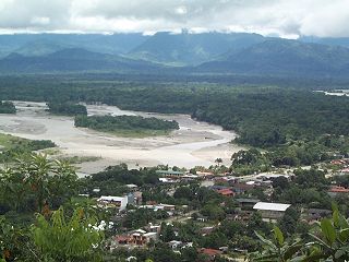
Villa Tunari or Tunari is a location in the department of Cochabamba, Bolivia. It is the seat of the Villa Tunari Municipality, the third municipal section of the Chapare Province. According to the census 2012 the population was 3,213 in the town which is an increment from 2,510 registered during the 2001 census.

Madre de Dios is one of the five provinces of the Bolivian Pando department and is situated in the southern parts of the department. Its name derives from Madre de Dios River on the northern border of the province.

Manuripi is one of the five provinces of Pando Department in Bolivia and is situated in the northwest of the department. Its name is derived from the Manuripi River, which passes through the province from west to east.

Nicolás Suárez is one of the five provinces of the Bolivian Pando department and is situated in the department's northwestern parts. Its name honors Nicolás Suárez Callaú (1861-1940) who owned major parts of today's Pando and Beni Departments in the times of the caoutchouc-boom.

Ichilo is one of the fifteen provinces of the Bolivian Santa Cruz Department and is situated in the department's north-western parts. The province was founded by a decree of 8 April 1926 and is named after Río Ichilo which is forming the province border in the West.
Entre Ríos is a small town in the Cochabamba Department of the South American Republic of Bolivia.
Mecapaca Municipality is the second municipal section of the Pedro Domingo Murillo Province in the La Paz Department, Bolivia. Its seat is Mecapaca. It is situated 28 km from the city of La Paz, the capital of the department and the seat of government for the country, and it stands at an elevation of 2,850 meters above sea level. According to the 2012 national census, the municipality of Mecapaca has a population of 16,027 inhabitants.
San Ramón is a small town in the Beni Department in Bolivia.
Puerto Pailas is a canton and town in the Santa Cruz Department in the South American Andean Republic of Bolivia.
Paurito is a small town in the Santa Cruz Department in the South American Andean Plurinational State of Bolivia.
Don Lorenzo is a small town in the Santa Cruz Department in the South American Andean Republic of Bolivia.
Campanero is a small town in the Santa Cruz Department in the South American Andean Republic of Bolivia.
Achiri is a location in the La Paz Department in Bolivia. In 2010 it had an estimated population of 817.
Patamanta is a small town in Bolivia. It is the second largest town in the district of Pucarani in the province of Los Andes, and is located on the right bank of an inlet towards Lake Titicaca. The village is located on the Altiplano. It lies on the plateau between the Andean mountain ranges of the Cordillera Occidental in the west and the Cordillera Central in the east. Due to the historical population development, the region has a high proportion of Aymara people, with 96.7% of the population speaking the Aymara language. The population was 691 in 1992, increasing to 745 in 2001, and then 857 in 2012.
Porvenir is a small town in the Nicolás Suárez Province of the Pando Department in Bolivia. It is located 33 kilometers south of Cobija, the department's capital city, at an altitude of 222 m on the left banks of Tahuamanu River, which in its later course is named Orthon River before it discharges into Beni River.

Tatasi is a small town in Bolivia in the Potosí Department, in Sud Chichas Province, Atocha Municipality. It is situated at the Tatasi River and located at the foothills of the Cordillera de Lípez.
Toledo (Oruro) is a small town in Bolivia. Toledo is the administrative seat of Saucarí Province, as well as that of Toledo Municipality. The town lies at an elevation of 3,715 metres (12,188 ft) between Río Laq'a Jawira in the west and Río Vinto Jahuira in the east, both of which drain into Lake Poopó.

Azurduy Municipality is the first municipal section of Azurduy Province in the Chuquisaca Department of Bolivia. Its seat is Villa Azurduy. In 2012 the population was 10,594 persons. The municipality is very poor; in 2010 93% were below the poverty line, and 75% were in extreme poverty. In 2001 there were seven automobiles in the municipality.

San Ignacio del Sara is a town in the Santa Cruz department in the lowlands of the South American Andes state of Bolivia.


