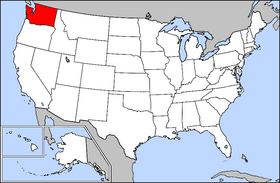
Snohomish County is a county located in the U.S. state of Washington. With a population of 827,957 as of the 2020 census, it is the third-most populous county in Washington, after nearby King and Pierce counties, and the 73rd-most populous in the United States. The county seat and largest city is Everett. The county forms part of the Seattle metropolitan area, which also includes King and Pierce counties to the south.

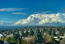
Edmonds is a city in Snohomish County, Washington, United States. It is located in the southwest corner of the county, facing Puget Sound and the Olympic Mountains to the west. The city is part of the Seattle metropolitan area and is located 15 miles (24 km) north of Seattle and 18 miles (29 km) southwest of Everett. With a population of 42,853 residents in the 2020 U.S. census, Edmonds is the third most populous city in the county.

Lynnwood is a city in Snohomish County, Washington, United States. The city is part of the Seattle metropolitan area and is located 16 miles (26 km) north of Seattle and 13 miles (21 km) south of Everett, near the junction of Interstate 5 and Interstate 405. It is the fourth-largest city in Snohomish County, with a population of 38,568 in the 2020 U.S. census.

Mountlake Terrace is a suburban city in Snohomish County, Washington, United States. It lies on the southern border of the county, adjacent to Shoreline and Lynnwood, and is 13 miles (21 km) north of Seattle. The city had a population of 19,909 people counted in the 2010 census.

Mukilteo is a city in Snohomish County, Washington, United States. It is located on Puget Sound between Edmonds and Everett, approximately 25 miles (40 km) north of Seattle. The city had a population of 20,254 at the 2010 census and an estimated 2019 population of 21,441.

Western Washington is a region of the United States defined as the area of Washington state west of the Cascade Mountains. This region is home to the state's largest city, Seattle, the state capital, Olympia, and most of the state's residents. The climate is generally far more damp and temperate than that of Eastern Washington.

Community Transit (CT) is the public transit authority of Snohomish County, Washington, United States, excluding the city of Everett, in the Seattle metropolitan area. It operates local bus, paratransit and vanpool service within Snohomish County, as well as commuter buses to Downtown Seattle and Northgate station. CT is publicly funded, financed through sales taxes, and farebox revenue, with an operating budget of $133.2 million. In 2022, the system had a ridership of 5,788,700, or about 24,300 per weekday as of the third quarter of 2023, placing it fourth among transit agencies in the Puget Sound region. The city of Everett, which serves as the county seat, is served by Everett Transit, a municipal transit system.

Everett Station is an Amtrak train station serving the city of Everett, Washington, United States. The station has provided service to the Cascades and Empire Builder routes since its opening in 2002, replacing an earlier station near the Port of Everett. The four-story building also houses social service programs and is the center of a 10-acre (4 ha) complex that includes parking lots and a large bus station used primarily by Community Transit, Everett Transit, and Sound Transit Express. The station has served as the northern terminus of the Sounder N Line since 2003 and the Swift Blue Line since 2009. It consists of two side platforms, one serving Amtrak and the other serving Sounder commuter trains. Everett Station also functions as a park and ride, with 1,067 short-term parking spaces located in lots around the station after it was expanded by Sound Transit in 2009.
The Washington Interscholastic Activities Association (WIAA) is the governing body of athletics and activities for secondary education schools in the state of Washington. As of February 2011, the private, 501(c)(3) nonprofit organization consists of nearly 800 member high schools and middle/junior high schools, both public and private.

The Puget Sound region is a coastal area of the Pacific Northwest in the U.S. state of Washington, including Puget Sound, the Puget Sound lowlands, and the surrounding region roughly west of the Cascade Range and east of the Olympic Mountains. It is characterized by a complex array of saltwater bays, islands, and peninsulas carved out by prehistoric glaciers.

Everett is the county seat and largest city of Snohomish County, Washington, United States. It is 25 miles (40 km) north of Seattle and is one of the main cities in the metropolitan area and the Puget Sound region. Everett is the seventh-largest city in the state by population, with 110,629 residents as of the 2020 census. The city is primarily situated on a peninsula at the mouth of the Snohomish River along Port Gardner Bay, an inlet of Possession Sound, and extends to the south and west.
The Scenic Subdivision or Scenic Sub is a railroad line running about 155 miles (249 km) from Seattle, Washington to Wenatchee, Washington. It is operated by BNSF Railway as part of their Northern Transcon. This route includes the Cascade Tunnel, as well as the 1893 site of the "last spike" near Scenic, Washington, which marked the completion for the Great Northern Railway transcontinental railway line built by James J. Hill.

The Chehalis Gap is a gap in the Coast Range of Washington state between the southernmost foothills of the Olympic Mountains called the Satsop Hills, and the Willapa Hills.

Shoreline North/185th station is a future Link light rail station on the Lynnwood Link Extension serving Shoreline, Washington. The station will be located in a trench on the east side of Interstate 5, on the north side of Northeast 185th Street. It will include an adjacent bus station and parking garage with 500 stalls. The station is scheduled to open in 2024, with the rest of the line.

The Swift Blue Line is a bus rapid transit route operated by Community Transit in Snohomish County, Washington, as part of the Swift system. The Blue Line is 16.7 miles (26.9 km) long and runs on the State Route 99 and Evergreen Way corridor between Everett Station and Aurora Village Transit Center. It has 34 stations in the cities of Everett, Lynnwood, Edmonds, and Shoreline.

Sitting Bull Mountain is a 7,759-foot (2,365-metre) double summit mountain in the North Cascades of Washington state. The north summit is higher than the south peak, and easier to climb, however neither peak sees much climbing activity. Sitting Bull Mountain is located 2.1 mi (3.4 km) northwest of Suiattle Pass in the heart of the Glacier Peak Wilderness. Its nearest higher peak is Plummer Mountain, 1.51 mi (2.43 km) to the south-southwest. The mountain is situated on the crest of the Cascade Range, on the shared border of Snohomish County and Chelan County. Precipitation runoff from Sitting Bull Mountain drains east into Agnes Creek which is a tributary of the Stehekin River, or west into Canyon Creek which is a tributary of the Suiattle River.
Kololo Peaks is an 8,200+ ft mountain located in the Glacier Peak Wilderness of the North Cascades in Washington state. The mountain is situated on the crest of the Cascade Range, on the shared border of Snohomish County and Chelan County, and also straddling the boundary between Mount Baker-Snoqualmie National Forest and Wenatchee National Forest. The nearest higher peak is Glacier Peak, 3.29 mi (5.29 km) to the north. Precipitation runoff and meltwater from the White River Glacier on the southeast slope drains into White River. On the west slope, the White Chuck Glacier drains into the White Chuck River, and the Suiattle Glacier and Honeycomb Glacier on the north and east sides drain into the Suiattle River. Surrounded by these glaciers, Fred Beckey in his Cascade Alpine Guide describes the mountain as being almost a nunatak.

White Mountain is a 7,043-foot (2,147-metre) mountain located in the Glacier Peak Wilderness of the North Cascades in Washington state. The mountain is situated on the crest of the Cascade Range, on the shared border of Snohomish County and Chelan County, and also straddling the boundary between Mount Baker-Snoqualmie National Forest and Wenatchee National Forest. White Mountain is located 3.04 mi (4.89 km) to the west-southwest of Kololo Peaks, and immediately north of White Pass. The Pacific Crest Trail traverses the south slope of the peak. Precipitation runoff from the peak drains into the White River, White Chuck River, and Sauk River. The mountain's name was suggested by The Mountaineers, and officially adopted in 1918 by the United States Board on Geographic Names.

Well Number 5, also called 164th Street Artesian Well, is an artesian well in North Lynnwood, Washington at Swamp Creek. The well puts out between 10–50 US gallons per minute.

Painted Mountain is a 6,975-foot-elevation (2,126-meter) summit located in the North Cascades, in Snohomish County of Washington state. The mountain is situated in the Glacier Peak Wilderness on land managed by Mount Baker-Snoqualmie National Forest. Neighbors include line parent Black Mountain, 2.2 mi (3.5 km) to the east, and Glacier Peak is 7 mi (11 km) to the northeast. Precipitation runoff from the peak drains west into tributaries of the North Fork Sauk River. Topographic relief is significant as the summit rises nearly 5,000 feet above the river in less than two miles.