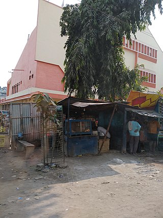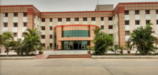
Sitamarhi is an Indian city in the Mithila region of Bihar. It is the district headquarters of the Sitamarhi district in Tirhut Division. The city was named in honour of the goddess Sita, who was born in Sitamarhi in Hindu mythology.

Gopalganj is one of the administrative districts in the Indian state of Bihar. The district headquarters is the town of Gopalganj, and the district is part of Saran Division. Major languages spoken are Hindi and Bhojpuri.

Patna district is one of the thirty-eight districts of Bihar state in eastern India. Patna, the capital of Bihar, is the district headquarters. The Patna district is a part of Patna division. The Patna district is divided into 6 Sub-divisions (Tehsils) i.e. Patna Sadar, Patna City, Barh, Masaurhi, Danapur and Paliganj.

Supaul district is one of the thirty-eight districts of Bihar, India. The town Supaul is the district's administrative headquarters. The district, which was split from the former Saharsa district on 14 March 1991, occupies 2,410 km2 (931 sq mi).

Nawada district is one of the thirty-eight districts of the Indian state of Bihar. Nawada is its administrative headquarters. The district is the easternmost district of the Magadh division, one of the nine administrative divisions of Bihar. The area of the modern district was historically part of the Magadha, Shunga and Gupta empires. Koderma and Giridih districts of the state of Jharkhand lie on the southern border of the district; it also shares borders with the Gaya, Nalanda, Sheikhpura, and Jamui districts of Bihar.

Kaimur district is one of the 38 districts of Bihar, India. The district headquarters are at Bhabua. Before 1991, it was part of Rohtas District. Till 1764 the region was a part of Ghazipur District and was a part of Kamsaar Raj and later it was a part of Chainpur Estate till 1837.

Barh is a sub division of Patna District. It is a town and one of the 6 sub-division of Patna District, Bihar in India. It is located on the southern bank of the Ganges.
Bagaha is a city and a municipality in the district of Pashchim Champaran in the state of Bihar, India. It is a subdivision of Pashchim Champaran district and is a Police District. It is located around 64 kilometres (40 mi) northwest of its district headquarters Bettiah. It is 294 km (183 mi) away from Bihar's state capital Patna.

Bakhtiyarpur is a town and a municipality notified area, in patna district the state of Bihar, India. Bakhtiyarpur is under the Patna Sahib Lok Sabha constituency. It is a major railway junction in Danapur railway division, ECR. The incumbent Chief Minister of Bihar, Nitish Kumar belongs to Bakhtiyarpur.
Daudnagar is a town and the subdivisional headquarter of Daudnagar Subdivision in Aurangabad district in the state of Bihar, India under the Magadh division. Until 1991, there was only one Subdivision in the Aurangabad district: Aurangabad Sadar. On 31 March 1991, one other subdivision, Daudnagar, was created. Daudnagar is a 200-year-old historical city and its living proof is Daudnagar has an old historical fort situated on the eastern bank of the Son River. National Highway NH139 which connects Jharkhand's Palamu district to Patna, passes through the town.

Koilwar or Koelwar is a nagar panchayat (town) and one of the 14 community development block in Bhojpur district in the Indian state of Bihar. As of 2011, the population of Koilwar town was 17,725, in 2,893 households. Koilwar lies on the Arrah-Patna highway (NH-922).
Lalganj is an important town and Nearest City, (60 kilometres Morden Old City Mehsi), and river port situated in Vaishali district, Bihar.
Mokama is a town and a municipal council of Patna district in the Indian state of Bihar. It is located 90 km (56 mi) east of Patna on the southern banks of the river Ganges. Mokama is the connecting town of north and south Bihar and has 2nd highest amount of lentil production in India. It emerged as an industrial area in State of Bihar after independence.

Phulwari or Phulwari Sharif is Block and town in Patna district in the Indian state of Bihar. It is included in the Patna Metropolitan Region and is one of the fastest growing area of urban Patna. The civilisation of the city dates back to the days of inception of the Sufi culture in India. Phulwari Sharif had been frequented by most Sufi saints of that period and is famous for its islamic spiritual dargah and old mosques.

Kundalpur is a village in Nalanda district in the Indian state of Bihar. It is located about 2.5 kilometres from ancient Nalanda Mahavihara, 11 kilometres southwest of Bihar Sharif, and 80 kilometres southeast of Patna.
Pirpainti is a town and a notified area in Bhagalpur district in the Indian state of Bihar. It is a block of the Bhagalpur district and also a vidhansabha.
Nayadih is a village among a block of villages in Derhgaon of the Kashichak Block, Nawada District, in Bihar, India. The main villages of Nayadih, Derhgaon and Bishwanathpur together have been referred to as Derhgaon.
Jalpura Tapa is a village and gram panchayat in Koilwar block, Bhojpur district in the Indian state of Bihar. Situated close to the Sone River, it is a large village with more than 12,000 residents. Population-wise it is the largest village and area-wise, it is the 2nd-largest village of Koilwar block.
Gorakhri village is located in Bikram block of Patna district in Bihar, India.
Sherpur is a village in Maner block of Patna district, Bihar, India. It is located in the northern portion of Patna district, about 22 kilometres northwest of the district seat Patna. Its population was 31,073 in the 2011 census.


