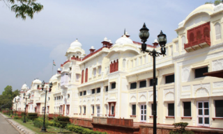
Patiala is a city in southeastern Punjab, northwestern India. It is the fourth largest city in the state and is the administrative capital of Patiala district. Patiala is located around the Qila Mubarak constructed by a chieftain Ala Singh, who founded the royal dynasty of Patiala State in 1763, and after whom the city is named.

Bathinda is a city and municipal corporation in Punjab, India. The city is the administrative headquarters of Bathinda district. It is located in northwestern India in the Malwa Region, 227 km (141 mi) west of the capital city of Chandigarh and is the fifth largest city of Punjab. It is the second cleanest city in Punjab after Mohali.

The Punjab Province was a province of British India. Most of the Punjab region was annexed by the British East India Company on 29 March 1849; it was one of the last areas of the Indian subcontinent to fall under British control. In 1858, the Punjab, along with the rest of British India, came under the rule of the British Crown. It had a land area of 358,355 square kilometers.

Patiala district is one of the twenty three districts in the state of Punjab in north-west India.

East Punjab was a province of India from 1947 until 1950. It consisted parts of the Punjab province that remained in India following the partition of the province between the new dominions of Pakistan and the Indian Union by the Radcliffe Commission in 1947. The mostly Muslim western parts of the old Punjab became Pakistan's West Punjab, later renamed as Punjab Province, while the mostly Hindu and Sikh eastern parts remained with India.

Bhawanigarh, earlier known as Dhode, is a town and a municipal council (Class-2) in the Sangrur district in the state of Punjab, India. It is also the headquarters of Bhawanigarh tehsil, which was formed in December 2016. The town is also called Dhode, after the clan of its original founders. The town lies 19 kilometres east of Sangrur on the Patiala-Sangrur road whereas Patiala is 39 kilometres east of Bhawanigarh. The literacy rate is higher than other places of Sangrur. Bhawanigarh is divided into 15 wards. The Bhawanigarh block consists of 66 villages in the Sangrur district.
Moonak is a town and a nagar panchayat in Sangrur district in the Indian state of Punjab. Moonak is situated near the Punjab-Haryana border. The nearest towns of Haryana are Jakhal Mandi and Tohana. The nearest commercial airport to Moonak is at Chandigarh which is 150 km from here. The majority of people are engaged in farming and agricultural activities.
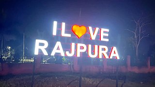
Rajpura is a city in Patiala district in the Indian state of Punjab, India, situated along the border of the Indian state of Haryana. It is located 26 KM Patiala city, towards East from District Head Quarter. It is Tehsil Head Quarter. Rajpura is the largest tehsil of the district.

Sardar Gurbachan Singh was a Sikh scholar, professor, and author. He was born in Moonak, Sangrur district. He was a lecturer at the Sikh National College at Lahore. At the Banaras Hindu University he held the Guru Nanak Chair of Sikh Studies. He received the Padma Bhushan in 1985. He received in 1985 the National fellowship by the Indian Council of Historical Research, New Delhi.
Punjab is home to 2.3% of India's population; with a density of 551 persons per km2. According to the provisional results of the 2011 national census, Punjab has a population of 27,743,338, making it the 16th most populated state in India. Of which male and female are 14,639,465 and 13,103,873 respectively. 32% of Punjab's population consists of Dalits. In the state, the rate of population growth is 13.9% (2011), lower than national average. Out of total population, 37.5% people live in urban regions. The total figure of population living in urban areas is 10,399,146 of which 5,545,989 are males and while remaining 4,853,157 are females. The urban population in the last 10 years has increased by 37.5%. According to the 2011 Census of India, Punjab, India has a population of around 27.7 million.

Sangrur district is in the state of Punjab in northern India. Sangrur city is the district headquarters. It is one of the five districts in Patiala Division in the Indian state of Punjab. Neighbouring districts are Malerkotla (north), Barnala (west), Patiala (east), Mansa (southwest) and Fatehabad (Haryana) and Jind (Haryana) (south).

Punjab is a state in northwestern India. Forming part of the larger Punjab region of the Indian subcontinent, the state is bordered by the Indian states of Himachal Pradesh to the north and northeast, Haryana to the south and southeast, and Rajasthan to the southwest; by the Indian union territories of Chandigarh to the east and Jammu and Kashmir to the north. It shares an international border with Punjab, a province of Pakistan to the west. The state covers an area of 50,362 square kilometres, which is 1.53% of India's total geographical area, making it the 19th-largest Indian state by area out of 28 Indian states. With over 27 million inhabitants, Punjab is the 16th-largest Indian state by population, comprising 23 districts. Punjabi, written in the Gurmukhi script, is the most widely spoken and the official language of the state. The main ethnic group are the Punjabis, with Sikhs (57.7%) and Hindus (38.5%) forming the dominant religious groups. The state capital, Chandigarh, is a union territory and also the capital of the neighbouring state of Haryana. Three tributaries of the Indus River — the Sutlej, Beas, and Ravi — flow through Punjab.
The Patiala and East Punjab States Union Legislative Assembly was the unicameral state-level legislative body of the Patiala and East Punjab States Union in India. Two elections to the assembly were held; one in 1951 and the second one in 1954. The assembly had 60 seats. The assembly used to meet at the Durbar (Court) of Qila Mubarak, the royal fort at Patiala.
Patiala Rural Assembly constituency is one of the 117 Legislative Assembly constituencies of Punjab state in India. It is part of Patiala district.
Rajpura Assembly constituency is one of the 117 Legislative Assembly constituencies of Punjab state in India. It is part of Patiala district and is unreserved.

Patiala Assembly constituency is a Punjab Legislative Assembly constituency in Patiala district, Punjab state, India.

The following outline is provided as an overview of and topical guide to Punjab:
National Highway 148B starts at Kotputli, state of Rajasthan and ends at Bathinda, state of Punjab. The major towns are in succession of distance on this highway: Narnaul, Mahendergarh, Charkhi Dadri, Bhiwani, Hansi, Barwala, Bhimewala Tohana, Moonak, Jakhal, Bareta, Budhlada, Bhikhi, Mansa and Maur. This highway meets with National Highway 54 at Bathinda. The highway is 427 km (265 mi) long and runs all within the states of Haryana, Punjab and Rajasthan.
Punjab State Highway 8, commonly referred to as SH 8, is a state highway in the state of Punjab in India. This state highway runs through Patiala district from Patiala to Haryana Border, Punjab on Pehowa highway in the state of Punjab. The total length of the highway is 32 kilometres.
