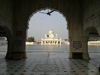
Faridkot is a city in the South-western part of state of Punjab, India. It serves as the headquarters for both, the Faridkot district. as well as the Faridkot Division. The division was established in 1995 at Faridkot which includes Faridkot, Bathinda, and Mansa districts.

The Cis-Sutlej states were a group of states in the contemporary Punjab and Haryana states of northern India during the 19th century, lying between the Sutlej River on the north, the Himalayas on the east, the Yamuna River and Delhi District on the south, and Sirsa District on the west. The small Punjabi kingdoms of the Cis-Sutlej states paid tributes to the Marathas, until the Second Anglo-Maratha War of 1803–1805, after which the Marathas lost this territory to the British.

The Punjab Province was a province of British India. Most of the Punjab region was annexed by the British East India Company on 29 March 1849; it was one of the last areas of the Indian subcontinent to fall under British control. In 1858, the Punjab, along with the rest of British India, came under the rule of the British Crown. It had a land area of 358,355 square kilometers.

East Punjab was a province of India from 1947 until 1950. It consisted parts of the Punjab province that remained in India following the partition of the province between the new dominions of Pakistan and the Indian Union by the Radcliffe Commission in 1947. The mostly Muslim western parts of the old Punjab became Pakistan's West Punjab, later renamed as Punjab Province, while the mostly Hindu and Sikh eastern parts remained with India.

Faridkot district is a district lying in the South-Western part of Punjab, India with Faridkot city as the district headquarters.

Moga district is one of the twenty-two districts in the state of Punjab, India. It became the 17th district of Punjab State on 24 November 1995 cut from Faridkot district. Moga District is among the largest producers of wheat and rice in Punjab, India. People from Moga City and Moga District belong to the Malwa culture. The district is noted for being the homeland for a high proportion of Indian Punjabi expatriates who emigrated abroad and their descendents, which has given it the nickname of "NRI district".
Moga is a city in the Indian state of Punjab. It was made a part and headquarters of the Moga district on 24 November 1995, by the then Chief Minister Harcharan Singh Brar. Before becoming a district, Moga was a part of Faridkot District as a tehsil. Moga is situated on the National Highway 95. The area of Dharamkot block with 150 villages has been merged into Moga district, which falls under the jurisdiction of Ferozpur division.
Kotkapura is a historic city in Faridkot district, Punjab, India. some 15 km from Faridkot City, 50 km from Bathinda, 40 km from Moga and 30 km from Muktsar in the state of Punjab, India. It is the largest city in the Faridkot District and has a large cotton market. It takes around 15 minutes by bus from Faridkot, 4 hours by road from Chandigarh and 2 hours from Ludhiana, and 8 hours from New Delhi by train to reach the city. It is a central city on route to Ganganagar, Ludhiana, Bathinda, Firozpur, etc. KotkKapura takes its name from its founder, Nawab Kapur Singh, and the word 'Kot', meaning a small fort – literally the 'Fort of Kapura'. The city is known for its "Dhodha Sweet" and "Atta Chicken" both of which are exported outside India.
Dhilwan is a town and a nagar panchayat in Kapurthala district in the state of Punjab, India.

Jaitu is a historical city. Jaitu is a municipal council in Faridkot district in the Indian state of Punjab. It is subdivision in Ferozepur Division. It is 30 km (19 mi) from Bathinda, 130 km (81 mi) from Ludhiana, 150 km (93 mi)from Amritsar, 180 km (110 mi) from Patiala and 234 km (145 mi) from Chandigarh.

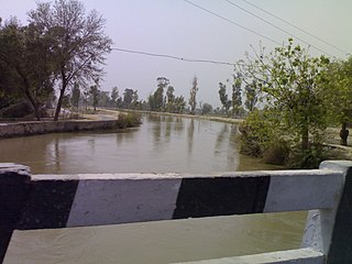
The Ganga Canal of Rajasthan is an irrigation system of canals laid down by Maharaja Ganga Singh in the present district of Sri Ganganagar in the early twentieth century. It is fed from the Sutlej River near Firozpur, Punjab, close to the India–Pakistan border, and passes through the Faridkot, Fazilka and Muktsar districts. Faridkot's Jhok Sarkari village lies on its path.
Malwai Giddha is the folk dance of males of Malwa region of Punjab. This dance was originally performed by Babey and hence is also called Babeyan da Gidhha but the dance is now performed by younger men too. This includes teasing of other people in Boliaan. The dance originated in the Malwa area of the Punjab region and is associated with the districts of Muktsar, Bathinda, Faridkot, Sangrur, Ferozpur, Mansa and Patiala.

Malwa College of Nursing was established in Nov 2000 by Dr. Ravinder Singh. It is named after Malwa, a region of Punjab and headquartered in Kotkapura in the district of Faridkot in the state of Punjab.

Faridkot State was a self-governing princely state of Punjab ruled by Brar Jats outside British India during the British Raj period in the Indian sub-continent until Indian independence. The state was located in the south of the erstwhile Ferozepore district during the British period. The former state had an area of around 1649.82 square kilometres. It population in 1941 was around 199,000 thousand. The state's rulers had cordial relations with the British.
Faridkot Assembly constituency is one of the 117 Legislative Assembly constituencies of Punjab state in India. It is part of Faridkot district.
Jaitu is one of the 117 Legislative Assembly constituencies of Punjab state in India. It is part of Faridkot district and is reserved for candidates belonging to the Scheduled Castes.
Panjgrain was one of the 117 assembly constituencies of Punjab, an Indian state lying in Faridkot district. Panjgrain was also part of Faridkot Lok Sabha constituency.
National Highway 354, commonly referred to as NH 354 is a national highway in India. It is a spur road of National Highway 54 under Bharatmala in the state of Panjab in India.


