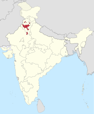
The Patiala and East Punjab States Union (PEPSU) was a state of India, uniting eight princely states between 1948 and 1956. The capital and principal city was Patiala. The state covered an area of 26,208 km2. Shimla, Kasauli, Kandaghat and Chail also became part of PEPSU.

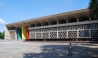
Punjab and Haryana High Court is the common High Court for the Indian states of Punjab and Haryana and the Union Territory of Chandigarh based in Chandigarh, India. Sanctioned strength of Judges of this High Court is 85 consisting of 64 Permanent Judges and 21 Additional Judges including Chief Justice. As of 14 September 2023, there are 58 Judges working in the High Court, comprising 36 Permanent and 22 Additional Judges.

The Punjab Regiment is the second oldest regiment still in service in the Indian Army, and is the most senior regional infantry regiment. It was formed from the 2nd Punjab Regiment of the British Indian Army in 1947 and has taken part in various battles and wars since, winning numerous honours for the same.

Jindo district is one of the 22 districts of Haryana state in northern India. Jind town is the administrative headquarters of the district. It is part of Hisar Division and was created in 1966.

State Bank of Patiala, founded in 1917, was an associate bank of the State Bank Group. It merged with State Bank of India on 1 April 2017. At the time of its merger, State Bank of Patiala had a network of 1445 service outlets, including 1314 branches, in all major cities of India, but most of the branches were located in the Indian states of Punjab, Haryana, Himachal Pradesh, Rajasthan, Jammu & Kashmir, Uttar Pradesh, Madhya Pradesh, Delhi, Gujarat and Maharashtra.

Mahendragarh district is one of the 22 districts of Haryana state in northern India. The district occupies an area of 1,899 km² and has a population of 922,088 (2021census). District have 4 Sub-divisions : Narnaul, Mahendragarh, Nangal Chaudhary and Kanina

Patiala district is one of the twenty three districts in the state of Punjab in north-west India.

East Punjab was a province of India from 1947 until 1950. It consisted parts of the Punjab province that remained in India following the partition of the province between the new dominions of Pakistan and the Indian Union by the Radcliffe Commission in 1947. The mostly Muslim western parts of the old Punjab became Pakistan's West Punjab, later renamed as Punjab Province, while the mostly Hindu and Sikh eastern parts remained with India.
Ghagga is a town and a municipal committee in Patiala district in the state of Punjab, India. It is located on the Patiala - Patran road and is very near to the border of Haryana. Ghagga falls in the Shutrana constituency of Punjab. It is famous for the Ghagga Kothi that was owned by the erstwhile royal family of Patiala, which is now under the control of Punjab Police.

Rajpura is a city in Patiala district in the Indian state of Punjab, India, situated along the border of the Indian state of Haryana. It is located 26 KM Patiala city, towards East from District Head Quarter. It is Tehsil Head Quarter. Rajpura is the largest tehsil of the district.
Rania is a town and a municipal committee in Sirsa district located on the upper bank of Ghaggar River in the Indian state of Haryana. Rania Town is a grain market in Sirsa district. Nearby cities to Rania includes Sirsa and Ellenabad. It shares its RTO office with Ellenabad which is also has its headquarters in Ellenabad. Earlier it was a part of Ellenabad subdivision but later carved out separately as a subdivision in Sirsa district of Haryana. It is at a distance of 22 km each from Sirsa and Ellenabad in opposite direction on Haryana State Highway 32A i.e. Bhambhoor-Jiwan Nagar Road which connects to Haryana State Highway 32 in Jiwan Nagar on one end and Haryana State Highway 23 in Bhambhoor on the other end.

Puadh is a historic region in north India that comprises parts of present-day Punjab, Haryana, Uttar Pradesh, Himachal Pradesh and the U.T. of Chandigarh, India. It has the Sutlej river in its north and covers the regions immediately south of the Ghaggar river. The people of the area are known as Puadhi and speak the Puadhi dialect of Punjabi. The capital cities of Puadh region are Rupnagar, Fatehgarh Sahib, Mohali, Patiala,Sangrur, Mansa Chandigarh, Nalagarh,Panchkula, Baddi ,Ambala, Yamunanagar
Punjab is home to 2.3% of India's population; with a density of 551 persons per km2. According to the provisional results of the 2011 national census, Punjab has a population of 27,743,338, making it the 16th most populated state in India. Of which male and female are 14,639,465 and 13,103,873 respectively. 32% of Punjab's population consists of Dalits. In the state, the rate of population growth is 13.9% (2011), lower than national average. Out of total population, 37.5% people live in urban regions. The total figure of population living in urban areas is 10,399,146 of which 5,545,989 are males and while remaining 4,853,157 are females. The urban population in the last 10 years has increased by 37.5%. According to the 2011 Census of India, Punjab, India has a population of around 27.7 million.
Saraswati Wildlife Sanctuary, also known as Seonsar Forest, is situated in Kaithal district of Haryana State, India. It is spread over an area of 4,452.85 hectares.

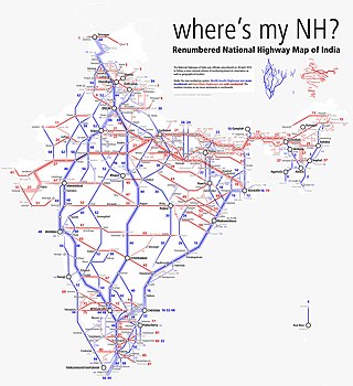
National Highway 5 (NH5) is a primary national highway in India, running from West to East, connecting Firozpur in Punjab to the Sino-Indian border at Shipki La. The highway passes through Moga, Jagraon, Ludhiana, Mohali, Chandigarh, Panchkula, Kalka, Solan, Shimla, Theog, Narkanda, Kumarsain, Rampur Bushahr and continues along the Sutlej River till its terminus near the Tibet border.

National Highway 7 is a highway connecting Fazilka (Punjab) to Mana (Uttarakhand) in India. It passes through the Indian states of Punjab, Haryana, Himachal Pradesh, and Uttarakhand.

National Highway 703 is a National Highway in Northern India. NH 703 connects Jalandar in Punjab ,Sirsa in Haryana and Churu in Rajasthan, running a distance of 342 km (213 mi). National Highway 703 starts at the junction of NH 3 at Jalandar and traverses down to Churu to meet NH 52.

The following outline is provided as an overview of and topical guide to Punjab:
National Highway 254, commonly referred to as NH 254, is a national highway in India. It is a spur road of National Highway 54. NH-254 traverses the states of Punjab and Haryana in India.
Shambhu is a village in the Patiala district, Punjab, India, near its border with Haryana. The village has a Khurd and Kalan set-up. Shambhu Kalan is also the headquarters of an eponymous community development block with 83 villages.


