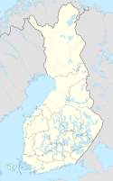
A national park is a natural park in use for conservation purposes, created and protected by national governments. Often it is a reserve of natural, semi-natural, or developed land that a government declares or owns. Although individual countries designate their own national parks differently, there is a common idea: the conservation of 'wild nature' for posterity and as a symbol of national pride. National parks are almost always open to visitors.

Savonlinna is a town and a municipality of 32,108 inhabitants in the southeast of Finland, in the heart of the Saimaa lake region, which is why the city is also nicknamed the "Capital of Saimaa". Together with Mikkeli, it is one of the largest towns in the South Savonia region and one of the concentrations in the region's hospital districts. The town is internationally known for its medieval St. Olaf's Castle and the annual Savonlinna Opera Festival. It encircles the municipality of Enonkoski.
Victoria is the smallest mainland state in Australia. As of 2022 it contained 5,081 separate protected areas with a total land area of 4,012,888 ha.

The Blue Mountains National Park is a protected national park that is located in the Blue Mountains region of New South Wales, in eastern Australia. The 267,954-hectare (662,130-acre) national park is situated approximately 80 kilometres (50 mi) west of Sydney, and the park boundary is quite irregular as it is broken up by roads, urban areas and inholdings. Despite the name mountains, the area is an uplifted plateau, dissected by a number of larger rivers. The highest point in the park is Mount Werong at 1,215 metres (3,986 ft) above sea level; while the low point is on the Nepean River at 20 metres (66 ft) above sea level as it leaves the park.
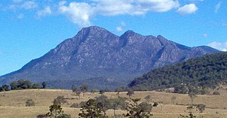
Mount Barney National Park is a national park in Queensland (Australia), 90 km southwest of Brisbane. It amalgamated the adjacent Mount Lindesay National Park in 1980. It is part of the Scenic Rim Important Bird Area, identified as such by BirdLife International because of its importance in the conservation of several species of threatened birds.

The Department of Conservation is the public service department of New Zealand charged with the conservation of New Zealand's natural and historical heritage.

Waterton Lakes National Park is a national park located in the southwest corner of Alberta, Canada. It borders Glacier National Park in Montana, United States. Waterton was the fourth Canadian national park, formed in 1895 and named after Waterton Lake, in turn after the Victorian naturalist and conservationist Charles Waterton. Its range is between the Rocky Mountains and prairies. This park contains 505 km2 (195 sq mi) of rugged mountains and wilderness.
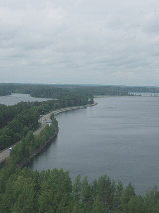
Punkaharju is a former municipality of Finland. It was consolidated with the town of Savonlinna on January 1, 2013.

The Trossachs generally refers to an area of wooded glens, braes, and lochs lying to the east of Ben Lomond in the Stirling council area of Scotland. The name is taken from that of a small woodland glen that lies at the centre of the area, but is now generally applied to the wider region.
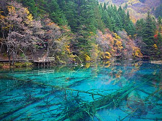
Jiuzhaigou is a nature reserve and national park located in the north of Sichuan Province in southwestern China. A long valley running north to south, Jiuzhaigou was inscribed by UNESCO as a World Heritage Site in 1992 and a World Biosphere Reserve in 1997. It belongs to the category V in the IUCN system of protected area categorization.

MacRitchie Reservoir is Singapore's oldest reservoir. The reservoir was completed in 1868 by impounding water with an earth embankment, and was then known as the Impounding Reservoir or Thomson Reservoir.
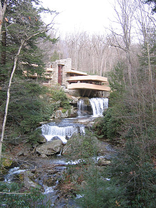
Bear Run is a 5.0-mile-long (8.0 km) tributary of the Youghiogheny River in Fayette County, Pennsylvania, in the United States.

Mono Lake Tufa State Natural Reserve is located near Yosemite National Park within Mono County, in eastern California. It was established in 1981 by the California State Legislature to preserve the natural limestone "tufa tower" formations at Mono Lake.
The Vätsäri Wilderness Area is located along the northeastern shore of Lake Inari in Inari, northern Finland, stretching all the way to the Finland–Norway border. The landscape is dominated by taiga forests of Scots pine, bog and bodies of water. The northeastern part rises as a treeless fell ridge. Vätsäri is one of twelve wilderness areas in Lapland and covers an area of 1,550 square kilometers (600 sq mi). The wilderness has one marked trail and a few cabins. The reserve is under the management of Metsähallitus and was established with the other wilderness reserves in 1991. It is part of Pasvik–Inari Trilateral Park along with Øvre Pasvik National Park and Øvre Pasvik Landscape Protection Area in Norway, and the joint Norwegian–Russian Pasvik Nature Reserve.

Rambynas Regional Park is one of the Regional Parks in Lithuania, situated at Pagėgiai municipality on the right Nemunas river bend in Lithuanian Republic near the border of Kaliningrad Oblast. The park was founded in 1992 with its area of 4,786 ha.
... Life is a constant movement. A Wide variety of different forms emerge and disappear... Over the thousand years, stones grow and decay. Life explodes, animals and people are born and so lost... These days, people learn how to look at nature at more calmed glance. And life effects are clearly visible in a strong relationship with nature as if the person opens the whole mystery of nature, all of the Mysteries...

The Dutchmans Stern Conservation Park is a protected area located in South Australia about 5 kilometres north-west of the town of Quorn in the Flinders Ranges. It includes a mountain known as The Dutchmans Stern from which its name is derived.

The Tusheti National Park in eastern Georgia is one of the eight new protected areas approved by Parliament of Georgia on 22 April 2003.
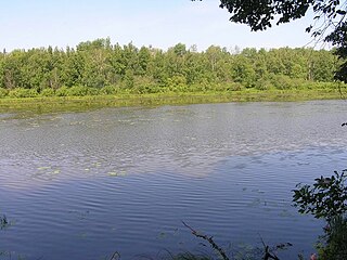
Nurgush Nature Reserve is a Russian 'zapovednik' One of the few intact forest landscapes of Northern European Russia, virtually untouched by human activities. It is designed to protect the floodplain complexes of the Vyatka River, numerous lakes and coniferous-deciduous forests. The reserved is situated in the Kotelnichsky District of Kirov Oblast. The reserve was created in 1994, but has been a protected area since at least 1952 when it was organized as a beaver reserve; it covers an area of 5,918 ha (22.85 sq mi).
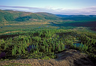
Baikal-Lena Nature Reserve is a Russian 'zapovednik' located on the northwest coast of Lake Baikal in southern Siberia. It protects both lake shore and the source of the Lena River. The reserve stretches along the western coast of Lake Baikal for about 120 km, with an average width of 65 km. The reserve is situated in the Kachugsky District of Irkutsk Oblast. As of December 1996, the Baikal-Lena Reserve is included in the list of sites of World Cultural and Natural Heritage, and a World Heritage Site with Pribaikalsky National Park. The Baikal-Lena Reserve is managed jointly with Pribaikalsky National Park, which is immediately to the south, thus protecting a continuous 580 km of shoreline on Lake Baikal.

Kostomuksha Nature Reserve is a Russian 'zapovednik' of forests, lakes, rivers and wetlands on the border of Russian and Finland. It was created in 1983, along with other protected areas, in part to mitigate the impact of the Karelskiy Okatysh mine outside of the town of Kostomuksha, one of the largest iron ore reserves in Russia, and also to protect the forest from increase commercial logging in the area. A further scientific purpose is the protection of forest reindeer and a type of landlocked salmon. The reserve is part of a transboundary reserve complex with reserves in Finland to the west, and is situated in the Kalevalsky District and Muyezersky District of the Republic of Karelia, about 500 km north of St. Petersburg and 500 km west of Arkhangelsk. The reserve was created in 1993, and covers an area of 47,569 ha (183.66 sq mi).

