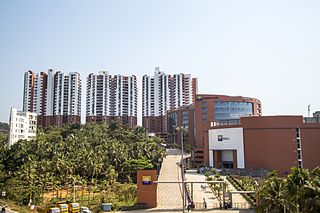
Kozhikode, also known in English as Calicut, is an Indian city and the second-largest metropolitan city in the State of Kerala. It is also the 19th largest in the country with a population of two million according to the 2011 census. Kozhikode is classified as a Tier 2 city by the Government of India.

Kasaragod ([kɑːsɑrɡoːɖɨ̆] formerly known in English as Kassergode, and Malayalam as Kanhirakode, is a municipal town and administrative headquarters of Kasaragod district of Kerala state in India. Established in the year 1966, Kasaragod was the first municipal town in Kasaragod district. It is the northernmost district of Kerala and is also known as Saptha Bhasha Sangama Bhoomi.

Wayanad is an Indian district in the north-east of Kerala state with administrative headquarters at the municipality of Kalpetta. It is the sole Plateau in Kerala. The Wayanad Plateau forms a continuation of Mysore Plateau, which is the southern portion of Deccan Plateau. It is set high on the Western Ghats with altitudes ranging from 700 to 2100 meters. Vavul Mala, a 2,339 m high peak situated on the trijunction of Wayanad, Malappuram, and Kozhikode districts, is the highest point in Wayanad district. The district was formed on 1 November 1980 as the 12th district in Kerala by carving out areas from Kozhikode and Kannur districts. About 885.92 sq.km of area of the district is under forest. Wayanad has three municipal towns—Kalpetta, Mananthavady and Sulthan Bathery. There are many indigenous tribals in this area. The Kabini River, which is a tributary of Kaveri River, originates at Wayanad. Wayanad district, along with the Chaliyar valley in neighbouring Nilambur region in Malappuram district, is known for natural Gold fields, which is also seen in other parts of Nilgiri Biosphere Reserve. Chaliyar river, which is the fourth longest river of Kerala, originates in Wayanad plateau. The historically important Edakkal Caves are located in Wayanad district.
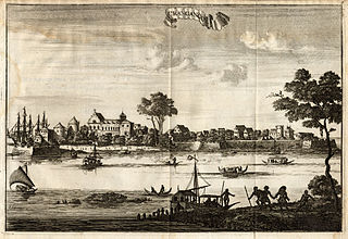
Kodungallur, IPA: [koɖuŋːɐlːuːr], is a historically significant town situated on the banks of river Periyar on the Malabar Coast in Thrissur district of Kerala, India. It is situated 29 kilometres (18 mi) north of Kochi (Cochin) by National Highway 66. Kodungallur, being a port city at the northern end of the Kerala lagoons, was a strategic entry point for the naval fleets to the extensive Kerala backwaters.
Kannur is one of the 14 districts along the west coast in the state of Kerala, India. The city of Kannur is the district headquarters and gives the district its name. The old name, Cannanore, is the anglicized form of the Malayalam name "Kannur". Kannur district is bounded by Kasaragod District to the north, Kozhikode district to the south, Mahé district to the southwest and Wayanad District to the southeast. To the east, the district is bounded by the Western Ghats, which forms the border with the state of Karnataka. The Arabian Sea lies to the west. Paithalmala is the highest point in Kannur District (1,372m). Enclosed within the southern part of the district is the Mahé district of the Union Territory of Puducherry. The district was established in 1957.

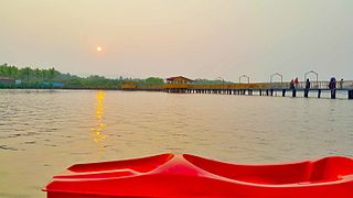
The Kerala backwaters are a network of brackish lagoons and lakes lying parallel to the Arabian Sea coast of Kerala state in southern India, as well as interconnected canals, rivers, and inlets, a labyrinthine system formed by more than 900 kilometres (560 mi) of waterways, and sometimes compared to American bayous. The network includes five large lakes linked by canals, both man made and natural, fed by 38 rivers, and extending virtually half the length of Kerala state. The backwaters were formed by the action of waves and shore currents creating low barrier islands across the mouths of the many rivers flowing down from the Western Ghats range. In the midst of this landscape there are a number of towns and cities, which serve as the starting and end points of backwater cruises. There are 34 backwaters in Kerala. Out of it, 27 are located either closer to Arabian Sea or parallel to the sea. The remaining 7 are inland navigation routes.

Ezhimala, a hill reaching a height of 286 metres, is located near Payyanur, in Kannur district of Kerala, south India. It is a part of a conspicuous and isolated cluster of hills, forming a promontory, 38 km north of Kannur (Cannanore). The Indian Naval Academy at Ezhimala is the Asia's largest, and the world's third-largest, naval academy.

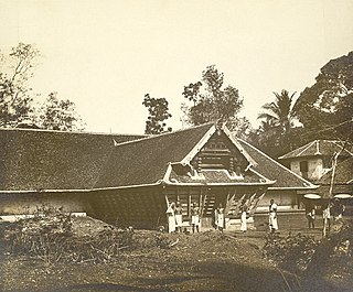
Malabar District, also known as Malayalam District, was an administrative district on the southwestern Malabar Coast of Bombay Presidency (1792-1800) and Madras Presidency (1800-1947) in British India, and independent India's Madras State (1947-1956). It was the most populous and the third-largest district in the erstwhile Madras State. The British district included the present-day districts of Kannur, Kozhikode, Wayanad, Malappuram, Palakkad, Chavakad Taluk and parts of Kodungallur Taluk of Thrissur district, and Fort Kochi area of Ernakulam district in the northern and central parts of present Kerala state, the Lakshadweep Islands, and a major portion of the Nilgiris district in Tamil Nadu. The detached settlements of Tangasseri and Anchuthengu, which were British colonies within the kingdom of Travancore in southern Kerala, also formed part of Malabar District until 1927. Malayalam was administrative as well as most spoken Lingua franca of Malabar District during British Rule. Jeseri, a distinct dialect of Malayalam, was spoken in the Laccadive Islands. Malabar District merged with the erstwhile state of Travancore-Cochin (1950-1956) to form Kerala according to the States Reorganisation Act, 1956. On the same day, the present Kasaragod district of South Canara District was also attached to Malabar, and the Laccadive&Minicoy Islands of Malabar were reorganised to form a new Union Territory. Malabar was trifurcated to form the districts of Kannur, Kozhikode, and Palakkad, on 1 January 1957.

Feroke, IPA: [fɐroːkːɨ̆], is a Municipality and a part of Kozhikode metropolitan area under Kozhikode Development Authority (K.D.A) in the Kozhikode district of the Indian state of Kerala.

Korapuzha, also known as Elathur River, is a short river of 40 km (25 mi), with a drainage area of 624 km2 (241 sq mi), flowing through the Kozhikode district of Kerala state in India. It is formed by the confluence of two streams, Akalapuzha and Punoor puzha which originate in the mountains of Wayanad district. The Korapuzha empties into the Arabian Sea at Elathur. The river and its main tributaries become tidal as they near the Arabian Sea. There is heavy boat traffic over the last 25 km (16 mi) of its course. It forms part of the West Coast Inland Navigation System.
Koyilandy, IPA: [kojilɐːɳɖi], formerly known in English as Quilandy, Malayalam as Pandalayani Kollam, Arabic as Fundriya, and Portuguese as Pandarani, is a municipality in the taluk of the same name in Kozhikode district, Kerala on the Malabar Coast. The historical town is located right in the middle of the coast of Kozhikode district, between Kozhikode (Calicut) and Vadakara (Badagara), on National Highway 66. Koyilandy is the 2nd most cleanest town of South India. Koyilandy harbour is the largest fishing harbour in Asia. The northern part of Pulimuttu is 1600 m long and the southern part is 915 m long. The picturesque Kappad beach lies near Koyilandy. India's first mangrove museum is situated in Koyilandy. Koyilandy is well connected to major towns like Kozhikode, Vatakara, Thamarassery, Balussery & Perambra. Koyilandy has the only port between Kozhikode and Thalassery. Located on the northwestern bank of the river Korapuzha, which was considered as the traditional boundary between the erstwhile regions of North Malabar and South Malabar, Koyilandy is also one of the oldest ports in South India.

Conolly Canal, sometimes spelled as Canoly Canal, is the part of the West coast canal (WCC) network of Kerala and the canal was constructed by combining the rivers and streams along the coast with the intention of creating a vast waterway from Kozhikode to Kochi. It was constructed in the year 1848 under the orders of then collector of Malabar, H.V. Conolly initially to facilitate movement of goods to Kallayi Port from hinter lands of Malabar through Kuttiyadi and Korapuzha river systems.

Kerala is a state on the Malabar Coast of India. It was formed on 1 November 1956, following the passage of the States Reorganisation Act, by combining Malayalam-speaking regions of the erstwhile regions of Cochin, Malabar, South Canara, and Travancore. Spread over 38,863 km2 (15,005 sq mi), Kerala is the twenty-first largest Indian state by area. It is bordered by Karnataka to the north and northeast, Tamil Nadu to the east and south, and the Lakshadweep Sea to the west. With 33 million inhabitants as per the 2011 census, Kerala is the thirteenth-largest Indian state by population. It is divided into 14 districts with the capital being Thiruvananthapuram. Malayalam is the most widely spoken language and is also the official language of the state.

Kasaragod is one of the 14 districts in the southern Indian state of Kerala. It's northern border Thalappady is located just 10 km south to Ullal, which is the southernmost portion of the major port city Mangalore, on the southwestern Malabar coast of India.

North Malabar refers to the geographic area of southwest India covering the state of Kerala's present day Kasaragod, Kannur, and Wayanad districts, and the taluks of Vatakara, Koyilandy, and Thamarassery in the Kozhikode District of Kerala and the entire Mahé Sub-Division of the Union Territory of Puducherry. Traditionally North Malabar is defined as the northern portion of erstwhile Malabar District which lies between Chandragiri River and Korapuzha River. The region between Netravathi River and Chandragiri River, which included the portions between Mangalore and Kasaragod, are also often included in the term North Malabar, as the Kumbla dynasty in the southernmost region of Tulu Nadu, had a mixed lineage of Malayali Nairs and Tuluva Brahmins.
Elathur is a part of Calicut corporation in Kozhikode district in the Indian state of Kerala. It is located about 12 km north of Kozhikode city on the National Highway 66. It is bounded by the Arabian Sea at the west and Korapuzha River at the north. The Elathur River is generally considered to be the boundary between the North Malabar and South Malabar in the erstwhile district of Malabar.

Kuttiady is a hilly town situated in the north eastern part of Kozhikode district in the North Malabar of Kerala, India. It is located 24 km (15 mi) from Vatakara and 13 km (8.1 mi) from Perambra. Kuttiady is situated in the slopes of the Western Ghats.The Kuttiady river flows through the town.
Chaliyam is a village situated at the estuary of Chaliyar in Kozhikode district of Kerala, India. Chaliyam forms an island, bounded by the Chaliyar in the north, and River Kadalundi in south, and the Conolly Canal in the east. It is located just opposite to Beypore port. Chaliyam was the former terminus of the South-West Line of the Madras Railway. Chaliyam is also famous for the Guinness World Records holder Muhammed Adil, a P.M who covered around seven km in the Chaliyar River with his hand and legs tied with ropes.

Kasaragod District is the northernmost district in the southwestern Indian coastal state of Kerala. The district has a long history starting from pre-historic times to modern period.

South Malabar refers to a geographical area of the southwestern coast of India covering some parts of the present-day Kerala. South Malabar covers the regions included in present-day Kozhikode Taluk of Kozhikode district, whole area of Malappuram district, Chavakkad Taluk of Thrissur district, and Palakkad district excluding parts of Chittur Taluk. The Fort Kochi region of Kochi city also historically belongs to South Malabar. The term South Malabar refers to the region of the erstwhile Malabar District which lies south to the river Korapuzha and bears high cultural similarity with both the Cochin as well as the North Malabar region.