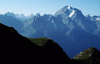
The Habicht is a mountain in the Stubai Alps of Austria. For a long time, the locals believed it to be the highest mountain in Tyrol, due to its prominence above the surrounding mountains. Despite what they thought, the highest peak in the Stubai Alps is Zuckerhütl which is 230 metres higher than Habicht. The name literally means "hawk" in German.

The Signalkuppe also known as Punta Gnifetti is a peak in the Pennine Alps on the border between Italy and Switzerland. It is a subpeak of Monte Rosa. The mountain is named after 'the Signal', a prominent gendarme atop the east ridge, named Cresta Signal.

The Ritzlihorn is a mountain of the Bernese Alps, overlooking Handegg in the canton of Bern. It lies on the range east of the Gauli Glacier and north of the Bächlistock.

The Feuerstein is a twin peak in the Stubai Alps on the border of Tyrol and South Tyrol.

The Grohmannspitze is a mountain in the Langkofel Group of the Dolomites in South Tyrol, Italy.
The Ohrenspitzen are three peaks on the border between Tyrol, Austria, and South Tyrol, Italy. They are a part of the Rieserferner Group in the Central Eastern Alps.
The Aiguille des Glaciers is a mountain in the Mont Blanc massif of the Graian Alps. It lies on the borders of Savoie and Haute-Savoie in France and Aosta Valley in Italy.

Pointe de l'Aiglière is a mountain in the French Alps. Located in the Massif des Écrins, the mountain is 3,307 m tall.

Pic des Souffles is a mountain in the French Alps. Located in the Massif des Écrins, the mountain is 3,099 m tall.

Enciastraia is a mountain in the Maritime Alps, on the boundary between the province of Cuneo and the French region of Provence-Alpes-Côte-d'Azur.
Monte Tagliaferro is a mountain of the Pennine Alps. It is one of the most popular hiking destination of Valsesia.
The Grande Rochère is a mountain of the Italian Pennine Alps, located north of Morgex in the Aosta Valley. Reaching a height of 3,326 metres above sea level, it is the culminating point of the group lying between the Col Ferret and the Great St. Bernard Pass.

Pizzo Bianco is a mountain of the Pennine Alps, overlooking Macugnaga in the Italian region of Piedmont. It lies on the range north of the Punta Grober, between the Belvedere Glacier and the valley of Quarazza.

The Patteriol is a mountain in the Verwall Alps in the Austrian state of Tyrol. It has an elevation of 3,056 m (AA). (In old literature the elevation is stated higher: 3,059 m or 10,037 ft. Patteriol is sometimes called "Matterhorn of Verwall" because of its shape.

The Ankogel is a mountain in the Ankogel Group in the eastern High Tauern range in Austria. It is the second highest mountain in the group, the Hochalmspitze being higher at 3,360 m.

The Wilde Leck is a mountain, 3,361 m (AA), in the Stubai Alps in the Austrian state of Tyrol. It rises immediately west of the Sulztalferner glacier and towers above the Ötztal valley, 5.5 km northwest of Sölden. It has a rocky summit made of solid granite and prominent arêtes. In the Stubai Alps the Wilde Leck is one of the most difficult summits to climb, because its easiest route runs initially over glaciers and then up a rock face that is assessed as climbing grade III (UIAA).

Punta Lavina (3,308m) is a mountain of the Graian Alps located on the border of Aosta Valley and Piedmont, Italy. It is located between the Aostan Cogne Valley in the north and the Piedmontese Soana Valley in the South. The mountain has an elegant pyramidal shape which is easily recognisable from both Canavese and Turin. It lies entirely within the Gran Paradiso National Park.

The Monte Capezzone is a mountain in the Pennine Alps of north-western Italy; with an elevation of 2,421 m (7,943 ft) is the highest peak of the Strona Valley.

The Monte Massone, at an elevation of 2,161 m (7,090 ft), is a mountain of the Pennine Alps in North-western Italy.

The Punta Mirauda is a mountain of the Ligurian Alps located in Piedmont.
This page is based on this
Wikipedia article Text is available under the
CC BY-SA 4.0 license; additional terms may apply.
Images, videos and audio are available under their respective licenses.

