Punta Islita Airport

Last updated
Islita Airport
Summary
Airport typePrivate
Serves Punta Islita, Costa Rica
LocationCorozalito
Elevation  AMSL 7 ft / 2 m
Coordinates 9°51′25″N85°22′15″W / 9.85694°N 85.37083°W / 9.85694; -85.37083 Coordinates: 9°51′25″N85°22′15″W / 9.85694°N 85.37083°W / 9.85694; -85.37083
Website Punta Islita Airport
Map
Costa Rica location map.svg
Airplane silhouette.svg
PBP
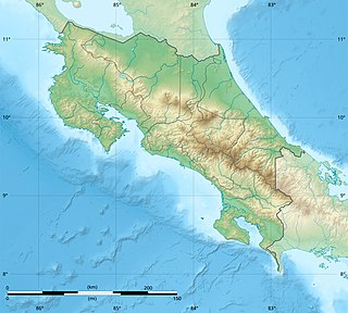
Location in Costa Rica
Runways
Direction LengthSurface
mft
03/211,0303,379Asphalt
Statistics (2014)
Passengers [1] 2,766
Passenger change 13–14Increase2.svg51.2%
Source: AIP [2] GCM [3] Google Maps [4] SkyVector [5]

Islita Airport( IATA : PBP, ICAO : MRIA) is an airport that serves the communities of Punta Islita in the Nandayure Canton of Costa Rica. The airport is at the village of Corozalito, 3 kilometres (1.9 mi) east of Punta Islita. It is the main access to a series of secluded beaches in southern Nicoya Peninsula.

An IATA airport code, also known as an IATA location identifier, IATA station code or simply a location identifier, is a three-letter code designating many airports around the world, defined by the International Air Transport Association (IATA). The characters prominently displayed on baggage tags attached at airport check-in desks are an example of a way these codes are used.

ICAO airport code four-letter code designating many airports around the world

The ICAOairport code or location indicator is a four-letter code designating aerodromes around the world. These codes, as defined by the International Civil Aviation Organization and published in ICAO Document 7910: Location Indicators, are used by air traffic control and airline operations such as flight planning.

Punta Islita is a resort town with secluded beaches in the Nandayure Canton, Guanacaste Province of Costa Rica. The Punta Islita Airport is located in a nearby town of Corozalito.

Contents

The runway is in a coastal valley leading into mountainous terrain, and has a 30 feet (9.1 m) rise from south to north. There is rising terrain in all quadrants except the south, which is the Pacific Ocean shore. The Liberia VOR-DME (Ident: LIB) is located 45.5 nautical miles (84 km) north-northwest of the airport. [6]
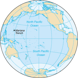
Pacific Ocean Ocean between Asia and Australia in the west, the Americas in the east and Antarctica or the Southern Ocean in the south.

The Pacific Ocean is the largest and deepest of Earth's oceanic divisions. It extends from the Arctic Ocean in the north to the Southern Ocean in the south and is bounded by Asia and Australia in the west and the Americas in the east.

The airport is owned by a private administrator and currently has four weekly scheduled flights from San José and Nosara.

Juan Santamaría International Airport Airport in Costa Rica

Juan Santamaría International Airport is the primary airport serving San José, the capital of Costa Rica. The airport is located in the city of Alajuela, 20 km west of downtown San José. It is named after Costa Rica's national hero, Juan Santamaría, a courageous drummer boy who died in 1856 defending his country against forces led by US-American filibuster William Walker.

Nosara Airport airport in Costa Rica

Nosara Airport is an airport serving Nosara, a village in the Guanacaste Province of Costa Rica. The airport is approximately 15 minutes from the beaches of Nosara, the main tourist attraction in the area. The airport is owned and administrated by the country's Directorate General of Civil Aviation (DGAC).

On December 31, 2017, a plane operated by Nature Air crashed shortly after takeoff from Punta Islita.

Airlines and destinations

There are currently no scheduled operations at the airport.

Charter services

Passenger Statistics

These data show number of passengers movements into the airport, according to the Directorate General of Civil Aviation of Costa Rica's Statistical Yearbooks.

Year20082009201020112012201320142015
Passengers3,8862,0292,1562,1521,8641,8292,766T.B.A.
Growth (%)Decrease2.svg 22.25%Decrease2.svg 47.79%Increase2.svg 6.26%Decrease2.svg 0.19%Decrease2.svg 13.38%Decrease2.svg 1.88%Increase2.svg 51.23%T.B.A.
Source: Costa Rica's Directorate General of Civil Aviation (DGAC). Statistical Yearbooks
(Years 2008, [7] [8] [9] 2011, [10] 2012, [11] 2013, [12] and 2014 [1] )
Year20002001200220032004200520062007
Passengers1,5501,7782,1303,3934,7663,8043,3764,998
Growth (%)N.A.Increase2.svg 14.71%Increase2.svg 19.80%Increase2.svg 59.30%Increase2.svg 40.47%Decrease2.svg 20.18%Decrease2.svg 11.25%Increase2.svg 48.05%
Source: Costa Rica's Directorate General of Civil Aviation (DGAC). Statistical Yearbooks
(Years 2000-2005, [13] 2006, [14] and 2007, [15] )

See also

Transport in Costa Rica

There are many modes of transport in Costa Rica but the country's infrastructure has suffered from a lack of maintenance and new investment. There is an extensive road system of more than 30,000 kilometers, although much of it is in disrepair; this also applies to ports, railways and water delivery systems. According to a 2016 U.S. government report, investment from China which attempted to improve the infrastructure found the "projects stalled by bureaucratic and legal concerns".

Related Research Articles

Daniel Oduber Quirós International Airport airport in Costa Rica

Daniel Oduber Quirós International Airport, also known as Liberia International Airport, is one of four international airports in Costa Rica. It serves especially as a tourism hub for those who visit the Pacific coast and western Costa Rica. The airport is named for Daniel Oduber Quirós, who served as president of Costa Rica from 1974 to 1978.

Tobías Bolaños International Airport airport in Costa Rica

Tobías Bolaños International Airport is one of four international airports in Costa Rica, and the secondary airport serving the city of San José, after Juan Santamaría International Airport. It is located in downtown San José, in Pavas District, San José Canton.

Quepos La Managua Airport airport in Costa Rica

La Managua Airport is an airport approximately 3 kilometres (2 mi) east of the Pacific coastal city of Quepos, Costa Rica, serving this city as well as the Manuel Antonio National Park and other tourist attractions in the central part of Puntarenas Province. The airport is named for the La Managua barrio where the it is located. The airport is owned and managed by the country's Directorate General of Civil Aviation (DGAC).

Tortuguero Airport airport in Costa Rica

Barra de Tortuguero Airport, is an airport serving Tortuguero village and Tortuguero National Park in Pococí Canton, Limón Province, Costa Rica.

Golfito Airport airport in Costa Rica

Golfito Airport is an airport serving Golfito, a port town on the northwest end of Golfito Bay, an inlet off the Gulf of Dulce in the Puntarenas Province of Costa Rica. The airport is owned and managed by the country's Directorate General of Civil Aviation (DGAC).

Palmar Sur Airport airport in Costa Rica

Palmar Sur Airport is an airport serving the adjacent towns of Palmar Norte and Palmar Sur in Osa Canton, Puntarenas Province, Costa Rica.

Puerto Jiménez Airport airport in Costa Rica

Puerto Jiménez Airport is an airport serving Puerto Jiménez, a Gulf of Dulce coastal town in Puntarenas Province, Costa Rica. The airport is just east of the town. It is owned and managed by the country's Directorate General of Civil Aviation (DGAC).

Tambor Airport airport in Costa Rica

Tambor Airport is an airport serving Tambor, Costa Rica. The airport also serves tourist destinations like Mal Pais, Santa Teresa, Montezuma, and the Cabo Blanco Absolute Natural Reserve.

Carrillo Airport airport in Costa Rica

Carrillo Airport is an airport serving Puerto Carrillo, a Pacific coastal village in Guanacaste Province, Costa Rica. The airport and village are 5 kilometres (3 mi) east of Sámara village.

Tamarindo Airport airport in Costa Rica

Tamarindo Airport is a private airport that serves Tamarindo, a coastal resort in Guanacaste province, Costa Rica. It receives daily scheduled flights from San José and Liberia, and private charter services are available. During the rainy season, the airport is frequently closed due to the weather.

Bahía Drake Airport airport in Costa Rica

Bahía Drake Airport is an airport serving Bahía Drake, a Pacific coastal district with a long tradition as a tourist destination in Osa Canton, Puntarenas Province, Costa Rica. The airport is also known as Drake Bay Airport.

San Isidro de El General Airport airport

San Isidro de El General Airport is an airport serving the city of San Isidro de El General and Pérez Zeledón county, Costa Rica. The airport is 3 kilometres (2 mi) south of downtown San Isidro.

Laurel Airport (Costa Rica) airport in Costa Rica

Laurel Airport is an airport serving the village of Laurel in Puntarenas Province, Costa Rica. The airport is among palm oil plantations, near the border with Panama.

La Fortuna Arenal Airport airport in Costa Rica

Arenal Airport is an airport serving La Fortuna, a district in San Carlos Canton, Alajuela Province, Costa Rica. The airport is named after the Arenal Volcano, one of the major tourist attractions in the country.

Parismina Airport airport that serves Parismina in Costa Rica

Parismina Airport is an airport that serves Parismina, a coastal town in Siquirres Canton, Limón Province, Costa Rica. In some cases the airport is also referred as Barra de Parismina Airport.

Hacienda Jacó Airport airport in Costa Rica

Hacienda Jacó Airport is a grass airstrip in Playa Hermosa, Garabito Canton, Puntarenas Province, Costa Rica.

Nicoya Airport airport in Costa Rica

Nicoya Airport is an airport serving the city of Nicoya in the Guanacaste Province of Costa Rica. The airport is owned and managed by the country's Directorate General of Civil Aviation.

Palo Arco Airport airport in Costa Rica

Palo Arco Airport is an airport serving the canton of Nandayure in Guanacaste Province, Costa Rica. There is rising terrain in all quadrants.

Nature Air Flight 9916

Nature Air Flight 9916 was a 40-minute chartered domestic passenger flight from Punta Islita Airport in Nandayure, Guanacaste Province, Costa Rica, to Costa Rica's capital San José that crashed on 31 December 2017 shortly after takeoff killing all 12 people onboard. The flight was operated by Costa Rican airline Nature Air using a Cessna 208 Caravan with 10 passengers, mostly tourists, and 2 crew members onboard. The plane crashed into mountainous terrain near the Punta Islita Airport.

References

  1. 1 2 DGAC Yearbook 2014 Archived 2016-03-04 at the Wayback Machine
  2. Aeronautical Information Publication (AIP) of Costa Rica, Section III (Airstrips) Archived 2016-03-04 at the Wayback Machine
  3. Airport information for Islita Airport at Great Circle Mapper.
  4. Google Maps - Punta Islita
  5. "Islita/ Nandayure Airport". SkyVector. Retrieved 12 March 2019.
  6. "Liberia VOR". Our Airports. Retrieved 12 March 2019.
  7. DGAC Yearbook 2009 Archived 2016-03-04 at the Wayback Machine ,
  8. DGAC Yearbook 2010 Archived 2016-01-25 at the Wayback Machine
  9. DGAC Yearbook 2010 Archived 2016-03-04 at the Wayback Machine
  10. DGAC Yearbook 2011 Archived 2016-03-04 at the Wayback Machine
  11. DGAC Yearbook 2012 Archived 2016-03-04 at the Wayback Machine
  12. DGAC Yearbook 2013 Archived 2016-03-04 at the Wayback Machine
  13. Oficina de Planificación, DGAC de Costa Rica
  14. DGAC Yearbook 2006 Archived 2016-01-25 at the Wayback Machine
  15. DGAC Yearbook 2007 Archived 2016-01-26 at the Wayback Machine