Limón International Airport in Limón, Costa Rica, is one of the four international airports in that country.
Bluefields International Airport is an airport serving Bluefields, a harbor city in the South Caribbean Coast Autonomous Region of Nicaragua. It is the busiest airport in the Caribbean coast of Nicaragua.
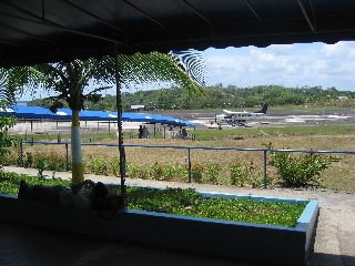
Changuinola "Capitan Manuel Niño" International Airport is an airport serving Changuinola, the capital of the Changuinola District in the Bocas del Toro Province in Panama. The name is in honor of the first Panamanian pilot.
Guápiles Airport is an airport serving Guápiles, a town in Pococí canton, Limón Province, Costa Rica. The runway is within the western section of the town.

La Plata Airport is a small airport serving La Plata, the capital city of the Buenos Aires Province, Argentina. The airport is 5 kilometres (3 mi) southeast of the centre of the city, and has a 60-square-metre (650 sq ft) terminal.

Junín Airport was a domestic airport serving Junín, a city in the Buenos Aires Province of Argentina. It is located 2 kilometres (1 mi) north of the city.
Miramar Airport is a public use airport serving Miramar, an Atlantic coastal town in the Buenos Aires Province of Argentina. The airport is 4 kilometres (2 mi) northwest of the town.
Pergamino Aeroclub is a public use airport in the countryside 5 kilometres (3 mi) west of Pergamino, a city in the Buenos Aires Province of Argentina.

Campo de Mayo Airport is a military airport located near San Miguel, Buenos Aires, Argentina.
Nueve de Julio Airport is a public use airport serving Nueve de Julio, a town in the Buenos Aires Province of Argentina. The airport is in the countryside 6 kilometres (4 mi) northwest of the town.
Arenal Airport is an airport serving La Fortuna, a district in San Carlos Canton, Alajuela Province, Costa Rica. The airport is named after the Arenal Volcano, one of the major tourist attractions in the country.
Nicoya Airport is an airport serving the city of Nicoya in the Guanacaste Province of Costa Rica. The airport is owned and managed by the country's Directorate General of Civil Aviation.
Upala Airport is an airport serving the town of Upala in Alajuela Province, Costa Rica. Upala is 10 kilometres (6 mi) south of the Nicaragua border.
Los Chiles Airport is an airport serving the town of Los Chiles in Alajuela Province, Costa Rica. The runway is on the east side of the town, and is 3 kilometres (2 mi) southeast of the Nicaraguan border.
Dieciocho Airport is an agricultural airport serving Finca Dieciocho and other oil palm plantations in Puntarenas Province, Costa Rica. The airport is 7 kilometres (4 mi) southeast of Palmar Sur and 1 kilometre (0.6 mi) off the Pan-American Highway. The runway lies alongside an unpaved field access road.
Las Piedras Airport is an airport serving the agricultural region southwest of Cañas in Guanacaste Province, Costa Rica. The nearest town is Bebedero, 1.6 kilometres (1 mi) north-northeast.
Chacarita Airport is an airport serving the town of Chacarita in Puntarenas Province, Costa Rica. Chacarita is on the Pacific coast at the base of the Puntarenas peninsula, just east of Puntarenas city.
La Flor Airport is an airport serving the La Flor hacienda in Guanacaste Province, Costa Rica. The runway is 6 kilometres (4 mi) north of Daniel Oduber Quirós International Airport.
El Carmen de Siquirres Airport is an airport serving the village and Del Monte banana plantation at El Carmen in Limón Province, Costa Rica. The plantation is 12 kilometres (7 mi) north of Siquirres.
General Villegas Airport is an airport serving the town of General Villegas in the Buenos Aires Province of Argentina. The airport is 3 kilometres (2 mi) north of General Villegas.
