Purangi

Last updated
Purangi
NZ-Taranaki plain map.png
Disc Plain red.svg
Purangi
Coordinates: 39°9′15″S174°31′51″E / 39.15417°S 174.53083°E / -39.15417; 174.53083
Country New Zealand
Region Taranaki
District New Plymouth District

Purangi is a locality east of Inglewood, New Zealand, situated on the banks of the Waitara River. It is within the traditional rohe of Ngāti Maru iwi. Today, Ngati Maru's headquarters are at Tarata. The Marae is called Te Upoko o te Whenua.

Inglewood, New Zealand Place in Taranaki, New Zealand

Inglewood is a town in the Taranaki Region of New Zealand's North Island. The population was 3,090 in the 2006 census, an increase of 144 from 2001. In 2013 it had risen to 3,243.

Waitara River river in New Zealand

The source of the Waitara River lies in the very steep hill country to the east of Mount Taranaki/Egmont, near Tahora. After proceeding in a southwesterly direction toward Central Taranaki, the river abruptly turns to flow in a northwesterly direction to the Tasman Sea: meeting it at the coastal town of Waitara.

Ngāti Maru (Taranaki) Māori iwi (tribe) in Aotearoa New Zealand

Ngāti Maru is a Māori iwi of inland Taranaki in New Zealand. They are descended from Maruwharanui, the eldest son of Pito Haranui and his wife, Manauea. Pito Haranui belonged to an ancient Taranaki people known as the Kahui-Maru, whose genealogy predates the arrival of Toi.

Contents

The Bell at Purangi - 1850s

The locality of Purangi, includes the sites of three Maori kainga; Pukemahoe, Purangi and Te Pokuru Pa. The first two were on the banks of the Waitara River, about a mile and a half apart. Te Pokuru Pa was six or seven miles from Pukemahoe. The story of the bell begins with Rev. Richard Taylor, Missionary of the Whanganui district. He placed the charge of the bell with Himiona Te Kapiti, a Maori layreader. At the time, Himiona lived on the upper reaches of the Whanganui river and was mainly responsible for the extension of Christianity in those districts. From Himiona the bell passed into the hands of Te Manihera Te Ikahaehae, also a layreader, of the Ngāti Maru.

Richard Taylor (missionary) English missionary in New Zealand

Richard Taylor was a Church Missionary Society (CMS) missionary in New Zealand. He was born on 21 March 1805 at Letwell, Yorkshire, England, one of four children of Richard Taylor and his wife, Catherine Spencer.

Te Manihera Te Ikahaehae was a Māori Anglican Lay-preacher from the Ngāti Maru of Taranaki iwi. He converted to Anglicanism in the 1850s. He was responsible for bringing the Bell of Purangi from Whanganui to Taranaki.

The bell was first used at Te Pokuru Pa, but the Pa was later deserted. During the 1850s, Ngati Maru erected an Anglican church at Pukemahoe, and so the bell was carried there. Once the bell was fixed in its place, Ngati Maru brought Archdeacon Govett (1819-1903) to open the church. There was much festivities on his arrival, for at the time he was the first white missionary who had ever gone into that part of the country. The chief of Purangi was Tutanuku Tume, elder brother of Te Manihera Tume. Both men were the nephews of Te Manihera Te Ikahaehae referred to above.

When the Anglo-Maori wars broke out in 1860, the newspaper of the day states that Titokowaru (a Hauhau chief and freedom fighter against the Pakeha) desecrated the church. He tore up the floor and converted the church into a Wharenui (Maori meeting house). If this was the case, this did not happen until 1869, when Titokowaru arrived in the Ngati Maru rohe.

Te Haina'Uira'Wehikore, Manihera's Sister took charge of the bell, and kept it in her care. In 1888, she met with Mr W.H.Skinner at Purangi and asked him to accept the bell back. She had two bells, a large one from the Anglican Church, and a smaller one from the Roman Catholic Mission at Ngakorako. Mr Skinner accepted both bells, and returned the Roman Catholic bell to the priest in charge of New Plymouth and the Anglican bell to St Mary's parish. This bell was attached to St Marys Schoolroom, and it was still there at the turn of the 20th century. [1]

Purangi Landless Natives Act 1907

Large areas of land were confiscated in Taranaki under the New Zealand Settlements Act 1863 and its subsequent amendments. This rendered many Maori landless. In 1907, the Crown passed legislation that allowed for the landless Maori at Purangi to be provided with enough land each to support themselves. This legislation was called the Purangi Landless Natives Act 1907.

The First Schedule of the Act, listed the Maori who were entitled to receive land under this legislation. They were Tutanuku Tume, Te Ika Haehae, Kapohanga Wehikore, Uira Wehikore and 15 others. Te Ikahaehae in this schedule was also known as Te Manihera Te Ikahaehae.

Sources

1. Taranaki Herald, Volume L, Issue 12448, 30 December 1903, Page 6

2. http://nzetc.victoria.ac.nz/tm/scholarly/tei-Gov1907Acts-t1-g1-t7-body1-d2.html

Related Research Articles

Taranaki Region of New Zealand in North Island

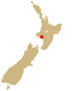
Taranaki is a region in the west of New Zealand's North Island, administered by the Taranaki Regional Council. It is named after its main geographical feature, the stratovolcano of Mount Taranaki.

Tītokowaru New Zealand Maori leader

Riwha Tītokowaru became a Māori leader in the Taranaki region and one of the most successful opponents of British colonization anywhere.

New Zealand Wars 1845–1872 armed conflicts in New Zealand

The New Zealand Wars were a series of armed conflicts that took place in New Zealand from 1845 to 1872 between the New Zealand government and allied Māori on one side and Māori people and Māori-allied settlers on the other. Until at least the 1980s, they were commonly referred to as the Land Wars or the Māori wars; the historian James Belich was one of the first to refer to them as the "New Zealand wars", in his 1987 book The New Zealand wars and the Victorian interpretation of racial conflict.

Second Taranaki War

The Second Taranaki War is a term used by some historians for the period of hostilities between Māori and the New Zealand Government in the Taranaki district of New Zealand between 1863 and 1866. The term is avoided by some historians, who either describe the conflicts as merely a series of West Coast campaigns that took place between the Taranaki War (1860–1861) and Titokowaru's War (1868–69), or an extension of the First Taranaki War.

Te Keepa Te Rangihiwinui Maori military commander

Te Keepa Te Rangihiwinui was a Māori military commander and noted ally of the government forces during the New Zealand Wars. First known as Te Rangihiwinui, he was later known as Te Keepa, Meiha Keepa, Major Keepa or Major Kemp.

Wiremu Kīngi Maori military leader

Wiremu Kīngi Te Rangitāke, Māori Chief of the Te Āti Awa Tribe, was leader of the Māori forces in the First Taranaki War.

Te Whanganui-a-Tara is the Māori name for Wellington Harbour. The term is also sometimes used to refer to the city of Wellington, the capital city of New Zealand, which lies on the shores of the harbour. "Te Whanganui-a-Tara" translates as "the great harbour of Tara", which refers to the rangatira Tara, who Māori tradition says visited the area in the 12th century and decided to stay.

Waitara, New Zealand Place in Taranaki, New Zealand

Waitara is a town in the northern part of the Taranaki region of the North Island of New Zealand. Waitara is located just off State Highway 3, 15 kilometres (9.3 mi) northeast of New Plymouth. Its population was 6312 in the 2013 census, an increase of 24 from 2006.

Ngāti Ruanui Māori iwi (tribe) in Aotearoa New Zealand

Ngāti Ruanui is a Māori iwi traditionally based in the Taranaki region of New Zealand. In the 2006 census, 7,035 people claimed affiliation to the iwi. However, most members now live outside the traditional areas of the iwi.

Te Āti Awa Māori iwi (tribe) in Aotearoa New Zealand

Te Āti Awa is a Māori iwi with traditional bases in the Taranaki and Wellington regions of New Zealand. Approximately 17,000 people registered their affiliation to Te Āti Awa in 2001, with around 10,000 in Taranaki, 2,000 in Wellington and around 5,000 of unspecified regional location.

Ngā Rauru Māori iwi (tribe) in Aotearoa New Zealand

Ngā Rauru is a Māori iwi in the Wanganui region of New Zealand. In the 2006 census, 4,047 Māori claimed affiliation to Ngā Rauru, representing 12 hapu.

Octavius Hadfield was Archdeacon of Kapiti, Bishop of Wellington from 1870 to 1893 and Primate of New Zealand from 1890 to 1893. He was a member of the Church Missionary Society (CMS) for thirty years. He was recognised as an authority on Māori customs and language. His views on Māori rights, expressed in several books strongly criticised the actions of the New Zealand Government. Hadfield married Catherine (Kate) Williams a daughter of the Rev. Henry Williams and Marianne Williams.

Lepperton Place in Taranaki, New Zealand

Lepperton is a small village in North Taranaki, New Zealand. It is approximately 6 km (3.7 mi) inland from Waitara township, 5 km (3.1 mi) west of the Waitara River, and 1 km (0.62 mi) east of State Highway 3A, which connects Inglewood to Waitara.

Midhirst Place in Taranaki, New Zealand

Midhirst is a small village in Taranaki, New Zealand, approximately 4 km north of Stratford, on State Highway 3. Inglewood is 17 km (11 mi) north of Midhirst, and New Plymouth is 35 km (22 mi) to the northwest.

Urenui Place in Taranaki, New Zealand

Urenui is a settlement in northern Taranaki, in the North Island of New Zealand. It is located on State Highway 3 close to the shore of the North Taranaki Bight, 13 kilometres east of Waitara and 6 km south-west of Mimi. The Urenui River flows past the settlement into the North Taranaki Bight.

Ngāti Mutunga Māori iwi (tribe) in Aotearoa New Zealand

Ngāti Mutunga is a Māori iwi (tribe) of New Zealand, whose original rohe were in north Taranaki. They migrated from Taranaki, first to Wellington, and then to the Chatham Islands in the 1830s. The rohe of the iwi includes Wharekauri, Te Whanga Lagoon and Waitangi on Chatham Island, and Pitt Island, also part of the Chatham Islands. The principal marae are at Urenui in Taranaki, and the Chatham Islands.

Ngāti Tama Māori iwi (tribe) in Aotearoa New Zealand

Ngāti Tama is a historic Māori iwi of present-day New Zealand which whakapapas back to Tama Ariki, the chief navigator on the Tokomaru waka. The Iwi of Ngati Tama is located in north Taranaki around Poutama. On its northern boundary are the Tainui and Waikato/Maniapoto tribes, and on the southern boundary is Ngati Mutunga. The close geographical proximity of Tainui's Ngati Toa and Ngati Mutunga explains the long, continuous, and close relationship among the three Iwi.

Te Manihera Poutama was a New Zealand mission teacher and Anglican missionary. Of Māori descent, he identified with the Ngāti Ruanui iwi. He was born in Taranaki, New Zealand.

References

  1. Taranaki Herald , Volume L, Issue 12448, 30 December 1903, Page 6

Further reading

General historical works

Anglican Church

Coordinates: 39°09′S174°31′E / 39.150°S 174.517°E / -39.150; 174.517