Cadbury Hill is a small hill, mostly in the civil parish of Congresbury, overlooking the village of Yatton in North Somerset. On its summit stands an Iron Age hill fort, which is a Scheduled Ancient Monument.

Wild Park is a 239.8-hectare (593-acre) Local Nature Reserve adjacent to Lewes Road in Brighton, East Sussex. It is owned and managed by Brighton and Hove City Council. It includes Hollingbury Castle, an Iron Age hillfort which is a Scheduled Monument, and Hollingbury Park golf course.

The Harrold-Odell Country Park is a 59.3 hectare Country park and Local Nature Reserve between the villages of Odell and Harrold in Bedfordshire. It is owned and managed by Bedford Borough Council, and it has a cafe, toilets and an information room.
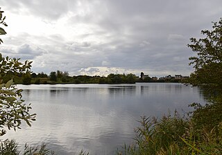
Eye Green Local Nature Reserve is a 12 hectare Local Nature Reserve in Eye Green in Cambridgeshire. It was managed by the Wildlife Trust for Bedfordshire, Cambridgeshire and Northamptonshire until September 2016, when management was transferred to its owner, Peterborough City Council. A small part is also in the Eye Gravel Pit geological Site of Special Scientific Interest.

Stanmore Country Park is a 30.7-hectare (76-acre) public park, Local Nature Reserve and Site of Metropolitan Importance for Nature Conservation in Stanmore in the London Borough of Harrow. It is owned and managed by Harrow London Borough Council.
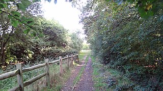
Ainslie Wood is a 2.03 hectares Local Nature Reserve and a Grade I Site of Nature Conservation Interest surrounded by urban housing in Chingford in the London Borough of Waltham Forest in England. It is owned by Waltham Forest Borough Council and operated by the council with Friends of Ainslie and Larks Woods.
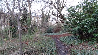
Barnsbury Wood is a Local Nature Reserve and Site of Borough Importance for Nature Conservation, Grade I, in Barnsbury in the London Borough of Islington. With an area of only 0.35 hectares, it is one of the smallest Local Nature Reserve in London It is owned and managed by Islington Council.

Northaw Great Wood is a 223.6-hectare (553-acre) biological Site of Special Scientific Interest (SSSI) near Cuffley in Hertfordshire, England. It covers Northaw Great Wood Country Park, which is managed by Welwyn Hatfield Borough Council, Well Wood, Justice Hill and Grimes Bottom. Part of the site is managed by Hertfordshire County Council as a schools' park. The country park is also a local nature reserve.

Harebreaks Wood is 5.1 hectare Local Nature Reserve in Watford in Hertfordshire. It is owned by Watford Borough Council and managed by the council and the Friends of Harebreaks Wood.

Flitwick Wood is a 14.2 hectares Local Nature Reserve in Flitwick in Bedfordshire. It is owned and managed by Central Bedfordshire Council.

Fenlake Meadows is a 19.2 hectare Local Nature Reserve located in the Kingsbrook area of Bedford. It is owned and managed by Bedford Borough Council.

Mowsbury Hill is a 2.8 hectare Local Nature Reserve and Scheduled Monument in north Bedford. It is owned and managed by Bedford Borough Council with the assistance of the Friends of Putnoe Wood and Mowsbury Hillfort.
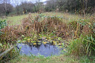
Hill Rise is a 0.9 hectare Local Nature Reserve (LNR) located in the Harpur area of Bedford. It is owned and managed by Bedford Borough Council.
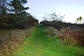
Park Wood is a 5.2 hectare Local Nature Reserve located in the Brickhill area of Bedford. It is owned by Bedford Borough Council and managed by the council with the assistance of the Friends of Park Wood.

Browns Wood is a six hectare Local Nature Reserve north of Clapham in Bedfordshire. It is owned and managed by Bedford Borough Council.

Grimeshaw Wood is a 16.8-hectare (42-acre) Local Nature Reserve on the western outskirts of Peterborough in Cambridgeshire. It is owned by Peterborough City Council, and managed by the council together with the Peterborough Environment City Trust.
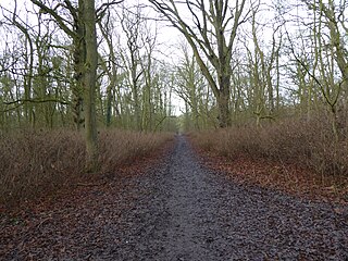
King's Wood is a 31.7 hectare Local Nature Reserve in Corby in Northamptonshire. It managed by the Wildlife Trust for Bedfordshire, Cambridgeshire and Northamptonshire.

Bradlaugh Fields is a 60-hectare (150-acre) open space in Northampton. The site is a former golf course. In 1987 it was proposed to build housing on the site, but after a campaign by local residents it was acquired by Northampton Borough Council and opened as a wildlife park in 1998. It was named after Charles Bradlaugh, a leading nineteenth century radical and atheist who was MP for Northampton. Three fields with a total area of 17.5 hectares are managed by the Wildlife Trust for Bedfordshire, Cambridgeshire and Northamptonshire as a nature reserve also called Bradlaugh Fields. Hills and Holes is at the southern end and two adjoining meadows, Scrub Field and Quarry Field, are at the northern end. Hills and Holes is an 8.3 hectare Local Nature Reserve (LNR) and Scrub Field is a 5.1-hectare (13-acre) LNR.


