
Toubkal, also Jbel Toubkal or Jebel Toubkal, is a mountain in southwestern Morocco, located in the Toubkal National Park. At 4,167 m (13,671 ft), it is the highest peak in Morocco, the Atlas Mountains, North Africa and the Arab world. Located 63 km (39 mi) south of the city of Marrakesh, and visible from it, Toubkal is an ultra prominent peak, the highest for over 2,000 km (1,200 mi). Toubkal is ranked 27th by topographic isolation.
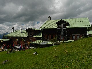
The Vorderkaiserfelden Hut is an alpine hut in the Kufstein district, Austria. It is located at 1,384 metres (4,541 ft) on the southwest slope of the Zahmer Kaiser below the Naunspitze and high above the Kaisertal valley in the Kaisergebirge mountain range. It has a good view over the Inn valley and Kufstein and across to the Mangfall Mountains and the Wilder Kaiser.

The Kaiser Mountains are a mountain range in the Northern Limestone Alps and Eastern Alps. Its main ridges – are the Zahmer Kaiser and south of it the Wilder Kaiser. The mountains are situated in the Austrian province of Tyrol between the town of Kufstein and the town of St. Johann in Tirol. The Kaiser Mountains offer some of the loveliest scenery in all the Northern Limestone Alps.

The Ellmauer Halt (2,344 m) is the highest peak in the mountain massif of the Wilder Kaiser in the Kaiser range in the Austrian state of Tyrol. To the east is the summit of the Kapuzenturm, a striking and isolated rock pinnacle. In 1883 the first summit cross was erected on the mountain top.

At 2,002 metres (6,568 ft) the Vordere Kesselschneid is the highest summit in the Zahmer Kaiser, the northern chain of the Kaiser Mountains in the Austrian state of Tyrol.

The Alpspitze is a mountain, 2628 m, in Bavaria, Germany. Its pyramidal peak is the symbol of Garmisch-Partenkirchen and is one of the best known and most attractive mountains of the Northern Limestone Alps. It is made predominantly of Wetterstein limestone from the Upper Triassic.

The Funtenseetauern is a 2,579 m high border peak between Germany and Austria on the northern edge of the Steinernes Meer, one of the nine massifs of the Berchtesgaden Alps. The Funtenseetauern rises south of Berchtesgaden, its broad shoulder towering over the lakes of Königssee and Obersee. To the northwest of the Funtenseetauern and linked to it by a ridge is the Stuhljoch (2,448 m), whose Stuhlwand rock face drops steeply into the bowl of the Funtensee.
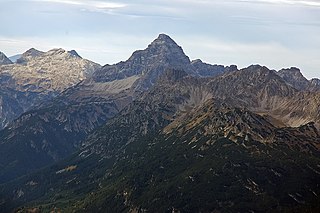
The Hochvogel is a 2,592-metre-high (8,504 ft) mountain in the Allgäu Alps. The national border between Germany and Austria runs over the summit. Although only the thirteenth highest summit in the Allgäu Alps, the Hochvogel dominates other parts of Allgäu Alps and the other ranges in the immediate neighbourhood. This is due to the fact that the majority of the higher peaks are concentrated in the central and western part of the Allgäu Alps. The Hochvogel stands on its own in the eastern part of the mountain group; the nearest neighbouring summits are 200 to 300 metres lower. Experienced climbers can ascend the summit on two marked routes.

The Petersköpfl is a 1,745m high summit in the Zahmer Kaiser, the northern ridge of the Kaisergebirge mountain range in the Austrian state of Tyrol. To the east, the Petersköpfl is linked by a ridge to the Einserkogel; to the west it is separated from the Naunspitze by a wind gap. To the south it falls steeply into the Kaisertal valley and to the north its steep rock faces tower above Ebbs. To the east there is a gently sloping plateau covered with mountain pine that forms the main ridge of the Zahmer Kaiser and runs up to the Pyramidenspitze.

The Stripsenjochhaus is an Alpine club hut owned by the Kufstein branch of the Austrian Alpine Club in the Kaisergebirge mountain range in the Austrian state of Tyrol.
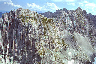
The Goinger Halt is a mountain in the Kaisergebirge range in the Northern Limestone Alps in Austria. It has a double summit: a northern top to the rear, the Hintere Goinger Halt, and a higher, southern top in front, the Vordere Goinger Halt. The name "Halt" means something like Alpine meadow and refers therefore to the peak over the meadow areas, that belong to the parish of Going.

The Stripsenkopf is a 1,807-metre-high (5,928 ft) mountain in the Kaisergebirge range of the Northern Limestone Alps in Austria. It belongs to the Zahmer Kaiser group and its summit is covered in mountain pine.
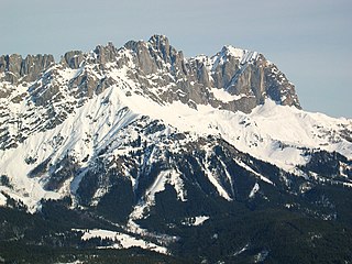
At 2,329 metres above sea level, the Ackerlspitze is the second highest peak in the Kaisergebirge range in the east of the Austrian state of Tyrol. The mountain is located in the eastern part of the range, also referred to as the Ostkaiser or East Kaiser. To the east it is flanked by the Maukspitze (2.231 m), to the north it sends a ridge to the Lärcheck (2,123 m). To the southwest a prominent, rocky arête runs over to the Regalmspitze (2,253 m) and on to the Kleines Törl. To the south the Ackerlspitze drops steeply, with vertical rock faces in places, into the Leukental valley. To the northwest it falls away just as steeply into the Griesner Cirque and to the northeast into the Mauk Cirque (Maukkar). On fine days there is an attractive and extensive panoramic view from the summit of the Ackerlspitze over the neighbouring mountain groups and as far as the Chiemsee lake in Bavaria as well as the Großvenediger.

The Hans Berger Haus is a refuge hut belonging to the Kufstein section of the Austrian Friends of Nature, located in the Kaisergebirge mountains in Tyrol. The tenants run a well-known climbing school here.
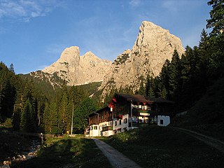
The Anton Karg Haus, formerly the Neue Hinterbärenbad Hut, is an Alpine club hut belonging to the Kufstein Section of the Austrian Alpine Club in the Kaisergebirge mountains in the Austrian state of Tyrol. The hut is named after the co-founder of the Kufstein Section, Anton Karg, who was the manager of the hut from 1888 and, from 1890 to 1919, the chairman of the Kufstein Branch of the Alpine Club.
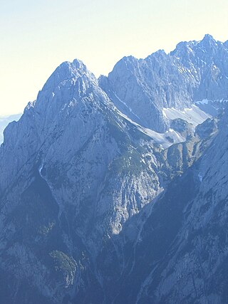
The Lärchegg is a 2,123-metre-high (6,965 ft) mountain in the Kaisergebirge range of the Northern Limestone Alps in Austria.

The Sonneck is a 2,260-metre-high (7,410 ft) mountain in the Kaisergebirge range of the Northern Limestone Alps in Austria. On its broad peak stands a solid summit cross, the panorama is comprehensive and there are particularly good views of the Ellmauer Halt, the highest mountain in the range, the Treffauer and Lake Hinterstein.
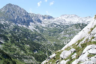
The Fritzerkogel is a mountain in the Tennengebirge in the northern Limestone Alps, Austria. With its elevation of 2,360 metres (7,740 ft), is one of the higher peaks in the mountain range. Seen from the north it stands out as a relatively isolated, broad summit block, whose mighty rock faces and steep, rugged, rocky flanks (Schrofen) fall away on all sides. Its 1,200-metre-high (3,900 ft) south cliff face is impressive and makes it a striking two-thousander.

The Hochplattig is a mountain, 2,768 m (AA) high, and the highest summit in the Mieming Chain, a mountain range in the Northern Limestone Alps in the state of Tyrol, Austria.

The Zettenkaiser is a 1,968 m high mountain with a summit cross in the Kaiser Mountains (Kaisergebirge) in the Northern Limestone Alps in Austria. It rises to the west of the almost 150-metre-higher Scheffauer, from which it is separated by a col. It is one of the more rarely visited summits in the Kaiser. There are great views south to the main chain of the Alps, north to the Zahmer Kaiser and west into the Inn Valley; to the east at the foot of the summit is the rock needle known as the Kaindlnadel and then the mighty Scheffauer.


