The Mohmand or Momand tribe is one of the most prominent Abdālī Pashtun tribes. They are descended from the 1st Son of Daulatyar and 2nd son, Daudzai, according to Pashtun historical literature. They are based primarily in the eastern districts of Nangarhar Province,(Logar Province)Afghanistan, and the Mohmand district of the Khyber Pakhtunkhwa Province of Pakistan, bordering Nangarhar to the east.

Khyber District is a district in Peshawar Division of Khyber Pakhtunkhwa province in Pakistan. Until 2018, it was an agency of Federally Administered Tribal Areas, with merger of FATA with Khyber Pakhtunkhwa, it became a district. It ranges from the Tirah valley down to Peshawar. It borders Nangarhar Province to the west, Orakzai District to the south, Kurram District to south west, Peshawar to the east and Mohmand District in north.

Mohmand District is a district in Peshawar Division of Khyber Pakhtunkhwa province in Pakistan. Until 2018, it was an agency of Federally Administered Tribal Areas, with merger of FATA with Khyber Pakhtunkhwa, it became a district. It was created as an agency in 1951. Mohmand is bordered by Bajaur District to the north, Khyber District to the south, Malakand and Charsadda districts to the east and Peshawar district to the southeast.
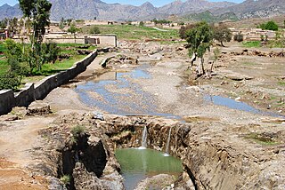
Ghalanai is the largest town and headquarters of Mohmand District in Khyber Pakhtunkhwa, province of Pakistan. It is located at 34°19'16N 71°24'0E with an altitude of 651 metres.

Baizai is an area of Upper Mohmand Tehsil, Mohmand Agency in the Federally Administered Tribal Areas of Pakistan. The area's local population consists entirely of Pashtuns, with many residents belonging to the Bazai sub-tribe of the larger Pashtun Mohmand tribe. In November 2011, the area came under media headlines when US-led NATO forces attacked a Pakistani military checkpoint in the town of Salala located in Baizai, killing 26 soldiers.

The Valley of Peshawar or Peshawar Basin is a broad valley situated in the central part of the Khyber Pakhtunkhwa province of Pakistan. The valley is 7,176 km2 (2,771 sq mi) in area, and is traversed by the Kabul River. It has a mean elevation of 345 metres (1,132 ft). The valley takes its name from the city of Peshawar, which is situated at the western part of the valley close to Warsak Dam. To the west of the valley lies the Khyber Pass. The five most populous cities in the valley are Peshawar, Mardan, Swabi, Charsadda, and Nowshera.

Bar Chamer Kand Tehsil is a subdivision located in Bajaur District, Khyber Pakhtunkhwa, Pakistan.
Barang Tehsil is a subdivision located in Bajaur District, Khyber Pakhtunkhwa, Pakistan.
Ambar Utmankhel Tehsil is a subdivision located in Mohmand District, Khyber Pakhtunkhwa, Pakistan. The population is 62,109 according to the 2017 census.
Halim Zai Tehsil is a subdivision located in Mohmand District, Khyber Pakhtunkhwa, Pakistan. The population is 78,749 according to the 2017 census.
Ghar Tehsil is a subdivision located in Mohmand District, Khyber Pakhtunkhwa, Pakistan. It's about 70km from Peshawar. The population is 35,290 according to the 2017 census.
Upper Mohmand Tehsil is a subdivision located in Mohmand District, Khyber Pakhtunkhwa, Pakistan. The population is 51,068 according to the 2017 census.
Lower Kurram Tehsil is a subdivision located in Kurram District, Khyber Pakhtunkhwa, Pakistan. The population is 136,719 according to the 2017 census.

Khar Bajaur Tehsil is a subdivision located in Bajaur District, Khyber Pakhtunkhwa, Pakistan. It starts in Jar to Zorbandar (east–west) and Tangai to Inzari (northwest–southwest) and A Inayat kali to Mandalu (northeast–southeast).
Halim Zai Shani Khel, or Shanikhel is an area of Halim Zai Tehsil, Mohmand Agency, Federally Administered Tribal Areas, Pakistan. The population is 3,643 according to the 2017 census.
Shahid Banda is an area of Pindiali Tehsil, Mohmand Agency, Federally Administered Tribal Areas, Pakistan. The population is 1,837 according to the 2017 census.
Sagi is an area of Safi Tehsil, Mohmand Agency, Federally Administered Tribal Areas, Pakistan. The population is 41,384 according to the 2017 census.
Chamarkand is an area of Safi Tehsil, Mohmand Agency, Federally Administered Tribal Areas, Pakistan. In 2017, the population was 11,296.
This article is a chronological outline of terrorist incidents in Pakistan in 2018.