
The Cape Colony, also known as the Cape of Good Hope, was a British colony in present-day South Africa named after the Cape of Good Hope, which existed from 1795 to 1802, and again from 1806 to 1910, when it united with three other colonies to form the Union of South Africa.

The Limpopo River rises in South Africa and flows generally eastward through Mozambique to the Indian Ocean. The term Limpopo is derived from Rivombo (Livombo/Lebombo), a group of Tsonga settlers led by Hosi Rivombo who settled in the mountainous vicinity and named the area after their leader. The river is approximately 1,750 kilometres (1,087 mi) long, with a drainage basin 415,000 square kilometres (160,200 sq mi) in size. The mean discharge measured over a year is 170 m3 per second at its mouth. The Limpopo is the second largest river in Africa that drains to the Indian Ocean, after the Zambezi River.

South Africa occupies the southern tip of Africa, its coastline stretching more than 2,850 kilometres from the desert border with Namibia on the Atlantic (western) coast southwards around the tip of Africa and then northeast to the border with Mozambique on the Indian Ocean. The low-lying coastal zone is narrow for much of that distance, soon giving way to a mountainous escarpment that separates the coast from the high inland plateau. In some places, notably the province of KwaZulu-Natal in the east, a greater distance separates the coast from the escarpment. Although much of the country is classified as semi-arid, it has considerable variation in climate as well as topography. The total land area is 1,220,813 km2 (471,359 sq mi). It has the 23rd largest Exclusive Economic Zone of 1,535,538 km2 (592,875 sq mi).
Dagenham is a town in East London, England, within the London Borough of Barking and Dagenham. Dagenham is centred 11.5 miles (18.5 km) east of Charing Cross.

German East Africa was a German colony in the African Great Lakes region, which included present-day Burundi, Rwanda, the Tanzania mainland, and the Kionga Triangle, a small region later incorporated into Mozambique. GEA's area was 994,996 km2 (384,170 sq mi), which was nearly three times the area of present-day Germany and double the area of metropolitan Germany at the time.

The Fashoda Incident, also known as the Fashoda Crisis, was an international incident and the climax of imperialist territorial disputes between Britain and France in East Africa, occurring in 1898. A French expedition to Fashoda on the White Nile river sought to gain control of the Upper Nile river basin and thereby exclude Britain from the Sudan. The French party and a British-Egyptian force met on friendly terms, but back in Europe, it became a war scare. The British held firm as both empires stood on the verge of war with heated rhetoric on both sides. Under heavy pressure, the French withdrew, ensuring Anglo-Egyptian control over the area.
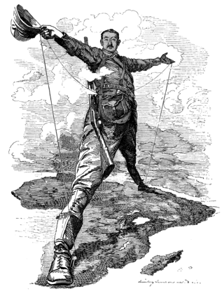
The Scramble for Africa, also called the Partition of Africa, Conquest of Africa, or Rape of Africa, was the invasion, annexation, division, and colonization of most of Africa by seven Western European powers during a short period known as New Imperialism. The 10 percent of Africa that was under formal European control in 1870 increased to almost 90 percent by 1914, with only Liberia and Ethiopia remaining independent.
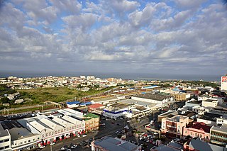
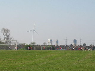
East London is a city on the southeast coast of South Africa in the Buffalo City Metropolitan Municipality of the Eastern Cape province. The city lies on the Indian Ocean coast, largely between the Buffalo River and the Nahoon River, and hosts the country's only river port. As of 2011, East London had a population of over 267,000 with over 755,000 in the metropolitan area.

The Eastern Cape is one of the provinces of South Africa. Its capital is Bhisho, but its two largest cities are East London and Gqeberha.

The Bechuanaland Protectorate was a protectorate established on 31 March 1885, by the United Kingdom of Great Britain and Ireland in Southern Africa. It became the Republic of Botswana on 30 September 1966.

The British Fourteenth Army was a multi-national force comprising units from Commonwealth countries during the Second World War. As well as British Army units, many of its units were from the Indian Army and there were also significant contributions from British Army's West and East African divisions. It was often referred to as the "Forgotten Army" because its operations in the Burma Campaign were overlooked by the contemporary press, and remained more obscure than those of the corresponding formations in Europe for long after the war. For most of the Army's existence, it was commanded by Lieutenant-General William Slim.

The R72 is a provincial route in Eastern Cape, South Africa that connects the N2 east of Port Elizabeth with East London via Port Alfred. It provides an alternative to the N2 for travel between Port Elizabeth and East London.

East Africa Protectorate was an area in the African Great Lakes occupying roughly the same terrain as present-day Kenya from the Indian Ocean inland to the border with Uganda in the west. Controlled by Britain in the late 19th century, it grew out of British commercial interests in the area in the 1880s and remained a protectorate until 1920 when it became the Colony of Kenya, save for an independent 16-kilometre-wide (10 mi) coastal strip that became the Kenya Protectorate.

Qonce, formerly known as King William's Town, is a city in the Eastern Cape province of South Africa along the banks of the Buffalo River. The city is about 60 kilometres (37 mi) northwest of the Indian Ocean port of East London. Qonce, with a population of around 35,000 inhabitants, forms part of the Buffalo City Metropolitan Municipality.

Port Alfred is a small town with a population of just under 26,000 in the Eastern Cape province of South Africa. It is situated on the eastern seaboard of the country at the mouth of the Kowie River, almost exactly halfway between the larger cities of Gqeberha and East London and 30 kilometres (19 mi) west of Cannon Rocks.

The Buffalo Volunteer Rifles (BVR) is an infantry regiment of the South African Army. As a reserve unit, it has a status roughly equivalent to that of a British Army Reserve or United States Army National Guard unit.

The East African campaign in World War I was a series of battles and guerrilla actions, which started in German East Africa (GEA) and spread to portions of Mozambique, Rhodesia, British East Africa, the Uganda, and the Belgian Congo. The campaign all but ended in German East Africa in November 1917 when the Germans entered Mozambique and continued the campaign living off Portuguese supplies.
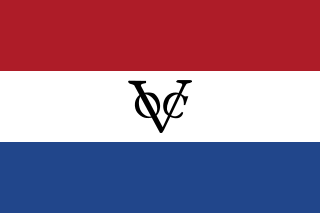
The Cape Colony was a Dutch United East India Company (VOC) colony in Southern Africa, centered on the Cape of Good Hope, from where it derived its name. The original colony and its successive states that the colony was incorporated into occupied much of modern South Africa. Between 1652 and 1691 it was a Commandment, and between 1691 and 1795 a Governorate of the United East India Company (VOC). Jan van Riebeeck established the colony as a re-supply and layover port for vessels of the VOC trading with Asia. The Cape came under VOC rule from 1652 to 1795 and from 1803 to 1806 was ruled by the Batavian Republic. Much to the dismay of the shareholders of the VOC, who focused primarily on making profits from the Asian trade, the colony rapidly expanded into a settler colony in the years after its founding.

The East London Harbour 0-4-0VB of 1873 was a South African steam locomotive from the pre-Union era in the Cape of Good Hope.


