Related Research Articles

The Columbia River is the largest river in the Pacific Northwest region of North America. The river rises in the Rocky Mountains of British Columbia, Canada. It flows northwest and then south into the US state of Washington, then turns west to form most of the border between Washington and the state of Oregon before emptying into the Pacific Ocean. The river is 1,243 miles (2,000 km) long, and its largest tributary is the Snake River. Its drainage basin is roughly the size of France and extends into seven US states and a Canadian province. The fourth-largest river in the United States by volume, the Columbia has the greatest flow of any river entering the Pacific and the 36th greatest of any river in the world.

The Yakima River is a tributary of the Columbia River in south central and eastern Washington state, named for the indigenous Yakama people. The length of the river from headwaters to mouth is 214 miles (344 km), with an average drop of 9.85 feet per mile (1.866 m/km). It is the longest river entirely in Washington state.

Grant County is a county located in the U.S. state of Washington. As of the 2010 census, the population was 89,120. The county seat is Ephrata, and the largest city is Moses Lake. The county was formed out of Douglas County in February 1909 and is named for U.S. President Ulysses S. Grant.

Grand Coulee Dam is a concrete gravity dam on the Columbia River in the U.S. state of Washington, built to produce hydroelectric power and provide irrigation water. Constructed between 1933 and 1942, Grand Coulee originally had only two powerhouses. The third powerhouse ("Nat"), completed in 1974 to increase energy production, makes Grand Coulee the largest power station in the United States by nameplate-capacity at 6,809 MW.

The Columbia River drainage basin is the drainage basin of the Columbia River in the Pacific Northwest region of North America. It covers 668,000 km2 or 258,000 sq mi. In common usage, the term often refers to a smaller area, generally the portion of the drainage basin that lies within eastern Washington.

The Columbia Basin Project in Central Washington, United States, is the irrigation network that the Grand Coulee Dam makes possible. It is the largest water reclamation project in the United States, supplying irrigation water to over 670,000 acres (2,700 km2) of the 1,100,000 acres (4,500 km2) large project area, all of which was originally intended to be supplied and is still classified as irrigable and open for the possible enlargement of the system. Water pumped from the Columbia River is carried over 331 miles (533 km) of main canals, stored in a number of reservoirs, then fed into 1,339 miles (2,155 km) of lateral irrigation canals, and out into 3,500 miles (5,600 km) of drains and wasteways. The Grand Coulee Dam, powerplant, and various other parts of the CBP are operated by the Bureau of Reclamation. There are three irrigation districts in the project area, which operate additional local facilities.

The Grand Coulee is an ancient river bed in the U.S. state of Washington. This National Natural Landmark stretches for about 60 miles (100 km) southwest from Grand Coulee Dam to Soap Lake, being bisected by Dry Falls into the Upper and Lower Grand Coulee.

Franklin D. Roosevelt Lake is the reservoir created in 1941 by the impoundment of the Columbia River by the Grand Coulee Dam in Washington state. It is named for Franklin D. Roosevelt, who was president during the construction of the dam. Covering 125 square miles, it stretches about 150 miles (240 km) from the Canada–US border to Grand Coulee Dam, with over 600 miles (970 km) of shoreline; by surface area it is the largest lake and reservoir in Washington. It is the home of the Lake Roosevelt National Recreation Area.

The Mokelumne River is a 95-mile (153 km)-long river in northern California in the United States. The river flows west from a rugged portion of the central Sierra Nevada into the Central Valley and ultimately the Sacramento–San Joaquin River Delta, where it empties into the San Joaquin River-Stockton Deepwater Shipping Channel. Together with its main tributary, the Cosumnes River, the Mokelumne drains 2,143 square miles (5,550 km2) in parts of five California counties. Measured to its farthest source at the head of the North Fork, the river stretches for 157 miles (253 km).
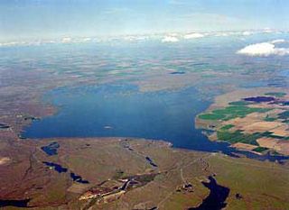
O'Sullivan Dam, one of the largest earthfill dams in the United States, is on Crab Creek in the U.S. state of Washington, about 45 km south of Ephrata and 25 km south of Moses Lake.
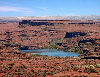
Drumheller Channels National Natural Landmark showcases the Drumheller Channels, which are the most significant example in the Columbia Plateau of basalt butte-and-basin Channeled Scablands. This National Natural Landmark is an extensively eroded landscape, located in south central Washington state characterized by hundreds of isolated, steep-sided hills (buttes) surrounded by a braided network of numerous channels, all but one of which are currently dry. It is a classic example of the tremendous erosive powers of extremely large floods such as those that reformed the Columbia Plateau volcanic terrain during the late Pleistocene glacial Missoula Floods.

Crab Creek is a stream in the U.S. state of Washington. Named for the presence of crayfish, it is one of the few perennial streams in the Columbia Basin of central Washington, flowing from the northeastern Columbia River Plateau, roughly 5 km (3.1 mi) east of Reardan, west-southwest to empty into the Columbia River near the small town of Beverly. Its course exhibits many examples of the erosive powers of extremely large glacial Missoula Floods of the late Pleistocene, which scoured the region. In addition, Crab Creek and its region have been transformed by the large-scale irrigation of the Bureau of Reclamation's Columbia Basin Project (CBP), which has raised water table levels, significantly extending the length of Crab Creek and created new lakes and streams.

Banks Lake is a 27-mile (43 km) long reservoir in central Washington in the United States.

Jackson Lake Dam is a concrete and earth-fill dam in the western United States, at the outlet of Jackson Lake in northwestern Wyoming. The lake and dam are situated within Grand Teton National Park in Teton County. The Snake River emerges from the dam and flows about eight hundred miles (1,300 km) through Wyoming, Idaho, Oregon, and Washington to its mouth on the Columbia River in eastern Washington.

The Bear River is a tributary of the Feather River in the Sierra Nevada, winding through four California counties: Yuba, Sutter, Placer, and Nevada. About 73 miles (117 km) long, the river flows generally southwest through the Sierra then west through the Central Valley, draining a narrow, rugged watershed of 295 square miles (760 km2).
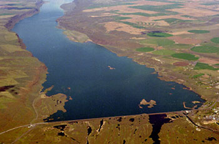
Dry Falls Dam is a rockfaced earthfill type dam in the U.S. state of Washington. Located in Grant County near Coulee City, it was built as part of the Bureau of Reclamation's Columbia Basin Project. Water from the Columbia River, impounded by Grand Coulee Dam, is pumped into Grand Coulee, a formerly dry canyon, through the short Feeder Canal. Grand Coulee's north end is sealed by North Dam and Dry Falls Dam stretches across the midsection of the Coulee. This allows the water pumped from the Columbia River to fill the upper Grand Coulee, creating a large equalizing reservoir known as Banks Lake. Water from the reservoir is fed into the irrigation project's Main Canal, which runs south from Dry Falls Dam to another reservoir called Billy Clapp Lake, formed by Pinto Dam.
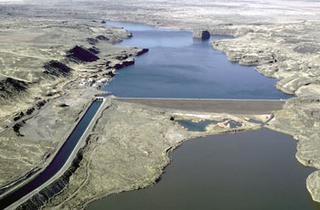
Pinto Dam is a dam in Grant County, Washington.
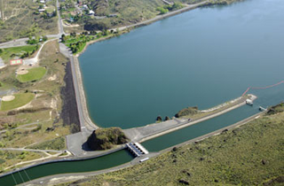
North Dam is an earth-fill embankment dam near the town of Grand Coulee in Grant County, Washington, United States. Construction of the dam began in 1946 and it was completed in 1951. Along with Dry Falls Dam about 22 mi (35 km) to the southeast, North Dam creates the reservoir Banks Lake within the ancient Grand Coulee riverbed. The lake serves as the equalizer reservoir of the Columbia Basin Project. Near the North Dam's left abutment is the entrance to the feeder canal of the project. The canal serves to either deliver water to the Pump-generating plant at Grand Coulee Dam or return water to Banks Lake from the same pumped-storage plant.
Yerrakaluva is a medium river which forms boundary between Khammam district of Telangana and West Godavari district of Andhra Pradesh state. It is the area which is often affected by floods. It is a tributary of Upputeru river. This river and the nearby Kolleru lake drain in to Upputeru river before joining Bay of Bengal near Mogultur of West Godavari district.

The following outline is provided as an overview of and topical guide to infrastructure of the U.S. state of Washington.
References
- ↑ "Grant County PUD Resources". Gcpud.org. Archived from the original on March 23, 2009. Retrieved 2008-12-25.
- ↑ Mark W. Nelson. "Columbia Basin Project". Usbr.gov. Archived from the original on December 6, 2008. Retrieved 2008-12-25.
- ↑ "96 Columbia Basin Irrigation Project-The Second Half, Alice Parker, Wheat Life". Bluefish.org. Retrieved 2008-12-25.
- ↑ "QCBID NEWS", Vol 1, Issue 1, November 2008
- ↑ "Archived copy" (PDF). Archived from the original (PDF) on July 8, 2011. Retrieved November 29, 2008.CS1 maint: archived copy as title (link)