Related Research Articles
Clark Township is a civil township of Mackinac County in the U.S. state of Michigan. As of the 2010 census, the township population was 2,256.
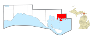
Lincoln City is an unincorporated community in Carter Township, Spencer County in the southwestern part of the U.S. state of Indiana. It lies five minutes south of Interstate 64, northeast of Evansville, and approximately twenty miles north of the Ohio River.
The Ohio Range is a mountain range in the Transantarctic Mountains of Antarctica. It is about 48 km (30 mi) long and 16 km (10 mi) wide, extending WSW-ENE from Eldridge Peak to Mirsky Ledge. The range forms the northeast end of the Horlick Mountains and consists primarily of a large snow-topped plateau with steep northern cliffs and several flat-topped ridges and mountains. The highest point is the summit of Mount Schopf.

The Northern Range is the range of tall hills across north Trinidad, the major island in the Republic of Trinidad and Tobago. The hills range from the Chaguaramas peninsula on the west coast to Toco in the east. The Northern Range covers approximately twenty-five percent of the land area of Trinidad.

Lanfair Valley is located in the Mojave Desert in southeastern California near the Nevada state line. It is bounded on the north by the New York Mountains and Castle Mountains, on the east by the Piute Range, and on the south by the Woods Mountains and Vontrigger Hills. Joshua Trees can be found in most of the valley. Elevation is 4,045 feet.
Satus Pass is a high mountain pass in the Cascade Range in the state of Washington. The pass connects Goldendale and the Klickitat Valley to the south with the Yakama Indian Reservation and Yakima Valley to the north. The Simcoe Mountains lie to the west of Satus Pass, and Bickleton Ridge in the Horse Heaven Hills to the east.
Cilrhedyn is a hamlet and parish in the counties of Carmarthenshire and Pembrokeshire, Wales, in the hill country to the south of the Teifi valley. The Afon Cych divides it into two unequal parts: West Cilrhedyn, Pembrokeshire and East Cilrhedyn, Carmarthenshire. The parish church is in West Cilrhedyn.
The Agua Dulce Mountains are a mountain range in the north-central Sonoran Desert of southwestern Arizona. The range is located in the extreme southwestern portion of Pima County, Arizona, immediately north of the international boundary with Mexico and about 30 mi (48 km) southwest of Ajo, Arizona. The range has three main sections that total about 15 miles in length and about nine miles in width. The range is located entirely within the Cabeza Prieta National Wildlife Refuge. The highpoint of the range is 2,852 feet (869 m) above sea level and is located at 32°01'32"N, 113°08'44"W. The summit is unnamed, but is marked on U.S. Geological Survey (USGS) maps for the "Quitovaquita" benchmark that was placed on the summit in 1920. The original surveyed height was 2,850 feet above sea level, but recent datum adjustments calculate the summit to be two feet higher.
The Belmont Mountains are a 25 mi (40 km) long, arid, low elevation mountain range about 50 mi west of Phoenix, Arizona in the northern Sonoran Desert, north of the Gila River. The range is in the south of a region of two parallel washes; the Bouse Wash flows northwest to the Colorado River, and the Centennial Wash flows southeast to meet the Gila River.
Woodcrest is a neighborhood located within Cherry Hill in Camden County, New Jersey, United States. The area dates back to the 1950s and is one of the oldest neighborhoods in Cherry Hill. It was developed by Morris and Harold Sarshik.

The Navesink Highlands, sometimes referred to as the Highlands of Navesink and also known as the Atlantic Highlands, is a range of low hills and upland areas located along the United States Atlantic coast in New Jersey. The hills of the Highlands reach over 350 feet (107 m) in elevation, reportedly reaching a maximum elevation of 391 feet at Crawford Hill, which is the highest point in Monmouth County. The seaward front of the Navesink Highlands constitute the highest headlands along the United States east coast south of Maine, with the highest point of the headlands reaching an elevation of 266 feet at Mount Mitchill.

The Warsaw Spire is a complex of Neomodern office buildings in Warsaw, Poland constructed by the Belgian real estate developer Ghelamco.
Temescal Mountains, also known as the Sierra Temescal, are one of the northernmost mountain ranges of the Peninsular Ranges in western Riverside County, in Southern California in the United States. They extend for approximately 25 mi (40 km) southeast of the Santa Ana River east of the Elsinore Fault Zone to the Temecula Basin and form the western edge of the Perris Block.

Chapel Hill is an unincorporated community in Polk Township, Monroe County, in the U.S. state of Indiana.
Reche Summit, at an elevation of 3,016 feet, the tallest peak of the range of mountains trending northwest to southeast south of Reche Canyon, in Riverside County, California. These include Blue Mountain to its northwest and to the southeast, Olive Summit and the Kalmia Hills.
Ferber Hills is a range of hills in Elko County, Nevada and Tooele County, Utah. The range is formed in three parallel ridges of hills trending northwest to southeast. Its highest summit is Utah Peak, in the center of the central ridge of the range, at an elevation of 6,680 feet, just east of the state line in Tooele County, Utah. Its second highest Summit is Ferber Peak, that rises to and elevation of 6,601 feet, at the south end of the southernmost ridge of the range at 40°12′43″N114°03′18″W just west of the state line in Elko County, Nevada. The highest point in the smaller northernmost ridge is an unnamed summit at 40°17′12″N113°59′48″W with an elevation of 5,745 feet in Tooele County.

Quitobaquito Springs are springs in Organ Pipe Cactus National Monument in Pima County, Arizona. The name is of Tohono O'odham origin meaning 'house ring spring'. The area has been populated for at least 16,000 years. It lies at an elevation of 1,152 feet (351 m), west of the south end of the Quitobaquito Hills, along the border of the United States with Mexico. The only US populations of the endangered Quitobaquito pupfish, the Sonoyta mud turtle, the desert caper, and the Howarth's white butterfly are found here. The Quitabaquito tryonia is an endemic resident of the springs.
Dragoon Spring is a spring in Cochise County, Arizona. It is located in Jordan Canyon on the northwest slope of the Dragoon Mountains at an elevation of 5,148 feet.
References
Coordinates: 31°59′05″N113°02′32″W / 31.98472°N 113.04222°W