Qullpa Jawira (La Paz)

Last updated
Qullpa Jawira
River
Name origin: Aymara
Country Bolivia
Region La Paz Department
Source Andes
 - location Pacajes Province, Caquiaviri Municipality
 - coordinates 17°07′10″S68°54′19″W / 17.11944°S 68.90528°W / -17.11944; -68.90528
Mouth Desaguadero River
 - location Ingavi Province, San Andrés de Machaca Municipality; Pacajes Province, Caquiaviri Municipality
 - coordinates 17°03′00″S68°51′00″W / 17.05000°S 68.85000°W / -17.05000; -68.85000 Coordinates: 17°03′00″S68°51′00″W / 17.05000°S 68.85000°W / -17.05000; -68.85000

The Qullpa Jawira [1] (Aymara qullpa saltpeter, jawira river, [2] "saltpeter river", also spelled Collpajahuira, Kollpa Jahuira) is a river in the La Paz Department in Bolivia. It is a right affluent of the Desaguadero River.

Aymara language native language in South America

Aymara is an Aymaran language spoken by the Aymara people of the Andes. It is one of only a handful of Native American languages with over one million speakers. Aymara, along with Spanish, is one of the official languages of Bolivia and parts of Peru. It is also spoken, to a much lesser extent, by some communities in northern Chile, where it is a recognized minority language.

La Paz Department (Bolivia) Department in Nuestra Señora de La Paz, Bolivia

The La Paz Department of Bolivia comprises 133,985 square kilometres (51,732 sq mi) with a 2012 census population of 2,706,359 inhabitants. It is situated at the western border of Bolivia, sharing Lake Titicaca with adjacent Peru. It contains the Cordillera Real, which reaches altitudes of 6.6 kilometers (4.1 mi). Northeast of the Cordillera Real are the Yungas, the steep eastern slopes of the Andes Mountains that make the transition to the Amazon River basin to the northeast. The capital of the department is the city of La Paz and is the administrative city and seat of government/national capital of Bolivia.

Bolivia country in South America

Bolivia, officially the Plurinational State of Bolivia is a landlocked country located in western-central South America. The capital is Sucre while the seat of government and financial center is located in La Paz. The largest city and principal industrial center is Santa Cruz de la Sierra, located on the Llanos Orientales a mostly flat region in the east of Bolivia.

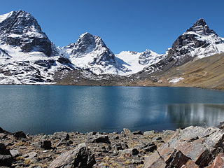
The river originates near 17°07′10″S68°54′10″W / 17.11944°S 68.90278°W / -17.11944; -68.90278 from various streams at a mountain named Taruj Llani south of Utani Apu in the Pacajes Province, Caquiaviri Municipality. It flows in a north-eastern direction. The confluence with the Desaguadero River is south of the community of Janq'u Phuch'u on the border of the Ingavi Province, San Andrés de Machaca Municipality, at 17°03′00″S68°51′00″W / 17.05000°S 68.85000°W / -17.05000; -68.85000 . [1] [3] [4]

Utani Apu mountain in Bolivia

Utani Apu (Aymara) is a 4,060 m (13,320 ft) mountain in the Andes of Bolivia. It is located in the La Paz Department, Ingavi Province, San Andrés de Machaca Municipality, and in the Pacajes Province, Caquiaviri Municipality.

Pacajes Province Province in La Paz Department, Bolivia

Pacajes is a province in the Bolivian department of La Paz. Its capital is Coro Coro.

Caquiaviri Municipality Municipality in La Paz Department, Bolivia

Caquiaviri Municipality is the second municipal section of the Pacajes Province in the La Paz Department, Bolivia. Its seat is Caquiaviri.

Related Research Articles

Ingavi Province Province in La Paz Department, Bolivia

Ingavi is a province in the La Paz Department in Bolivia. This is where the Battle of Ingavi occurred on November 18, 1841 and where the World Heritage Site of Tiwanaku is situated.

San Andrés de Machaca Municipality Municipality in La Paz Department, Bolivia

San Andrés de Machaca Municipality is the fifth municipal section of the Ingavi Province in the La Paz Department, Bolivia. Its seat is San Andrés de Machaca.

The Jach'a Jawira is a river in the La Paz Department of Bolivia, south of Wiñaymarka, the southern branch of Lake Titicaca. It is a tributary of the Desaguadero River.

Qullpa Jawira is a Bolivian river east of Poopó Lake in the Oruro Department, Challapata Province, Challapata Municipality, and in the Santiago de Huari Municipality. It originates near Ch'iyar Jaqhi northeast of Jatun Wila Qullu and flows in a north-eastern direction. South of Wila Qullu it meets the T'ula Pallqa River whose source, the Jach'a Juqhu River, is considered the origin of the Pillku Mayu.

Qullpa Jawira is a Bolivian river west of Poopó Lake and north of Coipasa Lake in the Oruro Department. It flows through the Escara Municipality in the Litoral Province and the Corque Municipality in the Carangas Province.

Warachi Qullu

Warachi Qullu is a 5,029-metre-high (16,499 ft) mountain in the Andes of Bolivia. It is situated in the Potosí Department, Antonio Quijarro Province, in the north-east of the Uyuni Municipality. Warachi Qullu lies at the river Ch'iyar Juqhu Q'awa (Chiar Jokho Khaua) which later is named Juqhu Jawira (Jokho Jahuiri), Jalsullani and Chiqapa (Chicapa). Its waters flow to Qullpa Jawira in the north-east.

Chutu Wankarani

Ch'utu Wankarani is a 4,475-metre-high (14,682 ft) mountain in the Chilla-Kimsa Chata mountain range in the Andes of Bolivia. It is located in the La Paz Department, Ingavi Province, Jesús de Machaca Municipality, northeast of Ch'ama (Chama). Ch'utu Wankarani lies northeast of Imill Wawani and Apachita and southeast of Jisk'a Sallalla and Wisk'achani. The Wila Jaqhi Jawira originates near Ch'utu Wankarani. It flows to the northeast.

Chuqi Qawa (Chuñuni Jawira)

Chuqi Q'awa is a 4,570-metre-high (14,993 ft) mountain in the Chilla-Kimsa Chata mountain range in the Andes of Bolivia. It lies in the La Paz Department, Ingavi Province, in the north of the Jesús de Machaca Municipality, near the border with the Tiwanaku Municipality. Chuqi Q'awa is situated south of the river Chuñuni Jawira (Chununi Jahuira).

Thujsa Jawira, which upstream successively is named Ingenio and Río Grande and downstream is called Llink'i, is a river in the La Paz Department in Bolivia. It flows to Awallamaya Lake south of Lake Titicaca.

Jach'a Jawira is a Bolivian river in the La Paz Department, Pacajes Province, Caquiaviri Municipality. It is a left tributary of the Desaguadero River.

Qala Jawira which upstream is named Laka Jaqhi(Lakajakke) is a river in the La Paz Department in Bolivia. It is a left tributary of the Desaguadero River.

Thujsa Jawira is a river in the La Paz Department in Bolivia. It is a left tributary of the Desaguadero River. The confluence is in the Caquiaviri Municipality of the Pacajes Province south of the village of Nasa Q'ara (Nazacara).

Qilani (Ingavi-Los Andes)

Q'ilani is a 4,216 m (13,832 ft) mountain in the Chilla-Kimsa Chata mountain range in the Andes of Bolivia. It is located in the La Paz Department, Ingavi Province, Jesús de Machaca Municipality, and in the Los Andes Province, Laja Municipality. It lies west of Turini. The Ch'iyar Jawira originates north of the mountain. It flows to the northeast.

Qawiri Qullu mountain in Bolivia

Q'awiri Qullu is a mountain in the Chilla-Kimsa Chata mountain range in the Andes of Bolivia which reaches a height of approximately 4,000 m (13,000 ft). It is located in the La Paz Department, Ingavi Province, on the border of the municipalities of Jesús de Machaca and Viacha, and in the Pacajes Province, Caquiaviri Municipality. Q'awiri Qullu lies southeast of Wayllani.

The Ch'alla Jawira which upstream is named Ch'api K'uchu and downstream successively is called Tupa Jawira and Qura Jawira is a river in the La Paz Department in Bolivia. It is a right affluent of the Aqhuya Jawira whose waters flow to the Desaguadero River.

The Ch'alla Jawira which upstream successively is named Chilla Jawira, Pichini Jawira, Janq'u Quta and Siwinqa is a river in the La Paz Department in Bolivia. It is a left tributary of the Desaguadero River.

The Llallawa Jawira which upstream successively is named Patu Uma, Ch'alla Jawira, Jach'a Qura, Lupipi and Chuqi Phuju is a river in the La Paz Department in Bolivia. It is a left tributary of the Desaguadero River.

Qullpani (Loayza) mountain in Bolivia

Qullpani is a mountain in the Bolivian Andes which reaches a height of approximately 3,660 m (12,010 ft). It is located in the La Paz Department, Loayza Province, Luribay Municipality, northeast of Luribay.

The Jach'a Jawira which upstream is named Wanun Jawira and downstream successively is called Sasari and Qullpa Jawira is a river in the Aroma Province in the La Paz Department of Bolivia.

References

  1. 1 2 Ley No. 2350, Ley de 7 de Mayo de 2002
  2. Radio San Gabriel, "Instituto Radiofonico de Promoción Aymara" (IRPA) 1993, Republicado por Instituto de las Lenguas y Literaturas Andinas-Amazónicas (ILLLA-A) 2011, Transcripción del Vocabulario de la Lengua Aymara, P. Ludovico Bertonio 1612 (Spanish-Aymara-Aymara-Spanish dictionary)
  3. Bolivian IGM map 1:100,000 Caquiaviri 3136
  4. "San Andrés de Machaca". INE, Bolivia. Retrieved February 5, 2016. (unnamed)