Räbke

Last updated
Räbke
Wappen Raebke.png
Coat of arms
Germany adm location map.svg
Red pog.svg
Räbke
Location of Räbke within Helmstedt district
Helmstedt (district)Lower SaxonySaxony-AnhaltWolfenbüttel (district)BraunschweigGifhorn (district)WolfsburgSalzgitterGevenslebenBeierstedtJerxheimSöllingenIngelebenTwieflingenSchöningengemeindefreies Gebiet SchöningenWarberggemeindefreies Gebiet BrunsleberfeldWolsdorfHelmstedtFrellstedtRäbkeSüpplingengemeindefreies Gebiet Königsluttergemeindefreies Gebiet KönigslutterSüpplingenburgKönigslutterLehreHelmstedtHelmstedtMarientalRennauGraslebengemeindefreies Gebiet Helmstedtgemeindefreies Gebiet MarientalQuerenhorstGroß TwülpstedtBahrdorfgemeindefreies Gebiet MarientalVelpkeDanndorfGrafhorstR%C3%A4bke
R%C3%A4bke
Coordinates: 52°12′N10°53′E / 52.200°N 10.883°E / 52.200; 10.883 Coordinates: 52°12′N10°53′E / 52.200°N 10.883°E / 52.200; 10.883
Country Germany
State Lower Saxony
District Helmstedt
Municipal assoc. Nord-Elm
Government
   Mayor Rainer Angerstein
Area
  Total 11.35 km2 (4.38 sq mi)
Elevation 134 m (440 ft)
Population (2015-12-31) [1]
  Total 683
  Density 60/km2 (160/sq mi)
Time zone CET/CEST (UTC+1/+2)
Postal codes 38375
Dialling codes 05355
Vehicle registration HE
Website www.raebke.de

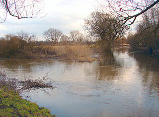
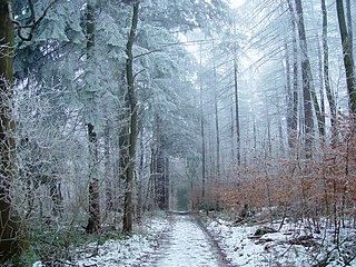
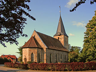
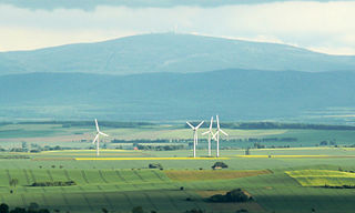
Räbke is a municipality in the district of Helmstedt, in Lower Saxony, Germany. It is part of the collective municipality ( Samtgemeinde ) of Nord-Elm. The village is situated north of the wooded Elm hill range at the Schunter river.

Municipalities of Germany the lowest official level of territorial division in Germany

Municipalities are the lowest level of official territorial division in Germany. This is most commonly the third level of territorial division, ranking after the Land (state) and Kreis (district). The Gemeinde which is one level lower in those states also includes Regierungsbezirke as an intermediate territorial division. The Gemeinde is one level higher if it is not part of a Samtgemeinde. Only 10 municipalities in Germany have fifth level administrative subdivisions and all of them are in Bavaria. The highest degree of autonomy may be found in the Gemeinden which are not part of a Kreis. These Gemeinden are referred to as Kreisfreie Städte or Stadtkreise, sometimes translated as having "city status". This can be the case even for small municipalities. However, many smaller municipalities have lost this city status in various administrative reforms in the last 40 years when they were incorporated into a Kreis. In some states they retained a higher measure of autonomy than the other municipalities of the Kreis. Municipalities titled Stadt are urban municipalities while those titled Gemeinde are classified as rural municipalities.

Helmstedt (district) District in Lower Saxony, Germany

Helmstedt is a district in Lower Saxony, Germany. It is bounded by the district of Wolfenbüttel, the City of Braunschweig, the District of Gifhorn, the City of Wolfsburg and the State of Saxony-Anhalt.

Lower Saxony State in Germany

Lower Saxony is a German state (Land) situated in northwestern Germany. It is the second-largest state by land area, with 47,624 km2 (18,388 sq mi), and fourth-largest in population among the 16 Länder federated as the Federal Republic of Germany. In rural areas, Northern Low Saxon and Saterland Frisian are still spoken, but the number of speakers is declining.

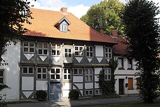
The settlement was first mentioned as Ridepe in a 1205 deed. Since the 16th century Räbke was known for its paper mills meeting the needs of the University of Helmstedt.

Paper mill factory that produces paper

A paper mill is a factory devoted to making paper from vegetable fibres such as wood pulp, old rags and other ingredients. Prior to the invention and adoption of the Fourdrinier machine and other types of paper machine that use an endless belt, all paper in a paper mill was made by hand, one sheet at a time, by specialized laborers.

University of Helmstedt university

The University of Helmstedt, was a university in Helmstedt in the Duchy of Brunswick-Wolfenbüttel that existed from 1576 until 1810.

The Lutheran church Rabke Kirche.jpg
The Lutheran church

Related Research Articles

Königslutter Place in Lower Saxony, Germany

Königslutter am Elm is a town in the district of Helmstedt in Lower Saxony, Germany.

Schunter river in Lower Saxony, Germany

The Schunter is a river in Lower Saxony, Germany, with a length of 58 km, right tributary of the Oker. It originates in the Elm hills near Räbke west of Helmstedt, flows northward to Süpplingenburg, then turns westward and joins the Oker at Schwülper, downstream of Braunschweig (Brunswick). Another municipality on the Schunter is Lehre.

Elm (hills) mountain range

The Elm is a range of hills north of the Harz mountains in the Helmstedt and Wolfenbüttel districts of Lower Saxony, Germany. It has a length of about 25 km (15.5 mi) and a width of 3–8 km (2–5 mi) and rises to an elevation of 323 meters. Surrounded by the Northern European Lowlands, the Elm is almost uninhabited and the largest beech forest in Northern Germany. The hills are of a triassic limestone called Elmkalkstein. Together with the neighbouring Lappwald range, the Elm has been a protected nature park since 1977.

Süpplingenburg Place in Lower Saxony, Germany

Süpplingenburg is a municipality in the district of Helmstedt, Lower Saxony, Germany. It is part of the collective municipality (Samtgemeinde) of Nord-Elm.

Nord-Elm is a federation of municipalities (Samtgemeinde) in Helmstedt, Lower Saxony. It is named after the Elm, on the northern edge of which it is located. Nord-Elm has an area of 63 km² and a population of 6,200 (2003); its capital is Süpplingen. It was founded in 1969.

Schöningen Place in Lower Saxony, Germany

Schöningen is a town of about 11,000 inhabitants in the district of Helmstedt, in Lower Saxony, Germany.

Grasleben Place in Lower Saxony, Germany

Grasleben is a municipality in the district of Helmstedt, in Lower Saxony, Germany. It is situated approximately 10 km north of Helmstedt, and 20 km southeast of Wolfsburg. The Municipality Grasleben includes the villages of Grasleben and Heidwinkel.

Velpke Place in Lower Saxony, Germany

Velpke is a municipality in the district of Helmstedt, in Lower Saxony, Germany. It is situated approximately 20 km north of Helmstedt, and 10 km east of Wolfsburg. The Municipality Velpke includes the villages of Büstedt, Meinkot, Velpke and Wahrstedt. Velpke is also the seat of the Samtgemeinde Velpke.

Schöppenstedt Place in Lower Saxony, Germany

Schöppenstedt is a small town in the district of Wolfenbüttel, in Lower Saxony, Germany. It is the administrative seat of the Samtgemeinde of Elm-Asse.

Gevensleben Place in Lower Saxony, Germany

Gevensleben is a municipality in the district of Helmstedt, in Lower Saxony, Germany. The Municipality Gevensleben includes the villages of Gevensleben and Watenstedt.

Mariental, Germany Place in Lower Saxony, Germany

Mariental is a municipality in the district of Helmstedt, in Lower Saxony, Germany. The Municipality Mariental includes the villages of Mariental-Dorf and Mariental-Horst. See also Mariental Abbey.

Rennau Place in Lower Saxony, Germany

Rennau is a municipality in the district of Helmstedt, in Lower Saxony, Germany. The Municipality Rennau includes the villages of Ahmstorf, Rennau and Rottorf am Klei.

Söllingen Place in Lower Saxony, Germany

Not to be confused with Solingen, North Rhine Westphalia.

Lorenz Heister German botanist and doctor

Lorenz Heister was a German anatomist, surgeon and botanist born in Frankfurt am Main.

Lappwald mountain range

The Lappwald is a heavily wooded range of hills, 20 km long and up to 5 km wide, in central Germany. It stretches northwards from the town of Helmstedt. The border between Lower Saxony and Saxony-Anhalt runs through the woods, of which about three quarters is on Lower Saxon terrain. The Lappwald is part of the Elm-Lappwald Nature Park.

Brunswick Land landscape

Brunswick Land is a historical region in the Southeast of the German state of Lower Saxony, centred around the city of Braunschweig. It refers to the core territory of the historic Duchy of Brunswick and its successor, the Free State of Brunswick, which was disestablished in 1946.

Elm-Lappwald Nature Park nature park in Lower Saxony, Germany

The Elm-Lappwald Nature Park is a nature park in southwest Lower Saxony, east of Brunswick in central Germany. It is dominated by the forested hill ranges of the Elm, Lappwald and Dorm as well as the region known as the Helmstedt Bowl.

Jerxheim–Helmstedt railway railway line

The Jerxheim–Helmstedt railway is a 22 km-long railway line in the south-east of the German state of Lower Saxony that was opened in 1858. It opened up the area south of the Elm hills. Until 8 December 2007, there were passenger services on the route from Brunswick via Wolfenbüttel, Schöppenstedt, Jerxheim and Schöningen to Helmstedt, which was last marketed as the Südelmbahn. The section from Helmstedt to Alversdorf freight yard has since been operated as a connecting line to a facility of the Energy from Waste (EEW) company, formerly half owned by E.ON.

References