
County Tipperary is a county in Ireland. It is in the province of Munster and the Southern Region. The county is named after the town of Tipperary, and was established in the early 13th century, shortly after the Norman invasion of Ireland. It is Ireland's largest inland county and shares a border with eight counties, more than any other. The population of the county was 159,553 at the 2016 census. The largest towns are Clonmel, Nenagh and Thurles.
Derry is a city in Northern Ireland.
O'Dea, is an Irish surname derived from Deághaidh, the name of a tenth-century clan chieftain.
Kilpatrick is an Irish surname, possibly a branch of the Cenél nEógain of the Northern Uí Néill. It may refer to:
Richmond is a small townland in the historical barony of Ormond Lower, County Tipperary, Ireland. It is approximately 1.4 square kilometres (0.54 sq mi) in area and located in the civil parish of Monsea. The townland borders and overlaps with the town of Nenagh. As of the 2011 census, the townland had a population of 153 people.
Ikerrin is a barony in County Tipperary, Ireland. This geographical unit of land is one of 12 baronies in County Tipperary. Its chief town is Roscrea. The barony lies between Eliogarty to the south and Ormond Upper to the west. As a "peninsula", it is surrounded on three sides by counties Offaly and Laois. The territory is currently administered by Tipperary County Council.
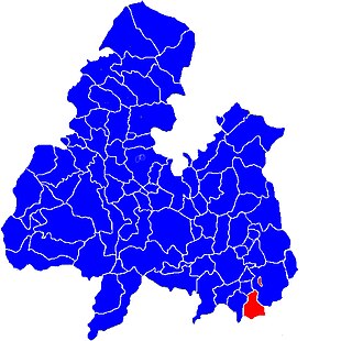
Ballymoreen, also written Ballymurreen, is a civil parish in County Tipperary, Ireland. It is one of 21 civil parishes in the barony of Eliogarty.
Ballymoreen, or Ballymurreen, is a townland in the civil parish of the same name in County Tipperary in Ireland. It is within the historical barony of Eliogarty in the south-east corner of North Tipperary, between Littleton and Horse and Jockey. Evidence of ancient settlement in Ballymurreen include a number of ringfort sites, a ruined church and graveyard dating to at least the 17th century, and the former site of a tower house and bawn. The townland, which is 1.3 square kilometres (0.5 sq mi) in area, had a population of 65 as of the 2011 census.
Rathcunikeen or Rathcumrikeen is a townland in the civil parish of Ballymurreen, County Tipperary in Ireland. It is an exclave of the parish, as it is surrounded by the neighbouring civil parish of Two-Mile-Borris.
Kilbrickane is a relatively small townland, measuring just over 78 hectares, in the civil parish of Loughmoe East, County Tipperary. The townland is 2 km (1.2 mi) from the village of Loughmore, 4 km (2.5 mi) from Templemore and 8 km (5.0 mi) from Thurles.

Moycarkey is an electoral division in County Tipperary in Ireland. It was originally an electoral division in the Thurles Poor Law Union in North Tipperary but is still used for various administrative purposes.

Ballymurreen, sometimes written Ballymoreen, is an electoral division in County Tipperary in Ireland. The code number assigned it by the Central Statistics Office is 22062.

Littleton is an electoral division in County Tipperary in Ireland. The code number assigned it by the Central Statistics Office is 22071.
Ballysheehan is a village in the southern part of County Tipperary, Ireland. It is also a civil parish in the barony of Middle Third, within the Munster province.
