
Baglung District, a part of Gandaki Province, is one of the seventy-seven districts of Nepal. The district, with Baglung as its district headquarters, covers an area of 1,784 km2 (689 sq mi) and has a population (2011) of 268,613.
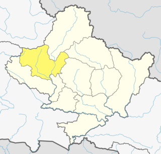
Myagdi District, a part of Gandaki Province, is one of the seventy-seven districts of Nepal. The district, with Beni as its district headquarters, covers an area of 2,297 km2 (887 sq mi), had a population of 114,447 in 2001 and 113,641 in 2011.

Babiyachaur is a Rural municipality in Myagdi District in the Dhaulagiri Zone of western-central Nepal. At the time of the 1991 Nepal census it had a population of 2797 people living in 537 individual households.
Baranja is a village development committee in Myagdi District in the Dhaulagiri Zone of western-central Nepal. At the time of the 1991 Nepal census it had a population of 4576 people living in 891 individual households.
Bhakilmi is a village development committee in Myagdi District in the Dhaulagiri Zone of western-central Nepal. At the time of the 1991 Nepal census it had a population of 3132 people living in 599 individual households.
Dagnam is a village development committee in Myagdi District in the Dhaulagiri Zone of western-central Nepal. At the time of the 1991 Nepal census it had a population of 1273 people living in 286 individual households.
Devisthan, Myagdi is a village development committee in Myagdi District in the Dhaulagiri Zone of western-central Nepal. At the time of the 1991 Nepal census it had a population of 3225 people living in 618 individual households.
Dowa, Nepal is a village development committee in Myagdi District in the Dhaulagiri Zone of western-central Nepal. At the time of the 1991 Nepal census it had a population of 1315 people living in 319 individual households.
Histhan Mandali is a village development committee in Myagdi District in the Dhaulagiri Zone of western-central Nepal. At the time of the 1991 Nepal census it had a population of 2206 people living in 514 individual households. Histhan Mandali most tourist spot in Myagdi District
Jhin is a village development committee in Myagdi District in the Dhaulagiri Zone of western-central Nepal. At the time of the 1991 Nepal census it had a population of 1234 people living in 283 individual households.
Kuhunkot is a village development committee in Myagdi District in the Dhaulagiri Zone of western-central Nepal. At the time of the 1991 Nepal census it had a population of 3311 people living in 668 individual households.
Marang, Nepal is a village development committee in Myagdi District in the Dhaulagiri Zone of western-central Nepal. At the time of the 1991 Nepal census it had a population of 1878 people living in 356 individual households.
Muna, Nepal is a village development committee in Myagdi District in the Dhaulagiri Zone of western-central Nepal. At the time of the 1991 Nepal census it had a population of 2152 people living in 456 individual households.
Narchyang is a village development committee in Myagdi District in the Dhaulagiri Zone of western-central Nepal. At the time of the 2001 Nepal census it had a population of 1762 people living in 421 individual households.
Niskot is a village development committee in Myagdi District in the Dhaulagiri Zone of western-central Nepal. At the time of the 1991 Nepal census it had a population of 1772 people living in 327 individual households.
Patlekhet is a village development committee in Myagdi District in the Dhaulagiri Zone of western-central Nepal. At the time of the 1991 Nepal census it had a population of 1697 people living in 345 individual households.
Rakhu Bhagawati is a village development committee in Myagdi District in the Dhaulagiri Zone of western-central Nepal. At the time of the 1991 Nepal census it had a population of 3329 people living in 698 individual households.
Rumaga is a village development committee in Myagdi District in the Dhawalagiri Zone of western-central Nepal. At the time of the 1991 Nepal census it had a population of 4612 people living in 873 individual households.
Shikha is a village development committee in Myagdi District in the Dhaulagiri Zone of western-central Nepal. At the time of the 1991 Nepal census it had a population of 5862 people living in 1350 individual households.
Tatopani is a village development committee in Myagdi District in the Dhaulagiri Zone of western-central Nepal. At the time of the 1991 Nepal census it had a population of 843 people living in 182 individual households.
