Related Research Articles

Rancho Simi, also known as Rancho San José de Nuestra Señora de Altagracia y Simí, was a 113,009-acre (457 km2) Spanish land grant in what is now eastern Ventura and western Los Angeles counties granted in 1795 to Santiago Pico, founder of the Pico family of California. After Santiago Pico's death in 1815, the Rancho was regranted to Santiago's sons Javier Pico and his two brothers, Patricio Pico and Miguel Pico by Diego de Borica. The name derives from Shimiji, the name of a Chumash village in the Simi Valley for thousands of years before the Spanish arrival.
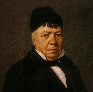
José Antonio de la Guerra y Noriega was a Californio military officer, ranchero, and founder of the prominent Guerra family of California. He served as the Commandant of the Presidio of Santa Barbara and the Presidio of San Diego.

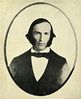
Captain José Antonio Ezequiel Carrillo (1796–1862) was a Californio politician, ranchero, and signer of the California Constitution in 1849. He served three terms as Alcalde of Los Angeles (mayor).

Rancho Las Vírgenes was a 17,760-acre (71.9 km2) land grant in the Santa Monica Mountains and Simi Hills, in present day western Los Angeles County, California. The lands of the Rancho Las Vírgenes included present day Agoura Hills, Oak Park, and Westlake Village and part of the Santa Monica Mountains.
Rancho El Conejo was a 48,572-acre (196.56 km2) Spanish land grant in California given in 1803 to Jose Polanco and Ygnacio Rodriguez that encompassed the area now known as the Conejo Valley in southeastern Ventura and northwestern Los Angeles Counties. El Conejo is Spanish for "The Rabbit", and refers to the many rabbits common to the region. The east-west grant boundaries approximately went from the border of Westlake Village near Lindero Canyon Road in the east to the Conejo Grade in the west. The north-south borders extended from the top of the Simi Hills at the end of Moorpark Road in the north to Hidden Valley in the Santa Monica Mountains in the south. The rancho is the site of the communities of Newbury Park, Thousand Oaks, and Westlake Village.
Rancho Santa Paula y Saticoy was a 17,773-acre (71.92 km2) Mexican land grant in the Santa Clara River Valley, in present-day Ventura County, California, and granted in 1843 by Governor Manuel Micheltorena to Manuel Jimeno Casarin. The rancho lands include the modern communities of Saticoy and Santa Paula along the Santa Clara River.
Rancho Huerhuero was a 15,685-acre (63.47 km2) Mexican land grant in present-day San Luis Obispo County, California of one square league given in 1842 by Governor Juan Alvarado and another three square leagues given in 1846 by Governor Pío Pico to José Mariano Bonilla. The grant extended along Huerhuero Creek and encompassed present day Creston southeast of Paso Robles.
Rancho Las Positas y La Calera was a 3,282-acre (13.28 km2) Mexican land grant in present-day Santa Barbara County, California. The grant consisted of two parts:- "La Calera" given in 1843 by Governor Manuel Micheltorena to Narciso Fabregat, and "Las Positas" given in 1846 by Governor Pío Pico to Thomas M. Robbins. The grant was the northwest of the pueblo and Presidio of Santa Barbara, and encompassed the present day Hope Ranch, Hidden Valley, and Campanil neighborhoods.
Rancho San Francisquito was a 1,471-acre (5.95 km2) Mexican land grant in present-day Santa Clara County, California given in 1839 by Governor Juan Alvarado to Antonio Buelna. The grant was located on the southwest side of San Francisquito Creek and encompasses present-day western Menlo Park and the northern part of the Stanford University campus.
Rancho San Gregorio was a 17,783-acre (71.97 km2) Mexican land grant in present day San Mateo County, California given in 1839 by Governor Juan Alvarado to Antonio Buelna. At the time, the grant was in Santa Cruz County; an 1868 boundary adjustment gave the land to San Mateo County. The rancho extended from Tunitas Creek in the north to the mouth of Pomponio Creek and encompassed San Gregorio, California, San Gregorio State Beach and La Honda
Rancho Jimeno was a 48,854-acre (197.71 km2) Mexican land grant in present-day Colusa County and Yolo County, California given in 1844 by Governor Manuel Micheltorena to Manuel Jimeno Casarin. The grant extended along the west bank of the Sacramento River from near the northern border of Colusa County south to just over the northern border of Yolo County.
Rancho San Julian was a 48,222-acre (195.15 km2) Mexican land grant and present-day ranch in present-day Santa Barbara County, California given in 1837 by Governor Juan B. Alvarado to José de la Guerra y Noriega. The grant name probably refers to José Antonio Julian de la Guerra. The grant was located west of present-day Santa Barbara.
Rancho Lompoc was a 42,085-acre (170.31 km2) Mexican land grant in present-day Santa Barbara County, California given in 1837 by Governor Juan B. Alvarado to Joaquín Carrillo and José Antonio Carrillo. The grant extended from present-day Lompoc west to the Pacific coast.
Rancho Mission Vieja de la Purísima was a 4,414-acre (17.86 km2) Mexican land grant in present-day northern Santa Barbara County, California given in 1845 by Governor Pío Pico to Joaquín Carrillo and José Antonio Carrillo. The grant included the original site of Mission La Purísima Concepción, located north of present-day Lompoc.
Rancho San Carlos de Jonata was a 26,634-acre (107.78 km2) Mexican land grant in present-day Santa Barbara County, California given in 1845 by Governor Pío Pico to Joaquín Carrillo and Jose Maria Covarrubias. The grant was west of Mission Santa Inés in the Santa Ynez Valley, and extended north from the Santa Ynez River along Zaca Creek. The grant encompasses present-day Solvang and Buellton.
Rancho Calleguas was a 9,998-acre (40.46 km2) Mexican land grant in present-day Ventura County, California given in 1837 by Governor Juan Alvarado to José Pedro Ruiz.
Rancho La Goleta was a 4,426-acre (17.91 km2) Mexican land grant in present-day Santa Barbara County, California given in 1846 by Governor Pío Pico to Daniel A. Hill. The grant extended along the Pacific coast from today’s Fairview Avenue in present-day Goleta, east to Hope Ranch. The grant was adjacent to Rancho Dos Pueblos granted to his son-in-law Nicolas A. Den in 1842.
Rancho Punta de la Concepcion was a 24,992-acre (101.14 km2) Mexican land grant in the northern Santa Ynez Mountains, in present day Santa Barbara County, California. It was granted by Governor Juan Alvarado in 1837, to Anastacio Carrillo. The grant extended along the Pacific coast from Point Arguello south to Cojo Creek, just east of Point Conception.
Rancho Cuyama was a 48,827-acre (197.60 km2) Mexican land grant in present day eastern Santa Barbara County, California given in 1846 by Governor Pío Pico to Cesario Lataillade. The grant extended along Cuyama River in the Cuyama Valley, near Cuyama and New Cuyama. There were two Mexican land grants made in the lower Cuyama Valley: on the north Rancho Cuyama granted in 1843 and to the south Rancho Cuyama granted in 1846.
The Guerra family is a prominent Californio family of Southern California. Members of the family held extensive rancho grants and numerous important positions, including numerous Mayors of Santa Barbara, California Senators, a Lieutenant Governor of California, and a signer of the California Constitution.
References
- ↑ Ogden Hoffman, 1862, Reports of Land Cases Determined in the United States District Court for the Northern District of California, Numa Hubert, San Francisco
- ↑ Diseño del Rancho Las Posas
- ↑ Jose Antonio Ezequiel Carrillo (1796-1862)
- ↑ United States. District Court (California : Southern District) Land Case 117 SD
- ↑ Finding Aid to the Documents Pertaining to the Adjudication of Private Land Claims in California, circa 1852-1892
- ↑ Report of the Surveyor General 1844 - 1886 Archived 2013-03-20 at the Wayback Machine