Related Research Articles

Manawatū-Whanganui is a region in the lower half of the North Island of New Zealand, whose main population centres are the cities of Palmerston North and Whanganui. It is administered by the Manawatū-Whanganui Regional Council, which operates under the name Horizons Regional Council.
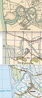
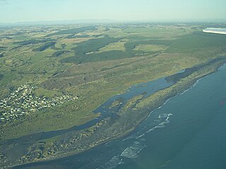
Tangimoana is a community in the Manawatū-Whanganui Region of the North Island of New Zealand. It had a population of 198 permanent residents in 2013. It is located 15 kilometres southwest of Bulls, and 30 kilometres west of Palmerston North.

The Rangitīkei River is one of New Zealand's longest rivers, 253 kilometres (157 mi) long.

The Manawatu District is a local government district in the Manawatū-Whanganui Region in the North Island of New Zealand.

The Rangitikei District is a territorial authority located primarily in the Manawatū-Whanganui region in the North Island of New Zealand, although a small part, the town of Ngamatea, lies in the Hawke's Bay Region. It is located in the southwest of the island, and follows the catchment area of the Rangitīkei River.

Mangaweka is a township on the State Highway One (SH1), Manawatū-Whanganui region, in the North Island of New Zealand, with a population of just under 200. It is between Taihape to the north and Hunterville to the south. The Rangitikei River runs adjacent to the township, which is popular for rafting, kayaking, fishing and swimming.
Turitea is a suburb of Palmerston North in the Manawatū-Whanganui region of New Zealand. It is located on the southern side of the Manawatu River, south of Massey University.

The Hautapu River is a river in the Manawatū-Whanganui region of New Zealand. It originates from Ngamatea Swamp in the New Zealand Army's Waiouru Training area. From here it flows south, through private farmland, and in some places following State Highway 1, for several kilometres before entering the Rangitikei River south of Taihape.

Vinegar Hill is a locality on State Highway 1 in New Zealand's North Island; a camp at that locality and an annual Christmas celebration held at the camp.

Utiku railway station was a station on the North Island Main Trunk in New Zealand, and in the Manawatū-Whanganui region. It opened in 1904 and closed in 1986. It was part of the 13+1⁄2 mi (21.7 km) Mangaweka to Taihape section, officially opened by the Prime Minister, Richard Seddon, on 21 November 1904. It closed in 1986. A passing loop remains.

Rata railway station was a station on the North Island Main Trunk in New Zealand, between Marton and Hunterville, 9 mi 46 ch (15.4 km) from Marton. There is now just a single track through the station site, a new crossing loop having replaced those at Rata and Porewa from 14 December 1983, 3.04 km (1.89 mi) to the west of Rata. The realignment of State Highway 1 alongside the railway

Overton railway station was a very small flag station on the North Island Main Trunk and in the Manawatū-Whanganui region of New Zealand.
Koitiata is a town located in the southwestern part of Rangitikei District of the Manawatū-Whanganui region of New Zealand's North Island. At the time of the 2018 census, Koitiata had a population of 128. Marton is located 24 km to the east and Whanganui is located 29 km to the northwest. Nearby Koitiata is Lake Koitiata.
Porewa is a rural community, in the Rangitikei District of the Manawatū-Whanganui region of New Zealand's North Island.

Marton railway station was a station and rail junction on the Marton–New Plymouth Line, opened on 4 February 1878. After the North Island Main Trunk (NIMT) made a junction to the south of Marton, a new station was built there and the old station renamed and downgraded, in 1898.
Springvale is a suburb of Whanganui, in the Whanganui District and Manawatū-Whanganui region of New Zealand's North Island.
Mataroa is a settlement in the Rangitikei District and Manawatū-Whanganui region of New Zealand's North Island.
Pukeokahu is a rural community in the Rangitikei District and Manawatū-Whanganui region of New Zealand's North Island.
Papanui Junction is a rural community in the Rangitikei District and Manawatū-Whanganui region of New Zealand's North Island. It is located west of Taihape, in the Turakina Valley.
Taoroa Junction or Taoroa is a rural community in the Rangitikei District and Manawatū-Whanganui region of New Zealand's North Island.
References
- ↑ "Rangitīkei: life off the beaten track". www.aa.co.nz. Retrieved 20 May 2021.
- ↑ "Manawatū-Whanganui". www.hortnz.co.nz. 2021. Retrieved 20 May 2021.