
Bondowoso Regency is a landlocked regency in East Java, Indonesia. It covers an area of 1,518.77 km2, and had a population of 736,772 at the 2010 Census and 776,151 at the 2020 Census; the official estimate as at mid 2022 was 781,417. The most common languages are Madurese and Javanese, although Madurese is the majority. The nearest large city is Surabaya, approximately five hours' drive away.
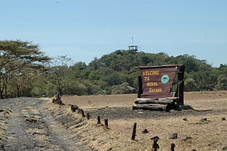
Situbondo Regency is a regency (kabupaten) of East Java province, Indonesia. It covers an area of 1,638.50 km2, and had a population of 647,619 at the 2010 Census and 685,967 at the 2020 Census; the official estimate as at mid 2022 was 673,102. It is located towards the eastern end of Java, before Banyuwangi. The administrative centre is Situbondo, a small town within the regency. One of the famous tourist sites is Baluran National Park.

Tanjungbalai, also colloquially written as Tanjung Balai, is a city in North Sumatra province, Indonesia, on the estuary of the Asahan River. It has an area of 60.52 square kilometers (23.37 sq mi) and the sixth largest kota (urban) population in North Sumatra with 154,445 inhabitants in the 2010 census and 176,027 at the 2020 Census; the official estimate as at mid 2022 was 179,748. The town has a ferry terminal with services to Port Klang, Malaysia, and the city-island of Singapore.

Rokan Hilir is a regency (kabupaten) of Riau Province, on Sumatra island, Indonesia. It was formed on 4 October 1999 from districts which had previously been the northwestern part of Bengkalis Regency. It occupies the lower part of the catchment area of the Rokan River, and has an area of 8,851.59 km2. It had a population of 553,216 at the 2010 census and 637,161 at the 2020 census; the official estimate as at mid 2022 was 638,407. The administrative centre of the Rokan Hilir Regency is located at the town of Bagansiapiapi.

Tebing Tinggi Deli or more commonly simply Tebing Tinggi is a city near the eastern coast of North Sumatra Province of Indonesia. It has an area of 38.44 km2 and a population at the 2010 Census of 145,180, which grew to 172,838 at the 2020 Census; the official estimate as at mid 2022 was 177,785. Tebing Tinggi is an enclave within Serdang Bedagai Regency, which surrounds it on all sides, and contains a kecamatan (district) bordering the city which is also named Tebing Tinggi.
Sukoharjo Regency is a regency in the Central Java province in Indonesia. It covers an area of 493.23 km2 and had a population of 824,238 at the 2010 Census and 907,587 at the 2020 Census; the official estimate as of mid-2022 was 916,627. Its capital is Sukoharjo, about 10 km south of Surakarta. This regency is bordered by the city of Surakarta in the north, Karanganyar Regency in the east, Wonogiri Regency and Yogyakarta in the south as well as Klaten Regency in the west. The regency is part of the metropolitan zone of Surakarta, which is known as Subosukawonosraten.

Balangan Regency is one of the regencies in the Indonesian province of South Kalimantan. It was created on 25 February 2003 from what were previously the eastern districts of North Hulu Sungai Regency. It now covers an area of 1,828.51 km2, and had a population of 112,430 at the 2010 Census and 130,355 at the 2020 Census; the official estimate as at mid 2022 was 134,512, consisting of 67,958 males and 66,554 females. The capital is Paringin. Motto: "Sanggam" (Banjarese), also an acronym for "Sanggup Bagawi Gasan Masyarakat".

North Hulu Sungai Regency is one of the regencies in the Indonesian province of South Kalimantan. It formerly covered a larger area in the north of the province, but on 25 February 2003 the eastern districts were split off to create a separate Balangan Regency. It now has an area of 907.49 km2, and had a population of 209,246 at the 2010 Census and 226,727 at the 2020 Census; the official estimate as at mid 2022 was 231,290. The capital of the regency is the town of Amuntai.
Tapin Regency is one of regencies in the Indonesian province of South Kalimantan; the capital is the town of Rantau. The regency's motto is "Ruhui Rahayu", and it is also shared by another Indonesian province East Kalimantan. It covers an area of 2,174.95 km2 and had a population of 167,877 at the 2010 Census and 189,475 at the 2020 Census; the official estimate as at mid 2022 was 194,628. The administrative centre of the regency is at Rantau.

Labuhanbatu Regency, alternatively written in space as Labuhan Batu Regency, is a regency of North Sumatra, Indonesia. Its seat is Rantau Prapat. It had an area of 9,322.5 km2 in 2000. Subsequently, the reduced regency has an area of 2,561.38 km2 and had a census population in 2010 of 415,248, which rose to 493,899 at the 2020 Census; the official estimate as at mid 2022 was 508,024.

South Labuhanbatu Regency is a regency of North Sumatra, Indonesia, created on 24 June 2008 by being carved out of the southern districts of the existing Labuhanbatu Regency The new South Labuhanbatu Regency covers an area of 3,596 square kilometres and according to the 2010 census it had a population of 277,673, which rose to 314,094 at the 2020 Census; the official estimate as at mid 2022 was 320,324. Its administrative headquarters are at Kotapinang.
North Labuhanbatu Regency is a regency of North Sumatra, Indonesia, created on 24 June 2008 by being carved out of the existing Labuhanbatu Regency, which in 2000 covered an area of 9,322.5 square kilometres and had a population of 840,382 according to the 2000 census. 60.99% of the regency is forested. The new North Labuhanbatu Regency covers 3,545.8 square kilometres and had a population of 331,660 at the 2010 Census, rising to 381,994 at the 2020 Census; the official estimate as at mid 2022 was 390,954.

Nias Selatan Regency is a regency in North Sumatra province, Indonesia, created on 25 February 2003 by the division of the existing Nias Regency. The regency covers a land area of 2,487.99 square kilometres and according to the 2010 census had a population of 289,708; the 2020 Census showed a population of 360,531, while the official estimate for mid 2022 was 373,674. Its administrative centre is the port of Teluk Dalam. Apart from the southern portion of Nias Island, the regency also includes the smaller Batu Islands to the south, lying between Nias and Siberut; these islands occupy nearly half of the land area of the Regency, but have just 9% of its population.

Supiori Regency is a regency in the Indonesian province of Papua. The Regency has an area of 634.24 km2 including the Aruri Islands group to the south, and had a population of 15,874 at the 2010 Census and 22,547 at the 2020 Census; the official estimate as at mid 2022 was 23,247 - comprising 12,056 males and 11,191 females. Until 8 January 2004, this area was part of the Biak Numfor Regency, from which it was split off in accordance with the Law dated 18 December 2003.
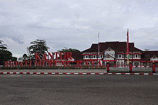
Murung Raya Regency is the most northerly of the thirteen regencies (kabupaten) which comprise the province of Central Kalimantan on the island of Borneo, Indonesia. It was created on 10 April 2002 from the former northwestern two-thirds of the North Barito Regency. The capital of the regency is the town of Puruk Cahu. The regency covers an area of 23,700 km2 and had a population of 96,857 inhabitants at the 2010 census and 111,527 at the 2020 census; the official estimate as at mid 2022 was 113,483.

Paser Regency is a regency (kabupaten) within East Kalimantan province in Indonesia, it is the southernmost regency of the East Kalimantan province. Its administrative centre is Tana Paser. It covers an area of 7,730 km2, and it had a population of 230,316 at the 2010 Census and 275,452 at the 2020 Census; the official estimate as at mid 2022 was 280,065 . Before 2007, this regency was formerly named Pasir Regency.
Ogan Komering Ilir Regency is a regency of South Sumatra Province, Indonesia. It takes its name from the Ogan River and the Komering River, which are the two main rivers that drain the area. The name Ilir means downstream. The administrative centre is the town of Kayu Agung. The regency borders Banyuasin Regency to the northwest, Bangka Strait, and the Java Sea to the east, Lampung Province to the south, and Palembang city, Ogan Ilir Regency, and East Ogan Komering Ulu Regency to the west.

Ogan Ilir Regency is a regency of South Sumatra Province, Indonesia. It takes its name from the main river which stream that area, Ogan River. And the name Ilir means downstream. Indralaya is the regency seat. The regency borders Palembang City and Muara Enim Regency to the north, Ogan Komering Ilir Regency to the east, Ogan Komering Ilir Regency, and East Ogan Komering Ulu Regency to the south, and Muara Enim Regency to the west.

West Tulang Bawang Regency is a regency (kabupaten) of Lampung Province, Sumatra, Indonesia. It was created on 29 October 2008 from what were formerly the western districts of Tulang Bawang Regency. It has an area of 1,201.15 km2 and had a population of 250,707 people at the 2010 Census and 286,162 at the 2020 Census; the official estimate as at mid 2022 was 289,620. The regency seat is the town of Panaragan Jaya.
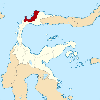
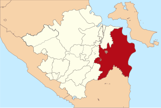
Tolitoli Regency is a regency of Central Sulawesi Province of Indonesia. It was previously part of a larger Buol Tolitoli Regency, but this was split into two on 4 October 1999 after rapid decentralization of the Indonesian government. The present Tolitoli Regency covers an area of 3,701.54 km2 and had a population of 211,296 at the 2010 Census and 225,154 at the 2020 Census; the official estimate as at mid 2022 was 228,641, comprising 116,514 male and 112,127 female inhabitants. Its regency seat is located at the town of Tolitoli, which is a port town and where its population is concentrated.
