
Chilean wine has a long history for a New World wine region, as it was the 16th century when the Spanish conquistadors brought Vitis vinifera vines with them as they colonized the region. In the mid-19th century, French wine varieties such as Cabernet Sauvignon, Merlot, Carmenère and Franc were introduced. In the early 1980s, a renaissance began with the introduction of stainless steel fermentation tanks and the use of oak barrels for aging. Wine exports grew very quickly as quality wine production increased. The number of wineries grew from 12 in 1995 to over 70 in 2005.

The Aconcagua River is a river in Chile that rises from the conflux of two minor tributary rivers at 1,430 metres (4,690 ft) above sea level in the Andes, Juncal River from the east and Blanco River from the south east. The Aconcagua river flows westward through the broad Aconcagua valley and enters the Pacific Ocean near the city of Concon, 20 kilometres (12 mi) north of Valparaíso.

Colchagua Province is one of three provinces of the central Chilean region of O'Higgins (VI). Its capital is San Fernando. It is bordered on the north by Cachapoal Province, on the east by the Argentine Republic, on the south by Curicó Province, and on the west by Cardenal Caro Province.

The Maule river or Río Maule is one of the most important rivers of Chile. It is inextricably linked to the country's pre-Hispanic (Inca) times, the country's conquest, colonial period, wars of Independence, modern history, agriculture, culture, religion, economy and politics. The Maule River marked the southern limits of the Inca Empire. Many famous men and women in Chile's history have been born in the Region named after the river. The river has also lent its name to one of the viticultural regions of the country, the Valley of Maule, a subregion of the Central Valley.

Cachapoal Province is one of three provinces of the central Chilean region of O'Higgins (VI). Its capital is the city of Rancagua.

Cachapoal River is tributary river of the Rapel River in Chile located in the Libertador General Bernardo O'Higgins Region. The river gives its name to the Cachapoal Province.

Tinguiririca River is a river of Chile located in the Libertador General Bernardo O'Higgins Region. It rises in the Andes, at the confluence of the rivers Las Damas and Del Azufre. From its source, it flows northwest for about 56 km to the vicinity of the city of San Fernando. In this portion of its course, the river receives the waters of the tributaries Clarillo and Claro. Then the river flows southwest and then turns northwest to empty into Rapel Lake.
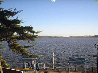
Rapel Lake is an artificial lake created by a dam on the Rapel River. It is located in the Libertador General Bernardo O'Higgins Region, Central Chile.

Palomo is a 4,860 metres (15,940 ft) high Chilean stratovolcano located in the commune of Machali, Cachapoal province, Libertador General Bernardo O'Higgins Region, west of Caldera del Atuel. Together with Tinguiririca it is one of two volcanoes in the region with evidence of Holocene volcanism. The volcano is remote and knowledge on its geology and potential volcanic hazards is limited.
Aillarehue or Ayllarehue ; a confederation of rehues or family-based units (lof) that dominated a region or province. It was the old administrative and territorial division of the Mapuche, Huilliche and the extinct Picunche people. Aillarehue acted as a unit only on special festive, religious, political and especial military occasions. Several aillarehues formed the Butalmapu, the largest military and political organization of the Mapuche.
The Lonquén River is in the Ñuble Region in the southern part of Central Chile. It forms at the confluence of the esteros Pichimávida and Colomávida that originate in the mountains in the east of the province. Its course lies from north to south, receiving from the west the flow of the esteros of La Huerta, Coipuencillo, El Salto, Coroney, and Ninhue, and from the east tributaries, estero Torrecilla, and other lesser tributaries like the estero Tiuque. The Lonquén then changes direction moving from east to west. In this section, it receives from the north the tributaries of the esteros Ranquil, Cholchol, Reloca, San Jose, and Santa Rosa, and from the south the esteros Corontas, Buenos Aires, Luengos, Cabrería, Molino, and Antequereo. It then empties into the Itata River from its northern bank as the Itata is turning toward the west.
The Claro River is a branch of the Tinguiririca River in the O'Higgins Region of Chile. The Claro River valley is an affluent community.
The Mostazal River is a river in the Coquimbo Region in Chile. It flows from east to west and changes its name to Rapel River (Coquimbo) which flows into the Embalse La Paloma.

Abanico Formation is a 3 kilometres (9,800 ft) thick sedimentary formation exposed in the Andes of Central Chile. The formation has been deposited in a timespan from the Eocene to the Miocene. Abanico Formation's contact with the overlying Miocene Farellones Formation has been the subject of differing interpretations since the 1960s. A small part of the formation crops out in the Mendoza Province of western Argentina.


