The Yilgarn Craton is a large craton that constitutes the bulk of the Western Australian land mass. It is bounded by a mixture of sedimentary basins and Proterozoic fold and thrust belts. Zircon grains in the Jack Hills, Narryer Terrane have been dated at ~4.27 Ga, with one detrital zircon dated as old as 4.4 Ga.

The Slave Craton is an Archaean craton in the north-western Canadian Shield, in Northwest Territories and Nunavut. The Slave Craton includes the 4.03 Ga-old Acasta Gneiss which is one of the oldest dated rocks on Earth. Covering about 300,000 km2 (120,000 sq mi), it is a relatively small but well-exposed craton dominated by ~2.73–2.63 Ga greenstones and turbidite sequences and ~2.72–2.58 Ga plutonic rocks, with large parts of the craton underlain by older gneiss and granitoid units. The Slave Craton is one of the blocks that compose the Precambrian core of North America, also known as the palaeocontinent Laurentia.

The Churchill Craton is the northwest section of the Canadian Shield and stretches from southern Saskatchewan and Alberta to northern Nunavut. It has a very complex geological history punctuated by at least seven distinct regional tectonometamorphic intervals, including many discrete accretionary magmatic events. The Western Churchill province is the part of the Churchill Craton that is exposed north and west of the Hudson Bay. The Archean Western Churchill province contributes to the complicated and protracted tectonic history of the craton, and marks a major change in the behaviour of the Churchill Craton with many remnants of Archean supracrustal and granitoid rocks.
The Wyoming Craton is a craton in the west-central United States and western Canada – more specifically, in Montana, Wyoming, southern Alberta, southern Saskatchewan, and parts of northern Utah. Also called the Wyoming Province, it is the initial core of the continental crust of North America.
The Seminoe Mountains greenstone belt represents a fragment of an Archean greenstone terrane within the Wyoming craton. The greenstone belt was mapped by Hausel, who identified significant gold anomalies at Bradley Peak in banded iron formation, quartz veins and in a large altered zone of metabasalts. Mapping differentiated three mappable units that included the Bradley Peak metavolcanics, the Seminoe Formation and the Sunday Morning metasediments.
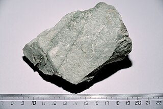
The South Pass greenstone belt is located within the Wyoming craton in the US. The region was the site of Wyoming's initial gold discovery in 1842.

The Algoman orogeny, known as the Kenoran orogeny in Canada, was an episode of mountain-building (orogeny) during the Late Archean Eon that involved repeated episodes of continental collisions, compressions and subductions. The Superior province and the Minnesota River Valley terrane collided about 2,700 to 2,500 million years ago. The collision folded the Earth's crust and produced enough heat and pressure to metamorphose the rock. Blocks were added to the Superior province along a 1,200 km (750 mi) boundary that stretches from present-day eastern South Dakota into the Lake Huron area. The Algoman orogeny brought the Archaen Eon to a close, about 2,500 million years ago; it lasted less than 100 million years and marks a major change in the development of the earth’s crust.
Dan Hausel a polymath of martial arts, geology, writing, astronomy, art, and public speaking. Hall-of-Fame 10th degree black belt grandmaster of Shorin-Ryu Karate and Kobudo, mineral exploration geologist who made several gold, colored gemstone, and diamond deposit discoveries in Alaska, Colorado, Montana and Wyoming, author of more than 600 publications including books, maps, professional papers and magazine articles, public speaker, artist, former astronomy lecturer for the Hansen Planetarium in Utah, and former rock musician.

The geology of Zimbabwe in southern Africa is centered on the Zimbabwe Craton, a core of Archean basement composed in the main of granitoids, schist and gneisses. It also incorporates greenstone belts comprising mafic, ultramafic and felsic volcanics which are associated with epiclastic sediments and iron formations. The craton is overlain in the north, northwest and east by Proterozoic and Phanerozoic sedimentary basins whilst to the northwest are the rocks of the Magondi Supergroup. Northwards is the Zambezi Belt and to the east the Mozambique Belt. South of the Zimbabwe Craton is the Kaapvaal Craton separated from it by the Limpopo Mobile Belt, a zone of deformation and metamorphism reflecting geological events from Archean to Mesoproterozoic times. The Zimbabwe Craton is intruded by an elongate ultramafic/mafic igneous complex known as the Great Dyke which runs for more than 500 km along a SSW/NNE oriented graben. It consists of peridotites, pyroxenites, norites and bands of chromitite.

The Barberton greenstone belt (BGB) is located in the Kapvaal craton of southeastern Africa. It characterizes one of the most well-preserved and oldest pieces of continental crust today by containing rocks in the Barberton Granite Greenstone Terrain (3.55–3.22 Ga). The BGB is a small, cusp-shaped succession of volcanic and sedimentary rocks, surrounded on all sides by granitoid plutons which range in age from >3547 to <3225 Ma. It is commonly known as the type locality of the ultramafic, extrusive volcanic rock, the komatiite. Greenstone belts are geologic regions generally composed of mafic to ultramafic volcanic sequences that have undergone metamorphism. These belts are associated with sedimentary rocks that occur within Archean and Proterozoic cratons between granitic bodies. Their name is derived from the green hue that comes from the metamorphic minerals associated with the mafic rocks. These regions are theorized to have formed at ancient oceanic spreading centers and island arcs. In simple terms, greenstone belts are described as metamorphosed volcanic belts. Being one of the few most well-preserved Archean portions of the crust, with Archean felsic volcanic rocks, the BGB is well studied. It provides present geologic evidence of Earth during the Archean (pre-3.0 Ga). Despite the BGB being a well studied area, its tectonic evolution has been the cause of much debate.

The geology of Sierra Leone is primarily very ancient Precambrian Archean and Proterozoic crystalline igneous and metamorphic basement rock, in many cases more than 2.5 billion years old. Throughout Earth history, Sierra Leone was impacted by major tectonic and climatic events, such as the Leonean, Liberian and Pan-African orogeny mountain building events, the Neoproterozoic Snowball Earth and millions of years of weathering, which has produced thick layers of regolith across much of the country's surface.

The geology of Sudan formed primarily in the Precambrian, as igneous and metamorphic crystalline basement rock. Ancient terranes and inliers were intruded with granites, granitoids as well as volcanic rocks. Units of all types were deformed, reactivated, intruded and metamorphosed during the Proterozoic Pan-African orogeny. Dramatic sheet flow erosion prevented almost any sedimentary rocks from forming during the Paleozoic and Mesozoic. From the Mesozoic into the Cenozoic the formation of the Red Sea depression and complex faulting led to massive sediment deposition in some locations and regional volcanism. Sudan has petroleum, chromite, salt, gold, limestone and other natural resources.
The geology of Sweden is the regional study of rocks, minerals, tectonics, natural resources and groundwater in the country. The oldest rocks in Sweden date to more than 2.5 billion years ago in the Precambrian. Complex orogeny mountain building events and other tectonic occurrences built up extensive metamorphic crystalline basement rock that often contains valuable metal deposits throughout much of the country. Metamorphism continued into the Paleozoic after the Snowball Earth glaciation as the continent Baltica collided with an island arc and then the continent Laurentia. Sedimentary rocks are most common in southern Sweden with thick sequences from the last 250 million years underlying Malmö and older marine sedimentary rocks forming the surface of Gotland.

Archean felsic volcanic rocks are felsic volcanic rocks that were formed in the Archean Eon. The term "felsic" means that the rocks have silica content of 62–78%. Given that the Earth formed at ~4.5 billion year ago, Archean felsic volcanic rocks provide clues on the Earth's first volcanic activities on the Earth's surface started 500 million years after the Earth's formation.
The geology of Nunavut began to form nearly three billion years ago in the Archean and the territory preserves some of the world's oldest rock units.
The geology of Wyoming includes some of the oldest Archean rocks in North America, overlain by thick marine and terrestrial sediments formed during the Paleozoic, Mesozoic and Cenozoic, including oil, gas and coal deposits. Throughout its geologic history, Wyoming has been uplifted several times during the formation of the Rocky Mountains, which produced complicated faulting that traps hydrocarbons.
The geology of Montana includes thick sequences of Paleozoic, Mesozoic and Cenozoic sedimentary rocks overlying ancient Archean and Proterozoic crystalline basement rock. Eastern Montana has considerable oil and gas resources, while the uplifted Rocky Mountains in the west, which resulted from the Laramide orogeny and other tectonic events have locations with metal ore.
The geology of South Korea includes rocks dating to the Archean and two large massifs of metamorphic rock as the crystalline basement, overlain by thick sedimentary sequences, younger metamorphic rocks and volcanic deposits.
The geology of the Northwest Territories has been mapped in different quadrangles by the Canadian government. The region has some of the oldest rocks in the world and among the oldest in North America, formed from several sections of stable craton continental crust, including the Slave Craton, Rae Craton and Hearne Craton. These rocks form the Archean and Proterozoic Precambrian basement rock of the region and are the subject of extensive research to understand continental crust and tectonic conditions on the early Earth.