
Moradabad district is one of the districts of Uttar Pradesh, India. Moradabad is the district headquarters. Moradabad district is a part of Moradabad division. It is used to be the second most populous district of Uttar Pradesh, after Prayagraj till a new district Sambhal was carved out of it in 2011.
Nagina is a town and a municipal board in Bijnor district in the Indian state of Uttar Pradesh.
Bilsi is a town and a municipal board in Badaun district in the state of Uttar Pradesh, India. It is located to the southwest of Bareilly and has its own tehsil. According to Census 2011 information the sub-district code of Bilsi block is 00780. Total area of Bilsi is 361 km2 including 332.13 km2 rural area and 28.60 km2 urban area. Bilsi has a population of 4,04,198 peoples. There are 67,758 houses in the sub-district. There are about 204 villages in Bilsi bloc
Chandpur is a town and a municipal board in Bijnor district in the Indian state of Uttar Pradesh, India.

Ganj Muradabad is a town and nagar panchayat in Safipur tehsil of Unnao district, Uttar Pradesh, India. It also serves as the headquarters of a community development block containing 86 rural villages. Handicrafts are a major industry here. As of 2011, Ganj Moradabad has a population of 10,957, in 1,723 households.
Jaspur is a developing town and a municipal board in Udham Singh Nagar district in the Indian state of Uttarakhand.

Kadipur is a town, tehsil and a nagar panchayat in Sultanpur district in the Indian state of Uttar Pradesh. It is located a short distance from the bank of the Gomti River, at a crossroads between two roads heading from Sultanpur to Surapur and from Pratapgarh to Dostpur and then on to Akbarpur. On the north side of town is a stream with a steep ravine that drains the surrounding area. The road to Sultanpur crosses over this stream on a bridge. The lands surrounding Kadipur are average quality for agricultural purposes. As of 2011, Kadipur has a population of 8,010 people, in 1,216 households.
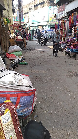
Kanth is a Nagar Palika Parishad in Moradabad district in the Indian state of Uttar Pradesh. It is home to small-scale bandage manufacturing industries. These are sold in Uttar Pradesh and in the rest of India under various licenses. Recently manufacturing of ready-made garments has also developed, contributing to the economy of the town.

Musafirkhana is a town and tehsil in Amethi district in Indian state of Uttar Pradesh. The word "Musafirkhana" means "Sarai," or "Dharamshala". Musafirkhana is located 32 km northwest of Amethi, 20 km from Jagdishpur. Gauriganj and Amethi are accessible from Musafirkhana via roadways; the nearest railway station is the Musafirkhana railway station on the Lucknow–Varanasi rail route via Sultanpur, and the nearest airport is the Amausi airport. It is surrounded by more than 100 villages. The town is between 26.37° north latitude and 81.8° east longitude at a height of 102 metres (434 feet) above mean sea level.
Rithora is a town and a nagar panchayat in Bareilly Tehsil of Bareilly district in the Indian state of Uttar Pradesh.
Sirsa is a town and a nagar panchayat in Allahabad district in the Indian state of Uttar Pradesh.

Sitarganj is a city and a municipal board in Udham Singh Nagar district in the Indian state of Uttarakhand. Now it is home to the Integrated Industrial Estate Sitarganj (IIE) being developed by State Industrial Development Corporation of Uttarakhand Limited (SIDCUL).
Thakurdwara is a town in Moradabad district in the indian state of Uttar Pradesh.

Joya is a nagar panchayat located along highway NH-24 in Amroha district in the Western Uttar Pradesh. It is predominantly a milk producing city. Joya was a gram panchayat before 1988. The late Abrar Hussain was the first chairman of Joya in 1988.
Moradabad Lok Sabha constituency is one of the 80 Lok Sabha (parliamentary) constituencies in western Uttar Pradesh state in northern India. Formed before the 1952 elections, according to Election Commission of India 2009 data the total electorates in the Moradabad Parliamentary constituency were 1,388,525 of which 634,547 are females and 753,978 are males. The administrative headquarters of Moradabad district is situated in the city of Moradabad. It is located in the northern part of the state at a distance of 167 km from the national capital, New Delhi. Hindi is the official language of Moradabad, though Urdu, Punjabi and English are widely spoken. National Highway NH 9 passes through Moradabad.
Fatanpur is a village situated about 30 km southwest of Moradabad in Uttar Pradesh, India. This village was established by Dahiya Jats from the Haryana State of India. The Jat clan of that area now comprises the Dahiyas, Tobias, Maliks, and Jatranas. The other castes found there are Saini, Thakur(nai), and Harijans. Most of this village's population is dependent on agriculture. The NREGA scheme is in progress in the village and many of the boys there have joined the Indian Armed Forces in recent years.
Rehar is a small town in Bijnor district, in Uttar Pradesh state, India.

Kunwar Sarvesh Kumar Singh also known as Rakesh Singh, is a businessman who served as the Member of Parliament from Moradabad, India from Bharatiya Janata Party. He is a veteran politician from Western Uttar Pradesh who belongs to Thakur (Rajput) caste. He is one of the Bahubali politicians in Uttar Pradesh. He was a five-term MLA from Thakurdwara from 1991 to 2007 and 2012 to 2014 till he was elected as MP from Moradabad Lok Sabha General Election in 2014. His son Kunwar Sushant Singh is currently BJP MLA from Barhapur.

Sambhal district is a district of Uttar Pradesh state in India. The district headquarter is Bahjoi town. 993 Villages and 16 Police stations fall under Sambhal district.
Surhan is a village in Martinganj Block in Azamgarh district of Uttar Pradesh State, India. It belongs to Azamgarh Division. It is located 44 km west of the District headquarters Azamgarh. 1 km from Martinganj. 249 km from State capital Lucknow.
