
Deerfield is a north shore suburb of Chicago in Lake County, Illinois, United States, with a small portion extending into Cook County, Illinois. The population was 19,196 at the 2020 census. Deerfield is home to the headquarters of Walgreens Boots Alliance, Baxter Healthcare, and Fortune Brands Home & Security. Deerfield is often listed among some of the wealthiest and highest earning places in Illinois and the Midwest. The per capita income of the village is $68,101 and the median household income is $143,729.
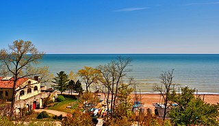
Glencoe is a lakefront village in northeastern Cook County, Illinois, United States. As of the 2020 census, the population was 8,849. Glencoe is part of Chicago's North Shore and is located within the New Trier High School District. Glencoe has the eighth highest income per household among municipalities in the U.S. with greater than 2,000 homes.
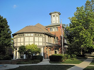
Lake Bluff is a village in Lake County, Illinois, United States. Per the 2020 census, the population was 5,616.
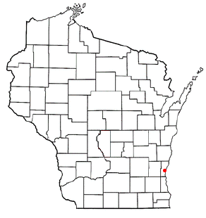
The Town of Grafton is a town located in Ozaukee County, Wisconsin, United States, and is in the Milwaukee metropolitan area. The town was created in 1846 and at the time of the 2020 Census had a population of 4,157.
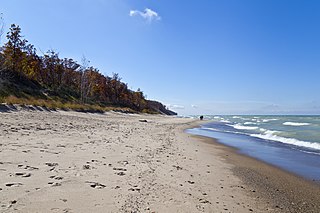
Indiana Dunes National Park is a United States national park located in northwestern Indiana managed by the National Park Service. It was authorized by Congress in 1966 as the Indiana Dunes National Lakeshore and was redesignated as the nation's 61st national park on February 15, 2019. The park runs for about 20 miles (32 km) along the southern shore of Lake Michigan and covers 15,349 acres (6,212 ha). Along the lakefront, the eastern area is roughly the lake shore south to U.S. 12 or U.S. 20 between Michigan City, Indiana, on the east and the Cleveland-Cliffs steel plant on the west. A small extension south of the steel mill continues west along Salt Creek to Indiana 249. The western area is roughly the shoreline south to U.S. 12 between the Burns Ditch west to Broadway in downtown Gary, Indiana. In addition, there are several outlying areas, including Pinhook Bog, in LaPorte County to the east; the Heron Rookery in Porter County, the center of the park; and the Calumet Prairie State Nature Preserve and the Hobart Prairie Grove, both in Lake County, the western end of the park.
Fort Sheridan is a residential neighborhood within the cities of Lake Forest, Highwood, and Highland Park in Lake County, Illinois, United States. It was originally established as Fort Sheridan, an Army post named after Civil War cavalry general Philip Sheridan, to honor his services to Chicago.

The North Shore consists of many affluent suburbs north of Chicago, Illinois, bordering the shore of Lake Michigan. These communities form part of Cook and Lake Counties. Exactly which communities comprise the "North Shore" is often a topic of debate, and a proper definition only includes suburbs that border Lake Michigan. Thus, only Evanston, Wilmette, Kenilworth, Winnetka, Glencoe, Highland Park, Highwood, Lake Forest, and Lake Bluff are recognized as part of the North Shore.

The city of Chicago is located in northern Illinois, United States, at the south western tip of Lake Michigan. It sits on the Saint Lawrence Seaway continental divide at the site of the Chicago Portage, an ancient trade route connecting the Mississippi River and the Great Lakes watersheds.

The Driftless Area, a topographical and cultural region in the American Midwest, comprises southwestern Wisconsin, southeastern Minnesota, northeastern Iowa, and the extreme northwestern corner of Illinois.

Lake Chicago was a prehistoric proglacial lake that is the ancestor of what is now known as Lake Michigan, one of North America's five Great Lakes. Fed by retreating glaciers, it drained south through the Chicago Outlet River.

The Grand Village of the Illinois, also called Old Kaskaskia Village, is a site significant for being the best documented historic Native American village in the Illinois River valley. It was a large agricultural and trading village of Native Americans of the Illinois confederacy, located on the north bank of the Illinois River near the present town of Utica, Illinois. French explorers Louis Joliet and Father Jacques Marquette came across it in 1673. The Kaskaskia, a tribe of the Illiniwek people lived in the village. It grew rapidly after a French mission and fur trading post were established there in 1675, to a population of about 6,000 people in about 460 houses. Around 1691 the Kaskaskia and other Illiniwek moved further south, abandoning the site due to pressure from an Iroquois invasion from the northeast.
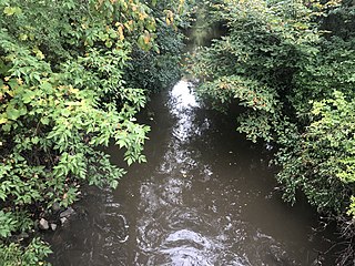
The Skokie River is a 20-mile-long (32 km) river that flows through the northern suburbs of Chicago, Illinois. It flows almost parallel to the shore of Lake Michigan, and historically discharged its outflow into that lake via the Chicago River. However, the construction of the Chicago Sanitary and Ship Canal in 1900 caused the drainage of the Chicago River, including its Skokie River tributary, to flow southwestward towards the Mississippi River.

Adeline Jay Geo-Karis Illinois Beach State Park, part of the Illinois state park system, is located along Lake Michigan in northern Lake County in northeast Illinois. Together with lands to the north, including Chiwaukee Prairie, it forms the Chiwaukee Prairie Illinois Beach Lake Plain, an internationally recognized wet-land of importance under the Ramsar Convention. The park is broken into two units that encompass an area of 4,160 acres (1,683 ha) and contains over six miles of Lake Michigan shoreline. In 2010, it was renamed for former state senator Adeline Geo-Karis.
Knollwood is an unincorporated community and census-designated place (CDP) in Lake County, Illinois, United States. Per the 2020 census, the population was 2,221. It is located within Shields Township and Libertyville Township. Knollwood shares a ZIP Code with the neighboring village of Lake Bluff, and children attend Lake Bluff schools. The residents of Knollwood were served by the Knollwood Fire Department until October 2018, after the trustees of the Rockland Fire Protection District ended their relationship with the department. Residents now receive fire protection from the Libertyville and Lake Forest fire departments. Police protection is provided by the Lake County Sheriff's Department.
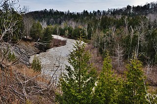
The Toronto ravine system is a distinctive feature of the city's geography, consisting of a network of deep ravines, which forms a large urban forest that runs through most of Toronto. The ravine system is the largest in any city in the world, with the Ravine and Natural Feature Protection Bylaw protecting approximately 110 square kilometres (42 sq mi) of public and privately-owned land. The ravine system has been presented as a central characteristic of the city, with the size of the ravine system leading Toronto to be described as "a city within a park".

Carpenter Park is a 322-acre (1.30 km2) park on the north bank of the Sangamon River on the far north side of the city of Springfield, Illinois. Part of the park is a dedicated Illinois Nature Preserve and has been designated as an Important Bird Area of Illinois. The park, which is operated by the Springfield Park District, is one of the roadside attractions of old Route 66.

Highland Park is a suburban city located in the southeastern part of Lake County, Illinois, United States, about 25 miles (40 km) north of downtown Chicago. Per the 2020 census, the population was 30,176. Highland Park is one of several municipalities located on the North Shore of the Chicago metropolitan area.
Openlands is a non-profit conservation organization and accredited land trust that works with groups and individuals in northeastern Illinois, northwestern Indiana, and southeastern Wisconsin to preserve open space, develop walking and biking trails, restore natural areas, and connect people to the outdoors. Openlands has protected and expanded public access to more than 55,000 acres of land for parks, forest preserves, land and water greenway corridors, and urban gardens across the Chicago metropolitan region. It is a member of Chicago Wilderness.

The Philip H. Sheridan Reserve Center is the former Fort Sheridan now in Lake Forest, Highwood, and Highland Park in Lake County, Illinois, United States. It was originally established as a United States Army Post named after Civil War Cavalry General Philip Sheridan, to honor his services to Chicago. When the main fort was officially closed by the Army on May 3, 1993, the majority of the property was sold by the Department of Defense to commercial land developers. Most of the original housing structures were then refurbished and resold as a residential community. Other buildings were given to cultural organizations like Midwest Young Artists, the largest youth music program in the Midwest. Approximately 90 acres (36 ha) of the southern end of the original post were retained by the Army; there the Army now operates the Sheridan Reserve Center complex.
The Willamette Escarpment is an escarpment that runs along the east bank of the Willamette River in Portland, Oregon, United States. The escarpment comprises two distinct sections: a 200-acre (81 ha) North Escarpment Unit, which extends from the Fremont Bridge northwest to the St. Johns Bridge, and a 75-acre (30 ha) South Escarpment Unit, which extends from the Sellwood Bridge north to the Ross Island Bridge.


