Related Research Articles

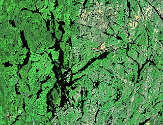
Lake Nipissing is a lake in the Canadian province of Ontario. It has a surface area of 873.3 km2 (337.2 sq mi), a mean elevation of 196 m (643 ft) above sea level, and is located between the Ottawa River and Georgian Bay. Lake Nipissing is the third-largest lake entirely in Ontario. It is relatively shallow for a large lake, with an average depth of only 4.5 m (15 ft). The shallowness of the lake makes for many sandbars along the lake's irregular shoreline. The lake reaches a maximum depth of 64 m (210 ft) near the mouth of the French River, off the shore of Blueberry Island. The lake has many islands most of which are protected under the Protection of Significant Wetlands scheme, controlled by the Ministry of Natural Resources and Forestry.

Bradford is the primary country urban area of the Town of Bradford West Gwillimbury, Ontario, in Canada. It overlooks a farming community, known as The Holland Marsh, located on the Holland River that flows into Lake Simcoe.
King's Highway 11, commonly referred to as Highway 11, is a provincially-maintained highway in the Canadian province of Ontario. At 1,784.9 kilometres (1,109.1 mi), it is the second-longest highway in the province, after Highway 17. Highway 11 begins at Highway 400 in Barrie and arches through northern Ontario to the Ontario–Minnesota border at Rainy River via Thunder Bay; the road continues as Minnesota State Highway 72 across the Baudette–Rainy River International Bridge. North and west of North Bay, Highway 11 forms part of the Trans-Canada Highway and is part of MOM's Way between Thunder Bay and Rainy River.

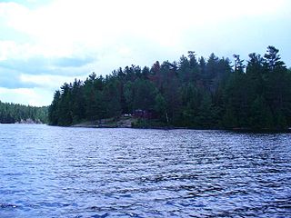
Lake Temagami, formerly spelled as Lake Timagami, is a lake in Nipissing District in northeastern Ontario, Canada, situated approximately 80 km north of North Bay. The lake's name comes from dimii-agamiing "tih-MEE-uh-guh-MEENG", which means "it is deep water by the shore" in the Ojibwa language.

Jumping Cariboo Lake, sometimes incorrectly spelled Jumping Caribou Lake, is a lake located within the Municipality of Temagami, in the Nipissing District, Ontario, Canada. It contains small islands and hidden bays. Ojibwa natives of the area have given the lake its name.
The Obabika River Provincial Park is a provincial park in Ontario, Canada, straddling across the boundaries of the Sudbury, Nipissing, and Timiskaming Districts. While it is named after and includes the Obabika River, the bulk of the park extends north of Obabika Lake to the eastern boundary of Lady Evelyn-Smoothwater Provincial Park.

Temagami, formerly spelled Timagami, is a municipality in northeastern Ontario, Canada, in the Nipissing District with Lake Temagami at its heart.
King's Highway 105, commonly referred to as Highway 105, is a provincially maintained highway in the Canadian province of Ontario. Located in the Kenora District of northern Ontario, the highway extends for 173.5 kilometres (107.8 mi) from an intersection with Highway 17 between Kenora and Dryden with the Red Lake mining area to the north. The route also passes through the town of Ear Falls near its midpoint. Highway 105 was built to provide access to the large gold deposits at Red Lake, which were only accessible by boat or plane between their discovery in 1926 and the opening of the highway in 1946. Highway 105 passes through long stretches of isolated forest and lakeland, with no services available between the distanced communities along the route.
The White Bear Forest is an old growth forest, located in Temagami, Ontario, Canada. The forest is named after Chief White Bear, who was the last chief of the Teme-Augama Anishnabai before Europeans appeared in the region. In some parts of the White Bear Forest trees commonly reach 200 to 300 years in age, while the oldest tree accurately aged in White Bear Forest was a red pine that was 400 years old in 1999. The White Bear Forest contains one of Canada's oldest portages, dating back some 3,000 years. Today, more than 17 km (11 mi) of trails access the White Bear Forest. A trail guide is available online at http://ancientforest.org/whitebear.html.

The Teme-Augama Anishnabai is the Indigenous Anishinaabe community of the Temagami First Nation. The ancestors of Teme-Augama Anishnabai have trapped and hunted animals in the Temagami region of Canada for over 5,000 years. Bear Island on Lake Temagami is home to the Indigenous community.
The Temagami River, formerly spelled as Timagami River, is a river in the Nipissing District of Ontario, Canada, in the Temagami region. Its source is Lake Temagami and flows through Cross Lake and Red Cedar Lake. It flows into the Sturgeon River at the community of River Valley.
The Temagami First Nation is located on Bear Island in the heart of Lake Temagami, the second largest in Lake Temagami after Temagami Island. Its community is known as Bear Island 1. Temagami First Nation (TFN) members are status Indians under the Indian Act that live on and off Bear Island.
Gary Potts was a chief of the Temagami First Nation and the Teme-Augama Anishnabai in Temagami, Ontario, Canada. He was chief in August 1973 when the Temagami Land Caution began with land claims being filed with title offices to prevent development on Crown land.
King's Highway 103, commonly referred to as Highway 103, was a provincially maintained highway in the Canadian province of Ontario. Located in the District Municipality of Muskoka and Simcoe County, the highway extended from Highway 12 at Waubaushene to Highway 69 at Foot's Bay. Established in 1944, it was originally a short gravel highway connecting Waubaushene to Port Severn. In 1950 it was chosen as the future route of the Trans-Canada Highway and extended to Foot's Bay. It existed until 1976, when a series of renumberings eliminated the designation, replacing it with Highway 69; Highway 400 has since been built over the majority of the former route.

The Milne Townsite, commonly referred to as Milnes, is an abandoned community in Strathy Township, municipality of Temagami, Nipissing District in northeastern Ontario, Canada, located on the north shore of Link Lake, just south of the Milne-Sherman Road, and about 2 km (1.2 mi) north of the town of Temagami. It covered about 3.5% of the town of Temagami and had 40 residents.
Obabika old-growth forest is an Eastern White Pine and Red Pine dominated old-growth forest at the north end of Obabika Lake, just west of the Temagami region of Ontario, Canada. At 2,400 hectares in size, it is commonly considered to be the largest remaining white pine dominated old-growth forest in the world. It is also sometimes called Chee-Skon Lake old-growth forest, or Wakimika Triangle old-growth forest. This area was slated for logging in 1989 and was protected largely as a result of a blockade on Red Squirrel Road in which 344 protestors were arrested, including future Ontario premier Bob Rae. The oldest trees in the Obabika old-growth forest are confirmed to be at least 375 years old, but a diversity of age classes occur in this forest. Another important feature of the area is the spirit rock, a column of rock on the shore of Chee-Skon Lake that is of spiritual significance to the Teme-Augama Anishnabai people.
The Ferguson Highway was a 260 mi (420 km) long gravel trunk road in Ontario, Canada. Built between 1925 and 1927 from the city of North Bay to the town of Cochrane, it was created to connect the growing agricultural and mining communities of Northern Ontario with other areas further south. The road eventually became part of Highway 11, and was largely bypassed by improved routings in the 1940s and 1950s.
Owaissa is an unincorporated place and railway point in the municipality of Temagami, Nipissing District, in Northeastern Ontario, Canada. It is in geographic Strathy Township, and is located on Ontario Highway 11, on the Ontario Northland Railway, and on the northern arm of Net Lake, about 3 km (1.9 mi) north of
The Temagami Land Caution was a territorial dispute in the Temagami area of Northeastern Ontario, Canada. In 1877, deputy chief Ignace Tonené filed a land claim concerning the Temagami region with the Parry Sound federal Indian Agent. The modern land claim was filed with land title offices in August 1973 by Gary Potts, then Chief of the Teme-Augama Anishnabai Indigenous Nation. The caution was intended as a way of maintaining 10,000 km2 (3,900 sq mi) of land that they claimed as "n'Daki Menan", meaning "Our Land". Existing throughout much of the 1970s and 1980s, it effectively prevented all types of development on Crown land, such as mining. Crown land sales were also prohibited due to the Temagami Land Caution. In 1988, Vince Kerrio approved the expansion of Red Squirrel Road directly through the Temagami Land Caution. This prompted a series of roadblocks by the Teme-Augama Anishnabai and by environmentalists in 1988–1989. In 1991, the Supreme Court of Canada ruled that the Teme-Augama Anishnabai gave up rights to the land via the 1850 Robinson Treaty despite the Tema-Augama Anishnabai claiming that they never signed or consented to the treaty. The Temagami Land Caution was lifted in 1995 as a result of a court order by the Supreme Court of Canada.
Red squirrel may refer to:
References
- ↑ Back, Brian. "Milestones in Environmental Preservation, 1901-1983". Ottertooth. Retrieved December 6, 2017.[ self-published source? ]
- ↑ Hodgins, Bruce W.; Lischke, Ute; McNab, David T., eds. (2003). Blockades & Resistance: Studies in Actions of Peace and the Temagami Blockades of 1988-89. Waterloo, Ontario: Wilfrid Laurier University Press. ISBN 0-88920-381-4. OCLC 49784186 . Retrieved December 6, 2017– via Google Books.