
Greene County is located in the U.S. state of Missouri. As of the 2020 census, its population was 298,915. making it the fourth most-populous county in Missouri. Its county seat and most-populous city is Springfield. The county was organized in 1833 and is named after American Revolutionary War General Nathanael Greene.
Holman is an extinct town in Webster County, in the U.S. state of Missouri. The GNIS classifies it as a populated place. The site is located on Missouri Supplemental Route OO, approximately fifteen miles (24 km) northeast of Springfield.
Oak Grove Heights is an unincorporated community in eastern Greene County, Missouri, United States. It is located on Route 125, approximately five miles northwest of Rogersville and one mile south of the James River.

Logan is an unincorporated community in eastern Lawrence County, Missouri, United States. It is located off U.S. Route 60, one mile northeast of Marionville. Several homes are located there.
Branch is an unincorporated community in southwestern Camden County, Missouri, United States. It is located on Route 73 one mile south of U.S. Route 54. Macks Creek is four miles to the northeast. Tunas is approximately four miles south on Route 73 in Dallas County.

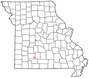
Goodson is an unincorporated community in Polk County, Missouri, United States. It is located at the intersection of Missouri Supplemental Routes C and P and is approximately sixteen miles northeast of Bolivar. Goodson is part of the Springfield, Missouri Metropolitan Statistical Area.

Polk is an unincorporated community in Polk County, Missouri, United States. It is located on Missouri Supplemental Route D, approximately twelve miles northeast of Bolivar. Polk is part of the Springfield, Missouri Metropolitan Statistical Area.
Clara is an unincorporated community in central Texas County, Missouri, United States. The community is located on a hilltop, approximately one-half mile northwest of the Big Piney River. It is about three miles southwest of Houston on Missouri Route Z.
Charity is an unincorporated community in southern Dallas County, in the U.S. state of Missouri.
Olive is an unincorporated community in southeastern Dallas County, in the U.S. state of Missouri.
Hickory Barren is an unincorporated community in northern Greene County, in the U.S. state of Missouri. The community is on Missouri Route H, two miles north of Fellows Lake. Fair Grove is approximately four miles to the northeast.
Muddy Creek is a stream in Johnson and Pettis Counties in the U.S. state of Missouri. It is a tributary of Lamine River.
Mohawk Corner is an unincorporated community in northeast Polk County, in the U.S. state of Missouri. The community is at the intersection of Missouri Routes 64 and D. Pittsburg and the Pomme de Terre Lake area are five miles to the north on Route 64 in Hickory County. Polk is two miles to the south on Route D.
Violet is an unincorporated community in eastern Polk County, Missouri.
Tiffin is an unincorporated community in southern St. Clair County, in the U.S. state of Missouri.

Rail is an extinct town in east central Wright County, in the Ozarks of southern Missouri, United States. The GNIS classifies it as a populated place. The village was located on the west bank of Beaver Creek, just southeast of the intersection of Missouri routes 38 and 95.
The Little Sac River is a stream in Greene, Polk and Dade counties the Ozarks of southwest Missouri, U.S.A.
Clear Creek is a stream in Cedar, Barton, Vernon, and St. Clair counties of southwest Missouri. It is a tributary to the Osage River.
Pierson Creek or Pearson Creek is a stream in southeastern Greene County in the Ozarks of southwest Missouri. The stream is a tributary of the James River.
Limestone Creek is a stream in Dade and Lawrence counties in the Ozarks of southwest Missouri. It is a tributary of Turnback Creek.

