Redtop, Missouri

Last updated
Redtop, Missouri
Unincorporated community
USA Missouri location map.svg
Red pog.svg
Redtop
Usa edcp location map.svg
Red pog.svg
Redtop
Coordinates: 37°30′13″N93°08′39″W / 37.50361°N 93.14417°W / 37.50361; -93.14417 Coordinates: 37°30′13″N93°08′39″W / 37.50361°N 93.14417°W / 37.50361; -93.14417
Country United States Flag of the United States.svg
State Missouri
County Dallas
Township Jasper
Elevation 371 m (1,217 ft)
Time zone Central (CST) (UTC-6)
  Summer (DST) CDT (UTC-5)
GNIS feature ID 737911 [1]

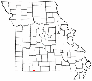
Redtop is an unincorporated community in Dallas County, Missouri. [1] It is located west of U.S. Route 65 (on an older alignment of the highway) approximately 9 mi (14 km) south of Buffalo.

Unincorporated area Region of land not governed by own local government

In law, an unincorporated area is a region of land that is not governed by a local municipal corporation; similarly an unincorporated community is a settlement that is not governed by its own local municipal corporation, but rather is administered as part of larger administrative divisions, such as a township, parish, borough, county, city, canton, state, province or country. Occasionally, municipalities dissolve or disincorporate, which may happen if they become fiscally insolvent, and services become the responsibility of a higher administration. Widespread unincorporated communities and areas are a distinguishing feature of the United States and Canada. In most other countries of the world, there are either no unincorporated areas at all, or these are very rare; typically remote, outlying, sparsely populated or uninhabited areas.
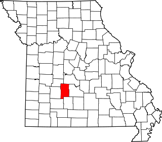
Dallas County, Missouri County in the United States

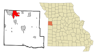
Dallas County is a county located in the U.S. state of Missouri. As of the 2010 census, the population was 16,777. Its county seat is Buffalo. The county was organized in 1842 as Niangua County and then renamed in 1844 for George M. Dallas, who served as Vice President under James K. Polk.
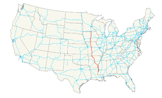
U.S. Route 65 highway in the United States

U.S. Route 65 is a north–south United States highway in the southern and midwestern United States. The southern terminus of the route is at U.S. Route 425 in Clayton, Louisiana. The northern terminus is at Interstate 35 just south of Interstate 90 in Albert Lea, Minnesota. Parts of its modern route in Iowa and historic route in Minnesota follow the old Jefferson Highway.

Redtop is part of the Springfield, Missouri Metropolitan Statistical Area.

Springfield, Missouri City in Missouri, United States

Springfield is the third-largest city in the state of Missouri and the county seat of Greene County. As of the 2010 census, its population was 159,498. As of 2017, the Census Bureau estimated its population at 167,376. It is the principal city of the Springfield metropolitan area, which has a population of 462,369 and includes the counties of Christian, Dallas, Greene, Polk, Webster.

History

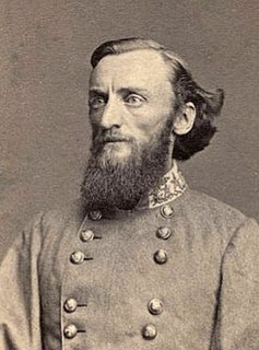
A post office was established in 1889 or earlier, and was named "Cassity" after the postmaster, T.N. Cassity. [1] [2] Because the name was similar to "Cassidy", a post office in southern Missouri, the name was changed to "Marmaduke", after Confederate general John S. Marmaduke. [1] [2] That name was too long for the postal ring or stamp, and again needed to be changed. Cassity's wife suggested "redtop", which was a type of grass ( Agrostis gigantea ) which grew in a large field behind the store in which the office was housed, and which had a reddish color when ripe. [2]

John S. Marmaduke 25th Governor of Missouri

John S. Marmaduke served as the 25th governor of Missouri from 1885 until his death in 1887. Prior to that, he was a senior officer of the Confederate States Army who commanded cavalry in the Trans-Mississippi Theater of the American Civil War. On September 6, 1863 Marmaduke killed Confederate Brigadier-General Lucius M. Walker in a duel. Major-General Sterling Price ordered Marmaduke's arrest, but suspended the order because of the impending Union advance on Little Rock, Arkansas. Marmaduke never faced a court martial for the duel.

<i>Agrostis gigantea</i> species of grass

Agrostis gigantea, known by its common names black bent and redtop, is a perennial grass of the Agrostis genus.

The post office was later moved to U.S. Route 65. [2]

Related Research Articles

A ZIP Code is a postal code used by the United States Postal Service (USPS) in a system it introduced in 1963. The term ZIP is an acronym for Zone Improvement Plan; it was chosen to suggest that the mail travels more efficiently and quickly when senders use the code in the postal address. The basic format consists of five digits. An extended ZIP+4 code was introduced in 1983 which includes the five digits of the ZIP Code, followed by a hyphen and four additional digits that reference a more specific location.

Cass County, Missouri Western Missouri, United States

Cass County is a county located in the western part of the U.S. state of Missouri. As of the 2010 census, the population was 99,478. Its county seat is Harrisonville. The county was organized in 1835 as Van Buren County, but was renamed in 1849 after U.S. Senator Lewis Cass of Michigan, who later became a presidential candidate.

Lafe, Arkansas Town in Arkansas, United States

Lafe is a town in Greene County, Arkansas, United States on Crowley's Ridge. The population was 458 at the 2010 census, up from 385 in 2000.

Marmaduke, Arkansas City in Arkansas, United States

Marmaduke is a city in Greene County, Arkansas, United States. The population was 1,111 in 2010.

Raymore, Missouri City in Missouri, United States

Raymore is a city in Cass County, Missouri, United States, within the Kansas City Metropolitan Area. Raymore is one of the fastest growing cities in the state of Missouri. The population was 19,206 at the 2010 census.

Buffalo, Missouri City in Missouri, United States

Buffalo is a city in Dallas County, Missouri, United States. The population was 3,084 at the 2010 census. It is the county seat of Dallas County.

Ridgedale, Missouri unincorporated community in Missouri

Ridgedale is an unincorporated community in southern Taney County, Missouri, United States. It lies about ten miles south of Branson on U.S. Route 65 about one-half mile north of the Arkansas state line. The community is part of the Branson, Missouri Micropolitan Statistical Area.

Long Lane, Missouri Unincorporated community in Missouri, United States

Long Lane is an unincorporated community in Dallas County, Missouri, United States. It is located on Route 32, eleven miles east of Buffalo.

Bennett Springs is an unincorporated community and census-designated place in Dallas and Laclede counties, Missouri, United States. As of the 2010 census it had a population of 130. It lies 12 miles (19 km) west of Lebanon on Missouri Route 64. The community is named after a spring that is reported variously as the third or fourth largest in the state, with an average daily flow of about one hundred million gallons, and which is the centerpiece of Bennett Spring State Park.

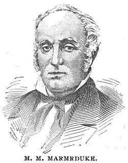
Meredith Miles Marmaduke American politician

Meredith Miles Marmaduke was an American politician who served as the 8th Governor of Missouri in 1844, following the suicide of Governor Thomas Reynolds. He was also the 6th lieutenant governor and father of John Sappington Marmaduke, a senior officer of the Confederate States Army who commanded cavalry in the Trans-Mississippi Theater of the American Civil War, serving as the 25th Governor of Missouri from 1885 to 1887.

Leann is an unincorporated community in Barry County, in the U.S. state of Missouri.

Wall Street, Missouri Unincorporated community in Missouri, United States

Wall Street is an unincorporated community in Dallas County, Missouri, United States. The community is located on Missouri Route 32, east of Buffalo and approximately 2.5 miles west of Long Lane.

Daugherty is an unincorporated community in Cass County, in the U.S. state of Missouri.

Ore is an unincorporated community in Cass County, in the U.S. state of Missouri.

Foose is an unincorporated community in western Dallas County, in the U.S. state of Missouri. The community lies on Missouri Route EE, just west of U.S. Route 65, approximately seven miles south-southwest of Buffalo. The Dallas-Polk county line is two miles west along Route EE. The community is at an elevation of 1207 feet and Greasy Creek, a tributary of the Niangua River, drains the area to the east of Route 65.

Greasy Creek is a stream in Dallas and Webster counties the Ozarks of southwest Missouri. It is a tributary of the Niangua River.

Olive is an unincorporated community in southeastern Dallas County, in the U.S. state of Missouri.

Shady Grove is an unincorporated community in southeast Dallas County, in the U.S. state of Missouri. The community was located on Route M, approximately five miles west of Conway. The Shady Grove School was just south of Route M, near the headwaters of Goose Creek.

References