Ledsham is a village and civil parish 4 miles (6 km) north of Castleford and 11 miles (18 km) east of Leeds in the county of West Yorkshire, England. The village is in the City of Leeds metropolitan borough and near to the A1(M) motorway. It had a population of 162 at the 2001 Census, increasing to 181 at the 2011 Census.

Boxgrove is a village, ecclesiastical parish and civil parish in the Chichester District of the English county of West Sussex, about 3.5 miles (5.6 km) north east of the city of Chichester. The village is just south of the A285 road which follows the line of the Roman road Stane Street.

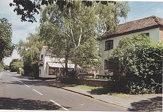
Acton Beauchamp is a village and civil parish in Herefordshire, England. It is approximately 12 miles (19 km) north-east from the city and county town of Hereford, and 3 miles (5 km) south-east from the market town of Bromyard. Acton [Beauchamp] was a settlement in Domesday Book, in the hundred of Doddingtree, mentioned in the chapters for Worcestershire and Herefordshire.
Dodington is a village and civil parish in South Gloucestershire, England. The village lies in a small, fertile valley between Codrington and Old Sodbury, and runs together with the even tinier hamlet of Coombes End. It is about 2.5 miles southeast of Chipping Sodbury and four miles from Yate railway station.

Antingham is a village and civil parish in the north of the English county of Norfolk. The village is located about 6 miles (9.7 km) south of Cromer and 3 miles (4.8 km) north of North Walsham. The civil parish has an area of 6.12 square kilometres and in the 2001 census had a population of 287 in 120 households, the population increasing to 355 at the 2011 Census. For the purposes of local government, the parish falls within the district of North Norfolk.
Badgeworth is a village and civil parish in the Tewkesbury district of Gloucestershire, England, between Gloucester and Cheltenham. According to the 2001 census, the parish had a population of 1,206, increasing to 1,286 at the 2011 census. Apart from the village of Badgeworth the parish also includes Bentham and Little Witcombe.
Easebourne is a village, Anglican parish and civil parish in the Chichester District of West Sussex, England. It is half a mile (0.8 km) north of Midhurst, across the River Rother on the A272 and A286 roads. The parish includes the hamlet of Henley to the north. In the 2001 census there were 708 households with a total population of 1,717 of whom 785 were economically active.

Dumbleton is a village and civil parish in the Tewkesbury district, in the county of Gloucestershire, England. The village is roughly 20 miles from the city of Gloucester. The village is known to have existed in the time of Æthelred I who granted land to Abingdon Abbey, and it is mentioned in the Domesday Book.

Graffham is a village, Anglican parish and civil parish in West Sussex, England, situated on the northern escarpment of the South Downs within the South Downs National Park. The civil parish is made up of the village of Graffham, part of the hamlet of Selham, and South Ambersham. It forms part of the Bury Ward for the purposes of electing a Councillor to Chichester District Council.

Cotheridge is a village and civil parish in the district of Malvern Hills in the county of Worcestershire, England. It is 4 miles (6 km) west of the city of Worcester and a mile north-east of the Leigh Court railway station on the Great Western Railway on the opposite side of the River Teme.
The River Teme flows on the southern and south-western part of the village where the land is low-lying and is susceptible to flooding. The soil content is loam and clay with the subsoil being Keuper Marl.

Littledean is a village in the Forest of Dean, west Gloucestershire, England. The village has a long history and formerly had the status of a town. Littledean Hall was originally a Saxon hall, although it has been rebuilt and the current house dates back to 1612. The remains of a Roman temple are situated in the grounds. Neither the hall or Roman remains are open to the public.

Handley is a village and civil parish in the unitary authority of Cheshire West and Chester and the ceremonial county of Cheshire, England. It is part of the local government ward of Tattenhall, a larger settlement approximately 2 miles (3.2 km) to the east. The hamlet of Milton Green is to the north west of the village. The A41 road, which previously passed through the village now bypasses it, having been re-routed further to the east.
Donnington is a small village, ecclesiastical parish and civil parish in the Chichester district of West Sussex, England. The village lies on the B2201 road, 2 miles (3.2 km) south of the centre of Chichester, within the Chichester built-up area. The northern part of the parish comprises the Stockbridge area of the City of Chichester.

North Mundham is a village, Anglican parish and civil parish in the Chichester district of West Sussex, England. It lies on the B2166 road two miles (3.2 km) southeast of Chichester. The parish includes the village of Runcton. The Anglican parish includes the neighbouring settlements of South Mundham, Runcton and Merston.
Hatherop is a village and civil parish in the Cotswolds Area of Outstanding Natural Beauty, about 2.5 miles (4.0 km) north of Fairford in Gloucestershire, England. The River Coln forms part of the western boundary of the parish.
Peopleton is a village and civil parish in the Wychavon district of Worcestershire, England. In 2001 the parish had a population of 640, with 245 households.

Ripple is a village and civil parish in the county of Worcestershire, England. Ripple is one of the most southerly parishes in the county and is situated on the A38 road with the River Severn as its western boundary. Besides Ripple, the parish contains the settlements of Holly Green, The Grove, Naunton, Ryall, Saxon's Lode, and Uckinghall. It had a combined population of 1,799 at the 2011 census.

Croome D'Abitot is a village and civil parish, which shares a joint parish council with Severn Stoke, in the Malvern Hills District in the county of Worcestershire, England. The parish church of St Mary Magdalene is situated in the grounds of Croome Court.
Up Hatherley is a civil parish and a suburb of the spa town of Cheltenham, Gloucestershire, England. Formerly a hamlet in the parish of Shurdington, it became a parish in 1887 and became a part of Cheltenham in 1991.

Dorsington is a village and civil parish in the Stratford-on-Avon district, in the county of Warwickshire, England. Dorsington was in Gloucestershire until 1931, when it was transferred to Warwickshire. It is located 2¾ miles west of Milcote railway station. The place-name 'Dorsington' is first attested in an Anglo-Saxon charter of 710, where it appears as Dorsintone. It is recorded in the Domesday Book of 1086 as Dorsintune. The name means 'the town or settlement of Deorsige's people'. In the 2001 census, it had a population of 138. By the 2011 Census, the population had increased to 150. The parish church of St Peter's is a Grade II* listed building built in 1764–1768. Dorsington was the original centre of the Heart of England Forest, begun by the businessman and philanthropist Felix Dennis.