Parramatta is a suburb of the City of Parramatta in the state of New South Wales, Australia. It is located approximately 24 kilometres (15 mi) west of the Sydney central business district on the banks of the Parramatta River. Parramatta is the administrative seat of the City of Parramatta and is often regarded as commercial centre for both the Greater Parramatta region as well as the broader Greater Western Sydney region.

The Upper Hunter Shire is a local government area in the Upper Hunter Region of New South Wales, Australia. The Shire was formed in May 2004 from the Scone Shire and parts of Murrurundi and Merriwa shires.

Abbotsford is a suburb in the Inner West of Sydney, in the state of New South Wales, Australia. Abbotsford is 10 kilometres west of the Sydney central business district in the local government area of the City of Canada Bay. Abbotsford sits on the peninsula between Abbotsford Bay and Hen and Chicken Bay, on the Parramatta River.

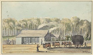
Varroville is a suburb of Sydney, in the state of New South Wales, Australia. Varroville is located 46 kilometres south-west of the Sydney central business district, in the local government area of the City of Campbelltown and is part of the Macarthur region. Varroville forms part of the scenic hills on the north-west side of the M5 South Western Motorway between Campbelltown and the Camden Valley Way.

Oakhurst is a suburb of Sydney, in the state of New South Wales, Australia 46 kilometres west of the Sydney central business district, in the local government area of the City of Blacktown. It is part of the Greater Western Sydney region.

Bowral is the largest town in the Southern Highlands of New South Wales, Australia, about ninety minutes south of Sydney. It is the main business and entertainment precinct of the Wingecarribee Shire and Highlands. At the 2016 census, the population of the Bowral area was 12,949.

Berrima is a historic village in the Southern Highlands of New South Wales, Australia, in Wingecarribee Shire. The village, once a major town, is located on the Old Hume Highway between Canberra and Sydney. It was previously known officially as the Town of Berrima. It is close to the three major towns of the Southern Highlands; Mittagong, Bowral and Moss Vale.

Mittagong is a town located in the Southern Highlands of New South Wales, Australia, in Wingecarribee Shire. The town acts as the gateway to the Southern Highlands when coming from Sydney. Mittagong is situated at an elevation of 635 metres (2,083 ft). The town is close to Bowral, Berrima, Moss Vale and the Northern Villages such as Yerrinbool and Colo Vale. Moreover, Mittagong is home to many wineries of the Southern Highlands which has been a recent growing wine and cellar door region.
Wyoming is a suburb of the Central Coast region of New South Wales, Australia, located 4 kilometres (2 mi) northeast of Gosford's central business district. It is part of the Central Coast Council local government area.

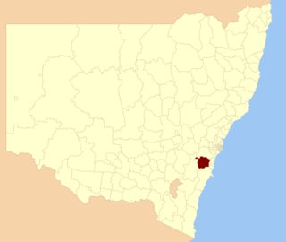
The City of Campbelltown is a local government area in the Macarthur region of south-western Sydney, in New South Wales, Australia. The area is located about 55 kilometres (34 mi) south west of the Sydney central business district and comprises 312 square kilometres (120 sq mi).

The City of Randwick is a local government area in the eastern suburbs of Sydney, New South Wales, Australia. Established in 1859, Randwick is the second-oldest local government area in New South Wales, after the City of Sydney. It comprises an area of 36 square kilometres (14 sq mi) and as at the 2016 census had a population of 140,660.

Moss Vale is a town in the Southern Highlands of New South Wales, Australia, in the Wingecarribee Shire. At the 2016 census, it has a population of 8,579 and is sited on the Illawarra Highway, which connects to Wollongong and the Illawarra coast via Macquarie Pass.

Harris Park is a suburb of Greater Western Sydney, in the state of New South Wales, Australia. Harris Park is located 23 kilometres west of the Sydney central business district in the local government area of the City of Parramatta and is part of the Greater Western Sydney region. Harris Park has a plurality Indian and Hindu population, both making up the largest ethnic and religious group.

Mittagong railway station is a heritage-listed railway station on the Main South line in New South Wales, Australia. It serves the town of Mittagong in the Southern Highlands. It was added to the New South Wales State Heritage Register on 2 April 1999.

Yerrinbool is a Northern Village of the Southern Highlands of New South Wales, Australia, in the Wingecarribee Shire, and is accessible from the Hume Highway and is about 12 km drive from nearby Mittagong. It is 6–8 km to Hill Top as the crow flies, accessible by foot via a fire trail. It was previously officially known as the Town of Yerrinbool. It is located on the historic Old Hume Highway. At the 2016 census, Yerrinbool had a population of 1,164.

Couridjah is a small town in the Macarthur Region of New South Wales, Australia, in Wollondilly Shire. It was previously known officially as "Village of Couridjah". At the 2016 census, Couridjah had a population of 303.

Challoner Cottage is a heritage-listed former children's home dormitory at 82 Bong Bong Road, Renwick, Wingecarribee Shire, New South Wales, Australia. It is also known as Cottage No. 12 or the Old Dormitory Building. It is a surviving feature of the institution variously known as the Mittagong Training School for Boys and Mittagong Farm Home, State Ward Home or Children's Home. It was added to the New South Wales State Heritage Register on 28 March 2014.
The Hassall and Jefferis Cottages are a heritage-listed former inn, coach staging post and children's home dormitory and now residence at Old South Road, Mittagong, Wingecarribee Shire, New South Wales, Australia. It was built from 1827 to 1842 by George Cutter and William Sherwin. It is also known as Cutter's Inn and Cottage No. 8 and Cottage No. 11. It is a surviving feature of the institution variously known as the Mittagong Training School for Boys and Mittagong Farm Home, State Ward Home or Children's Home, although it predated the facility. It was added to the New South Wales State Heritage Register on 2 April 1999.
Berrima Post Office is a heritage-listed post office at Argyle Street, Berrima, Wingecarribee Shire, New South Wales, Australia. It was built in 1886 by R. N. Matthews. It was added to the New South Wales State Heritage Register on 2 April 1999.
Berrima Inn is a heritage-listed residence and former inn, cafe, craft shop and restaurant at Jellore Street, Berrima, Wingecarribee Shire, New South Wales, Australia. It was built by Brian McMahon. It is also known as McMahon's Inn. It was added to the New South Wales State Heritage Register on 2 April 1999.