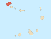
The recorded history of Cape Verde begins with Portuguese discovery in 1456. Possible early references go back around 2000 years.

Tarrafal de São Nicolau is a city in the western part of the island of São Nicolau, Cape Verde. With a population of 3,733, it is the most populous settlement of the island. It is the seat of the Tarrafal de São Nicolau Municipality, and the main port of the island. It is situated on the west coast, 9 km southwest of Ribeira Brava.

Lomba is a settlement in the northwestern part of the island of Fogo, Cape Verde. In 2010 its population was 731. It is situated 10 km northeast of the island capital São Filipe.

Lagariça is a settlement in the western part of the island of Fogo, Cape Verde. It is situated 6 km northeast of the island capital São Filipe. One of its localities is named Coxo.

Figueira Pavão is a settlement in the southeastern part of the island of Fogo, Cape Verde. In 2010 its population was 320. It is situated 3 km southwest of Cova Figueira and 20 km east of the island capital São Filipe. Nearby settlements are Achada Furna to the west and Estância Roque to the north.

Santo António is a settlement in the western part of the island of Fogo, Cape Verde. It is situated 6 km northeast of the island capital São Filipe.

Estância Roque is a settlement in the eastern part of the island of Fogo, Cape Verde. In 2010 its population was 411. It is situated 3 km west of Cova Figueira and 19 km east of the island capital São Filipe. Nearby places include Figueira Pavão in the south and Cabeça Fundão in the northwest.

Vicente Dias is a settlement in the western part of the island of Fogo, Cape Verde. It is situated 2 km northwest of Luzia Nunes and 5 km east of the island capital São Filipe.

Fajãzinha is a settlement in the northern part of the island of Fogo, Cape Verde. It is situated on the coast, 3 km northwest of Mosteiros and 23 km northeast of the island capital São Filipe. Each year on May 13, the festival of Our Lady of Fatima is celebrated in the settlement.

Miguel Gonçalves is a settlement in the central part of the island of Fogo, Cape Verde. It is situated at about 850 m elevation, 8 km east of the island capital São Filipe.

Relva is a settlement in the eastern part of the island of Fogo, Cape Verde. It is situated near the coast, 7 km southeast of Mosteiros and 23 km northeast of the island capital São Filipe.

Fontainhas is a settlement in the northern part of the island of Santo Antão, Cape Verde. It is situated near the rocky north coast of the island, 2 km southwest of Ponta do Sol and 19 km north of the island capital Porto Novo. The settlement includes the smaller villages Corvo and Forminguinhas, about 1 km west of Fontainhas proper.

Tarrafal de Monte Trigo is a settlement in the southwestern part of the island of Santo Antão, Cape Verde. In 2010 its population was 841. It is situated on the coast, 27 km west of the island capital Porto Novo. The settlement was mentioned as Terrafal in the 1747 map by Jacques-Nicolas Bellin.

Carriçal is a settlement in the eastern part of the island of São Nicolau, Cape Verde. It is situated on the south coast, 8 km southeast of Juncalinho and 24 km east of Ribeira Brava. It is the easternmost settlement on the island. Some 8 km east is the island's easternmost point, Ponta Leste. The place was mentioned as Currissal in the 1747 map by Jacques-Nicolas Bellin.

Pombas is a city in the northeastern part of the island of Santo Antão, Cape Verde. It is the seat of the municipality Paul. It is situated on the coast, at the mouth of the Ribeira do Paul, 7 km (4.3 mi) southeast of Ribeira Grande and 15 km (9.3 mi) north of the island capital Porto Novo. The national roads EN1-SA02 and EN1-SA03 connect Pombas with Ribeira Grande and Porto Novo, respectively. Pombas was elevated from town to city in 2010.

Morro is a settlement in the west of the island of Maio in Cape Verde. It is located 5 km north of the island capital Porto Inglês and 6 km south of Calheta. As of the 2010 census, its population was 310. The beach north of the village, Praia do Morro, is a 6.66 km2 nature reserve.

Cape Verde was a colony of the Portuguese Empire from the initial settlement of the Cape Verde Islands in 1462 until the independence of Cape Verde in 1975.

Xoxo is a settlement in the northeastern part of the island of Santo Antão in Cape Verde. It is situated 5 kilometres (3.1 mi) south of Ribeira Grande and 13 kilometres (8.1 mi) north of the island capital Porto Novo. The settlement lies in Cova-Paul-Ribeira da Torre Natural Park. The Ribeira da Torre flows through the settlement. The only road to Xoxo goes from Ribeira Grande through the Ribeira da Torre valley.

Baía is a settlement in the eastern part of the island of Santiago, Cape Verde. It is part of the municipality of São Domingos. In 2010 its population was 489. It is situated near the east coast, 2 km southeast of Achada Baleia, 2 km northwest of Moia Moia and 14 km northeast of Praia. It sits at an elevation of about 20 meters. The settlement consists of several localities, including Achada Baixo, Castelinho and Covão Santana. The ruined Gothic church of Nossa Senhora da Luz, which was part of the 15th century Portuguese settlement Alcatrazes, stands at the shore near Baía.


