The National Hurricane Center (NHC) is the division of the United States' NOAA/National Weather Service responsible for tracking and predicting tropical weather systems between the Prime Meridian and the 140th meridian west poleward to the 30th parallel north in the northeast Pacific Ocean and the 31st parallel north in the northern Atlantic Ocean. The agency,which is co-located with the Miami branch of the National Weather Service,is situated on the campus of Florida International University in University Park,Miami,Florida.

Hurricane Vince was an unusual hurricane that developed in the northeastern Atlantic basin. Forming in October during the 2005 Atlantic hurricane season,it strengthened over waters thought to be too cold for tropical development. Vince was the twentieth named tropical cyclone and twelfth hurricane of the extremely active season.

Tropical Storm Zeta was a very late-developing tropical storm that formed in the central Atlantic Ocean during the 2005 Atlantic hurricane season,one month after the season's official end. Becoming a tropical depression on December 30,and intensifying the following day into the season's 28th storm,Zeta continued into January 2006. It was one of only two Atlantic tropical cyclones to span two calendar years.

James Louis Franklin is a former weather forecaster encompassing a 35-year career with National Oceanic and Atmospheric Administration (NOAA). He served as the first branch chief of the newly formed Hurricane Specialist Unit (HSU) before his retirement in 2017.

The Hurricane Weather Research and Forecasting (HWRF) model is a specialized version of the weather research and forecasting model and is used to forecast the track and intensity of tropical cyclones. The model was developed by the National Oceanic and Atmospheric Administration (NOAA),the U.S. Naval Research Laboratory,the University of Rhode Island,and Florida State University. It became operational in 2007.

Neil Laverne Frank is an American meteorologist and former director of the National Hurricane Center (NHC) in Florida. He was instrumental in advancing both the scientific and informational aspects of hurricane forecasting. He retired in 2008 as Chief Meteorologist at KHOU-TV in Houston. He is the grandfather of Christian singer Forrest Frank.

Edward Neil "Ed" Rappaport served as the acting director of the National Hurricane Center from 2007 to 2008 and again from 2017 to 2018. He replaced former director Bill Proenza on July 9,2007. Rappaport was replaced by Bill Read in 2008. He began serving as acting director again when Richard Knabb left the NHC in 2017 until Kenneth Graham was selected to succeed him in 2018.

William L. Read is an American meteorologist who served in the United States Navy,the National Weather Service (NWS),and as consultant for television stations such as KPRC-TV during his career. He has worked at NWS offices in Sterling,Virginia,Fort Worth,Texas,San Antonio,Texas,Silver Spring,Maryland,Houston,Texas,and Miami,Florida over the years,reaching the post of director of the National Hurricane Center from January 25,2008 until June 2012.

Tropical Storm Fay was an unusual tropical storm that moved erratically across the state of Florida and the Caribbean Sea. The sixth named storm of the 2008 Atlantic hurricane season,Fay formed from a vigorous tropical wave on August 15 over the Dominican Republic. It passed over the island of Hispaniola,into the Gulf of Gonâve,across the island of Cuba,and made landfall on the Florida Keys late in the afternoon of August 18 before veering into the Gulf of Mexico. It again made landfall near Naples,Florida,in the early hours of August 19 and progressed northeast through the Florida peninsula,emerging into the Atlantic Ocean near Melbourne on August 20. Extensive flooding took place in parts of Florida as a result of its slow movement. On August 21,it made landfall again near New Smyrna Beach,Florida,moving due west across the Panhandle,crossing Gainesville and Panama City,Florida. As it zigzagged from water to land,it became the first storm in recorded history to make landfall in Florida four times. Thirty-six deaths were blamed on Fay. The storm also resulted in one of the most prolific tropical cyclone related tornado outbreaks on record. A total of 81 tornadoes touched down across five states,three of which were rated as EF2. Fay would cause around $560 million in damages throughout its lifespan.

Hurricane Epsilon was the twenty-seventh named tropical or subtropical storm and the final of 15 hurricanes in the record-breaking 2005 Atlantic hurricane season. Originating from a cold front beneath an upper-level low,Epsilon formed on November 29 about 915 mi (1470 km) east of Bermuda,becoming the second tropical storm to do so in that area of the Atlantic within the span of a week. Initially,the National Hurricane Center (NHC) forecast the storm to transition into an extratropical cyclone within five days,due to conditions unfavorable for significant intensification. Epsilon continually defied forecasts,at first due to an unexpected loop to the southwest,and later due to retaining its strength despite cold waters and strong wind shear.

A post-tropical cyclone is a former tropical cyclone that no longer possesses enough tropical qualities to be considered a tropical cyclone. The word may refer to a former tropical cyclone undergoing extratropical transition or a tropical cyclone degenerating into a remnant low. A tropical cyclone degenerating into a trough or wave,or having its low level circulation dissipate overland,lacks a cyclonic circulation and is referred as remnants instead of a post-tropical cyclone. However,post-tropical cyclones or remnants can continue producing high winds and heavy rains.

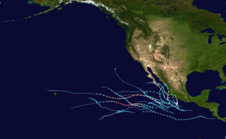
The 2021 Pacific hurricane season was a moderately active Pacific hurricane season,with above-average activity in terms of number of named storms,but below-average activity in terms of major hurricanes,as 19 named storms,8 hurricanes,and 2 major hurricanes formed in all. It also had a near-normal accumulated cyclone energy (ACE). The season officially began on May 15,2021 in the Eastern Pacific Ocean,and on June 1,2021,in the Central Pacific in the Northern Hemisphere. The season ended in both regions on November 30,2021. These dates historically describe the period each year when most tropical cyclogenesis occurs in these regions of the Pacific and are adopted by convention. However,the formation of tropical cyclones is possible at any time of the year,as illustrated by the formation of Tropical Storm Andres on May 9,which was the earliest forming tropical storm on record in the Eastern Pacific. Conversely,2021 was the second consecutive season in which no tropical cyclones formed in the Central Pacific.

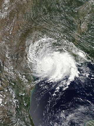
Tropical Storm Imelda was a tropical cyclone which was the fourth-wettest storm on record in the U.S. state of Texas,causing devastating and record-breaking floods in southeast Texas. The eleventh tropical cyclone and ninth named storm of the 2019 Atlantic hurricane season,Imelda formed out of an upper-level low that developed in the Gulf of Mexico and moved westward. Little development occurred until the system was near the Texas coastline,where it rapidly developed into a tropical storm before moving ashore shortly afterward on September 17. Imelda weakened after landfall,but continued bringing large amounts of flooding rain to Texas and Louisiana,before dissipating on September 21.

Hurricane Dolores was a powerful and moderately damaging tropical cyclone whose remnants brought record-breaking heavy rains and strong winds to California. The seventh named storm,fourth hurricane,and third major hurricane of the record-breaking 2015 Pacific hurricane season,Dolores formed from a tropical wave on July 11. The system gradually strengthened,attaining hurricane status on July 13. Dolores rapidly intensified as it neared the Baja California peninsula,finally peaking as a Category 4 hurricane on the Saffir–Simpson scale with winds of 130 mph (215 km/h) on July 15. An eyewall replacement cycle began and cooler sea-surface temperatures rapidly weakened the hurricane,and Dolores weakened to a tropical storm two days later. On July 18,Dolores degenerated into a remnant low west of the Baja California peninsula.

Hurricane Douglas was a strong tropical cyclone that became the closest passing Pacific hurricane to the island of Oahu on record,surpassing the previous record held by Hurricane Dot in 1959. The eighth tropical cyclone,fifth named storm,first hurricane,and first major hurricane of the 2020 Pacific hurricane season,Douglas originated from a tropical wave which entered the basin in mid-July. Located in favorable conditions,the wave began to organize on July 19. It became a tropical depression on July 20 and a tropical storm the following day. After leveling off as a strong tropical storm due to dry air,Douglas began rapid intensification on July 23,becoming the season's first major hurricane the following day and peaking as a Category 4 hurricane. After moving into the Central Pacific basin,Douglas slowly weakened as it approached Hawaii. The storm later passed north of the main islands as a Category 1 hurricane,passing dangerously close to Oahu and Kauai,causing minimal damage,and resulting in no deaths or injuries. Douglas weakened to tropical storm status on July 28,as it moved away from Hawaii,before degenerating into a remnant low on July 29 and dissipating on the next day.

Hurricane Genevieve was a strong tropical cyclone that almost made landfall on the Baja California Peninsula in August 2020. Genevieve was the twelfth tropical cyclone,eighth named storm,third hurricane,and second major hurricane of the 2020 Pacific hurricane season. The cyclone formed from a tropical wave that the National Hurricane Center (NHC) first started monitoring on August 10. The wave merged with a trough of low pressure on August 13,and favorable conditions allowed the wave to intensify into Tropical Depression Twelve-E at 15:00 UTC. Just six hours later,the depression became a tropical storm and was given the name Genevieve. Genevieve quickly became a hurricane by August 17,and Genevieve began explosive intensification the next day. By 12:00 UTC on August 18,Genevieve reached its peak intensity as a Category 4 hurricane,with maximum 1-minute sustained winds of 130 mph and a minimum central pressure of 950 millibars (28 inHg). Genevieve began to weaken on the next day,possibly due to cooler waters caused by Hurricane Elida earlier that month. Genevieve weakened below tropical storm status around 18:00 UTC on August 20,as it passed close to Baja California Sur. Soon afterward,Genevieve began to lose its deep convection and became a post-tropical cyclone by 21:00 UTC on August 21,eventually dissipating off the coast of Southern California late on August 24.

Hurricane Sally was a destructive and slow-moving Atlantic hurricane that was the first hurricane to make landfall in the U.S. state of Alabama since Ivan in 2004,coincidentally on the same date in the same place. The eighteenth named storm and seventh hurricane of the extremely active 2020 Atlantic hurricane season,Sally developed from an area of disturbed weather which was first monitored over the Bahamas on September 10. The system grew a broad area of low-pressure on September 11,and was designated as a tropical depression late that day. Early the next day,the depression made landfall at Key Biscayne and subsequently strengthened into Tropical Storm Sally that afternoon. Moderate northwesterly shear prevented significant intensification for the first two days,but convection continued to grow towards the center and Sally slowly intensified. On September 14,a center reformation into the center of the convection occurred,and data from a hurricane hunter reconnaissance aircraft showed that Sally had rapidly intensified into a strong Category 1 hurricane. However,an increase in wind shear and upwelling of colder waters halted the intensification and Sally weakened slightly on September 15 before turning slowly northeastward. Despite this increase in wind shear,it unexpectedly re-intensified,reaching Category 2 status early on September 16 before making landfall at peak intensity at 09:45 UTC on September 16,near Gulf Shores,Alabama,with maximum sustained winds of 110 mph (180 km/h) and a minimum central pressure of 965 millibars (28.5 inHg). The storm rapidly weakened after landfall before transitioning into an extratropical low at 12:00 UTC the next day. Sally's remnants lasted for another day as they moved off the coast of the Southeastern United States before being absorbed into another extratropical storm on September 18.

Hurricane Zeta was a late-season major hurricane in 2020 that made landfall on the Yucatán Peninsula and then in southeastern Louisiana,the latest on record to do so at such strength in the United States. Zeta was the record-tying sixth hurricane of the year to make landfall in the United States. The twenty-seventh named storm,twelfth hurricane and fifth major hurricane of the extremely active 2020 Atlantic hurricane season,Zeta formed from a broad area of low pressure that formed in the western Caribbean Sea on October 19. After battling wind shear,the quasi-stationary low organized into Tropical Depression Twenty-Eight on October 24. The system strengthened into Tropical Storm Zeta early on October 25 before becoming a hurricane the next day as it began to move northwestward. Hurricane Zeta made landfall on the Yucatán Peninsula late on October 26 and weakened while inland to a tropical storm,before moving off the northern coast of the peninsula on October 27. After weakening due to dry air entrainment,Zeta reorganized and became a hurricane again,and eventually a Category 2 hurricane,as it turned northeastward approaching the United States Gulf Coast on October 28. It continued to strengthen until it reached its peak intensity as a major Category 3 hurricane with 115-mile-per-hour (185 km/h) sustained winds and a minimum pressure of 970 mbar (28.64 inHg) as it made landfall at Cocodrie,Louisiana,that evening. Zeta continued on through Mississippi and parts of Alabama with hurricane-force winds. Zeta gradually weakened as it accelerated northeastward,and became post-tropical on October 29,as it moved through central Virginia,dissipating shortly afterwards off the coast of New Jersey. After bringing accumulating snow to parts of New England,the extratropical low-pressure system carrying Zeta's remnant energy impacted the United Kingdom on November 1 and 2.

Tropical Storm Fred was a strong tropical storm which affected much of the Greater Antilles and the Southeastern United States in August 2021. The sixth tropical storm of the 2021 Atlantic hurricane season,Fred originated from a tropical wave first noted by the National Hurricane Center on August 4. As the wave drifted westward,advisories were initiated on the wave as a potential tropical cyclone by August 9 as it was approaching the Leeward Islands. Entering the Eastern Caribbean Sea after a close pass to Dominica by the next day,the potential tropical cyclone continued northwestward. By August 11,the disturbance had formed into Tropical Storm Fred just south of Puerto Rico,shortly before hitting the Dominican Republic on the island of Hispaniola later that day. The storm proceeded to weaken to a tropical depression over the highly mountainous island,before emerging north of the Windward Passage on August 12. The disorganized tropical depression turned to the west and made a second landfall in Northern Cuba on August 13. After having its circulation continuously disrupted by land interaction and wind shear,the storm degenerated into a tropical wave as it was turning northward near the western tip of Cuba the following day. Continuing north,the remnants of Fred quickly re-organized over the Gulf of Mexico,regenerating into a tropical storm by August 15. Fred continued towards the Florida Panhandle and swiftly intensified to a strong 65 mph (105 km/h) tropical storm before making landfall late on August 16 and moving into the state of Georgia. Afterward,Fred continued moving north-northeastward,before degenerating into an extratropical low on August 18. Fred's remnants later turned eastward,and the storm's remnants dissipated on August 20,near the coast of Massachusetts.


