Riley Creek | |
River | |
Country | Canada |
---|---|
Province | Ontario |
Part of | Great Lakes Basin |
Source | Riley Lake |
- location | Ryde Township, Gravenhurst, District Municipality of Muskoka |
- elevation | 247 m (810 ft) |
- coordinates | 44°49′05″N79°10′40″W / 44.81806°N 79.17778°W |
Mouth | Black River |
- location | Dalton Township, Kawartha Lakes |
- elevation | 235 m (771 ft) |
- coordinates | 44°47′48″N79°09′51″W / 44.79667°N 79.16417°W [1] Coordinates: 44°47′48″N79°09′51″W / 44.79667°N 79.16417°W [1] |
Length | 3.5 km (2 mi) |
Riley Creek is a stream in the Great Lakes Basin in Central Ontario, Canada. [1] [2] [3] [4] It flows south from its source at Riley Lake in geographic Ryde Township [5] in the municipality of Gravenhurst, District Municipality of Muskoka, to its mouth as a right tributary of the Black River in geographic Dalton Township [6] in the city of Kawartha Lakes. The Black River flows via the Severn River to Georgian Bay on Lake Huron.
A stream is a body of water with surface water flowing within the bed and banks of a channel. The stream encompasses surface and groundwater fluxes that respond to geological, geomorphological, hydrological and biotic controls.
The Great Lakes Basin consists of the Great Lakes and the surrounding lands of the states of Illinois, Indiana, Michigan, Minnesota, New York, Ohio, Pennsylvania, and Wisconsin in the United States, and the province of Ontario in Canada, whose direct surface runoff and watersheds form a large drainage basin that feeds into the lakes. It is generally considered to also include a small area around and beyond Wolfe Island, Ontario, at the east end of Lake Ontario, which does not drain into the Great lakes, but into the Saint Lawrence River.
Central Ontario is a secondary region of Southern Ontario in the Canadian province of Ontario that lies between Georgian Bay and the eastern end of Lake Ontario.
About 80% of the creek lies within Queen Elizabeth II Wildlands Provincial Park. [2]
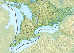
The Queen Elizabeth II Wildlands Provincial Park is a provincial park in south-central Ontario, Canada, between Gravenhurst and Minden. The park, named for Elizabeth II, Queen of Canada, is 33,505 hectares in size, making it the second largest park south of Algonquin Park, but it has a fragmented shape as a result of many private lands within its boundary.
Riley Lake is a lake in geographic Ryde Township in the town of Gravenhurst, District Municipality of Muskoka in Central Ontario, Canada. It is part of the Great Lakes Basin.
Bobs Lake is a lake in Frontenac County and Lanark County in Eastern Ontario, Canada. It is in the St. Lawrence River drainage basin and is the source of the Tay River.
Riley Lake is a lake in geographic Code Township in the municipality of Sioux Narrows-Nestor Falls, Kenora District in Northwestern Ontario, Canada. It is part of the Hudson Bay drainage basin.
Koshlong Creek is a river in geographic Glamorgan Township in the municipality of Highlands East, Haliburton County in Central Ontario, Canada. The river is in the Great Lakes Basin and is a left tributary of the Burnt River.
The Black River is a river in Hastings County in Central Ontario, Canada. It is part of the Great Lakes Basin, and is a left tributary of the Moira River.
The Black River is a river in Cochrane District and Timiskaming District in Northeastern Ontario, Canada. It is part of the James Bay drainage basin, and is a right tributary of the Abitibi River. The municipality of Black River-Matheson is named after the river.
Depot Creek is a river in Sudbury District in Northeastern Ontario, Canada, near the community of Cartier. It is in the Great Lakes Basin and is a left tributary of Carhess Creek.
Carhess Creek is a river in Greater Sudbury and Sudbury District in Northeastern Ontario, Canada. It is in the Great Lakes Basin and is a right tributary of the Onaping River. The name is a portmanteau of the names of two geographic townships through which it flows, Hess Township and Cartier Township.
The North River is a river in the municipality of Havelock-Belmont-Methuen, Peterborough County in Central Ontario, Canada. It is part of the Great Lakes Basin, and is a right tributary of the Crowe River.
The Makonie River is a river in Sudbury District in northeastern Ontario, Canada. It is in the James Bay drainage basin, and is a left tributary of the Chapleau River.
The Nemegosenda River is a river in Algoma District and Sudbury District in northeastern Ontario, Canada. It is in the James Bay drainage basin, and is a right tributary of the Kapuskasing River.
The Borden River is a river in Sudbury District in northeastern Ontario, Canada. It is in the James Bay drainage basin, and is a left tributary of the Nemegosenda River.
The Saganash River is a river in Cochrane District in northeastern Ontario, Canada. It is in the James Bay drainage basin, and is a right tributary of the Kapuskasing River.
The Shawmere River is a river in Sudbury District in northeastern Ontario, Canada. It is in the James Bay drainage basin, and is a left tributary of the Ivanhoe River.
The Fire River is a river in Algoma District in northeastern Ontario, Canada. It is in the James Bay drainage basin, and is a left tributary of the Missinaibi River.
Woollings Creek is a creek in Timiskaming District and Cochrane District in northeastern Ontario, Canada. It is in the James Bay drainage basin and is a tributary of the Whiteclay River.
The Jocko River is a river in Nipissing District in Northeastern Ontario, Canada. It is in the Saint Lawrence River drainage basin, is a right tributary of the Ottawa River, and lies entirely within Jocko Rivers Provincial Park.
Riley Lake is a Dispersed rural community and unincorporated place in geographic Ryde Township in the town of Gravenhurst, District Municipality of Muskoka, in Central Ontario, Canada. The community lies on the northwest shore of the eponymous Riley Lake, the source of Riley Creek.
Sucker Lake is a lake in geographic La Salle Township and geographic Osborne Township in the Unorganized North Part of Nipissing District in Northeastern Ontario, Canada, about 5.5 kilometres (3.4 mi) east of the railway point of Diver on the Ontario Northland Railway. It is in the Saint Lawrence River drainage basin and is the source of Sucker Creek.
Grindstone Creek is a stream in the Unorganized North Part of Algoma District in Northeastern Ontario, Canada. It is in the Great Lakes Basin and is a left tributary of the Mississagi River.