The Scugog River is a river in the city of Kawartha Lakes in Central Ontario, Canada. It is in the Kawartha Lakes region, is part of the Great Lakes Basin, and is a branch of the Trent-Severn Waterway.
The Talbot River is a river in the Great Lakes Basin in Central Ontario, Canada which flows from Talbot Lake to Lake Simcoe and forms the border between Ramara township to the north and the Brock township to the south from the river mouth to the edge of their border with the city of Kawartha Lakes at the east.

The Crowe River is a river in the counties of Haliburton, Hastings, Northumberland and Peterborough in southern Ontario, Canada. It is in the Lake Ontario drainage basin and is a tributary of the Trent River.
The Head River is a river in the township of Ramara, Simcoe County and the city of Kawartha Lakes in Southern Ontario, Canada. It is in the Great Lakes Basin, and flows from Head Lake west to the Black River, east of Lake Couchiching. The Black River flows via the Severn River to Georgian Bay on Lake Huron.
Black Lake is a lake in the municipality of Minden Hills, Haliburton County in Central Ontario, Canada. It is part of the Great Lakes Basin and lies within geographic Lutterworth Township.

Jack Lake is a lake and reservoir in the municipalities of Havelock-Belmont-Methuen and North Kawartha, Peterborough County in Central Ontario, Canada, about 100 mi (160 km) directly northeast of Toronto and at the edge of the Canadian Shield in the northeastern portion of the Kawartha lakes region. The lake is in the Great Lakes Basin, and serves as a small headwater pond for the Trent-Severn Waterway. The Dispersed rural community of Jack Lake is on the northwest shore of the lake, reached by Peterborough County Road 52 / Jack Lake Road from the community of Apsley, about 5 kilometres (3.1 mi) to the north on Ontario Highway 28.
Kawagama Lake is located on the northwestern border of Haliburton and Muskoka counties in Central Ontario, Canada.
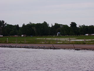
Riley Lake is a lake in geographic Ryde Township in the town of Gravenhurst, District Municipality of Muskoka in Central Ontario, Canada. It is part of the Great Lakes Basin.
Mitchell Lake is a small, artificial lake in the Great Lakes Basin and located in the city of Kawartha Lakes in Central Ontario, Canada. The lake was formed sometime in the first decade of the twentieth century alongside the construction of the Kirkfield Lift Lock, which was completed and operational by the end of 1907. It is part of the summit of the Trent–Severn Waterway, the middle of a connection via canals of Balsam Lake on the Gull River system, which flows eventually to Lake Ontario, and the Kirkfield Lift Lock and Canal Lake on the Talbot River system, which flows to Lake Simcoe and eventually to Lake Huron.
The Drag River is a river in the municipalities of Minden Hills and Dysart et al in Haliburton County, Southern Ontario, Canada. It is in the Great Lakes Basin and is a right tributary of the Burnt River.
The Big East River is a river in Muskoka District and Nipissing District in Northeastern Ontario, Canada. The river is in the Great Lakes Basin, is a left tributary of the Muskoka River, and flows from Algonquin Provincial Park to Huntsville.

Koshlong Lake is a lake in the municipalities of Highlands East and Dysart et al, Haliburton County in Central Ontario, Canada. It is part of the Great Lakes Basin.
Koshlong Creek is a river in geographic Glamorgan Township in the municipality of Highlands East, Haliburton County in Central Ontario, Canada. The river is in the Great Lakes Basin and is a left tributary of the Burnt River.

The Beaver River is a river in Grey County and Simcoe County in Southern Ontario, Canada. It is part of the Great Lakes Basin, and is a tributary of Lake Huron. The river's drainage basin is under the auspices of Grey Sauble Conservation.

The Black River is a river in the Regional Municipality of York and the Regional Municipality of Durham in Central Ontario, Canada. It is part of the Great Lakes Basin, and is a tributary of Lake Simcoe; the entire watershed is under the auspices of the Lake Simcoe Region Conservation Authority.
Black Lake is a lake in the municipality of Dysart et al, Haliburton County in Central Ontario, Canada. It is part of the Great Lakes Basin and lies within geographic Dysart Township.
The Black River is a river in Simcoe County in Central Ontario, Canada. It is part of the Great Lakes Basin, and is a left tributary of the Severn River.
The Irondale River is a river in Haliburton County in Central Ontario, Canada. It is part of the Great Lakes Basin, and is a left tributary of the Burnt River.
Riley Creek is a stream in the Great Lakes Basin in Central Ontario, Canada. It flows south from its source at Riley Lake in geographic Ryde Township in the municipality of Gravenhurst, District Municipality of Muskoka, to its mouth as a right tributary of the Black River in geographic Dalton Township in the city of Kawartha Lakes. The Black River flows via the Severn River to Georgian Bay on Lake Huron.
Corben Creek is a stream in the municipality of Minden Hills, Haliburton County, and the unitary city of Kawartha Lakes in Central Ontario, Canada. It is in the Great Lakes Basin and is tributary of Balsam Lake.
