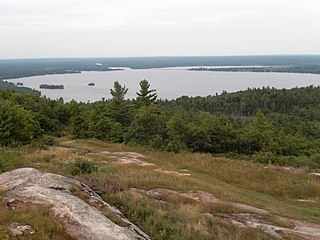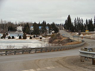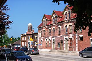
The Township of Fenelon was a municipality and incorporated township located in the centre of the former Victoria County. It is now a geographic township within the city of Kawartha Lakes, Ontario, Canada. The township was named after François de Salignac de la Mothe-Fénelon (missionary) (1641-79) who was a missionary in New France, establishing a mission on the Bay of Quinte.

Rosedale is a Dispersed Rural Community and unincorporated place located in the city of Kawartha Lakes, Ontario, Canada, 29 kilometres (18 mi) north-west of Lindsay. It is partly in geographic Fenelon Township and partly in Somerville Township, and is on the Rosedale River, part of the Trent–Severn Waterway, where that river drains Balsam Lake on its way to Cameron Lake.

Kashabowie is an unincorporated place and Compact Rural Community in southwestern Thunder Bay District in Northwestern Ontario, Canada. It is on the Canadian National Railway Kashabowie Subdivision main line, built originally as the Canadian Northern Railway transcontinental main line, between the railway points of Planet to the west and Postans to the east, and has a passing siding.

Batchawana Bay is an unincorporated place and Compact Rural Community in Algoma District in Northeastern Ontario, Canada. It is also the name of a local services board, consisting of parts of the geographic townships of Fisher, Herrick, Ryan and Tilley. It is located north of Sault Ste. Marie, Ontario, on the shores of Batchawana Bay off Lake Superior.

Riley Lake is a lake in geographic Ryde Township in the town of Gravenhurst, District Municipality of Muskoka in Central Ontario, Canada. It is part of the Great Lakes Basin.

Bobs Lake is a lake in Frontenac County and Lanark County in Eastern Ontario, Canada. It is in the St. Lawrence River drainage basin and is the source of the Tay River.

Riley Lake is a lake in geographic Code Township in the municipality of Sioux Narrows-Nestor Falls, Kenora District in Northwestern Ontario, Canada. It is part of the Hudson Bay drainage basin.

Koshlong Creek is a river in geographic Glamorgan Township in the municipality of Highlands East, Haliburton County in Central Ontario, Canada. The river is in the Great Lakes Basin and is a left tributary of the Burnt River.

Calabogie Lake is a reservoir lake in the municipality of Greater Madawaska, Renfrew County in Eastern Ontario, Canada. It is on the Madawaska River system, is part of the Saint Lawrence River drainage basin, and is located in the geographic townships of Bagot Township and Blythfield Township.

The Black River is a river in Hastings County in Central Ontario, Canada. It is part of the Great Lakes Basin, and is a left tributary of the Moira River.

The Black River is a river in Cochrane District and Timiskaming District in Northeastern Ontario, Canada. It is part of the James Bay drainage basin, and is a right tributary of the Abitibi River. The municipality of Black River-Matheson is named after the river.

The Kashabowie River is a river in southwestern Thunder Bay District in Northwestern Ontario, Canada. It is in the Great Lakes Basin and is a tributary of the Shebandowan Lakes.

The Nemegosenda River is a river in Algoma District and Sudbury District in northeastern Ontario, Canada. It is in the James Bay drainage basin, and is a right tributary of the Kapuskasing River.

Riley Creek is a stream in the Great Lakes Basin in Central Ontario, Canada. It flows south from its source at Riley Lake in geographic Ryde Township in the municipality of Gravenhurst, District Municipality of Muskoka, to its mouth as a right tributary of the Black River in geographic Dalton Township in the city of Kawartha Lakes. The Black River flows via the Severn River to Georgian Bay on Lake Huron.

McLaren's Bay is a Dispersed rural community and unincorporated place in geographic Parkman Township in the Unorganized North Part of Nipissing District in Central Ontario, Canada. The community lies on the eponymous McLaren's Bay on the west shore of Lake Timiskaming, at the mouth of Opimika Creek. McLaren's Point is just north of the community.

Sucker Lake is a lake in geographic La Salle Township and geographic Osborne Township in the Unorganized North Part of Nipissing District in Northeastern Ontario, Canada, about 5.5 kilometres (3.4 mi) east of the railway point of Diver on the Ontario Northland Railway. It is in the Saint Lawrence River drainage basin and is the source of Sucker Creek.

Postans is an unincorporated place and railway point in southwestern Thunder Bay District in Northwestern Ontario, Canada. It is on the Canadian National Railway Kashabowie Subdivision main line, built originally as the Canadian Northern Railway transcontinental main line, and just off Ontario Highway 11, at this point part of the Trans-Canada Highway, in both cases between the community of Kashabowie to the west and the railway point of Kabaigon to the east. Postans is also at the outlet from Postans Lake where an unnamed creek heads west to Postans Bay on Kashabowie Lake, part of the Kashabowie River.

The Rosedale River is a river in the City of Kawartha Lakes in Central Ontario, Canada. It is in the Great Lakes Basin and is part of the Trent–Severn Waterway. The river is named after Rosa Dale, the wife of settler John Cameron, who first settled the area of nearby Fenelon Falls.

Corben Creek is a stream in the municipality of Minden Hills, Haliburton County, and the unitary city of Kawartha Lakes in Central Ontario, Canada. It is in the Great Lakes Basin and is tributary of Balsam Lake.

Jack Lake is a dispersed rural community and unincorporated place in the municipality of Havelock-Belmont-Methuen, Peterborough County in Central Ontario, Canada. The community is on the northwest shore of Jack Lake, in the Kawartha lakes region, and parts of the community extend to the west into the neighbouring municipality of North Kawartha. Jack Lake is reached by Peterborough County Road 52 / Jack Lake Road from the community of Apsley, about 5 kilometres (3.1 mi) to the north on Ontario Highway 28.


