Centro Estadual de Unidades de Conservação do Amazonas
The Rio Negro State Park North Section (Portuguese: Parque Estadual do Rio Negro Setor Norte) is a state park in the state of Amazonas, Brazil. It protects an area of Amazon rainforest to the west of the Rio Negro.
South Rio Negro conservation units 2: Rio Negro State Park North Section
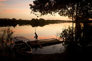
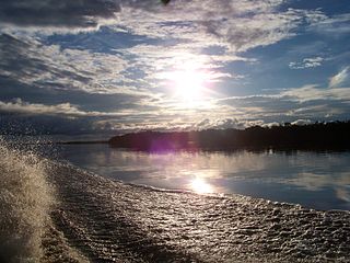
The Rio Negro State Park North Section is in the municipality of Novo Airão in the state of Amazonas. It has an area of 146,028 hectares (360,840 acres) and a perimeter of 237.15 kilometres (147.36mi).[1] It is 167 kilometres (104mi) from Manaus, and is accessed by boat from the Rio Negro.[2]
To the northeast the state park is bounded by the right bank of the Rio Negro. The state park adjoins the Jaú National Park along its north west boundary. Most of this boundary follows the Carabinani River, which flows north east to enter the Jaú River a few kilometres before that river enters the Rio Negro. The state park adjoins the Rio Negro Right Bank Environmental Protection Area along its south east boundary, which is formed by the Puduari River.[2] The terrain rises to a maximum elevation of 108 metres (354ft) in the watershed in the centre of the park.[3]
Environment
The region in which the Rio Negro State Park North Section lies has a humid tropical climate with average monthly temperatures no lower than 18°C (64°F). Monthly rainfall is highest in April, at an average of around 400 millimetres (16in) and lowest in August with about 150 millimetres (5.9in).[4] The park includes open igapó forest, higher terra firma forest areas and campinarana forests. 13% is open rainforest and 87% dense rainforest.[5]Euterpe catinga and Bactris species are found in the campinarana. The economically useful Mezilaurus itauba and Heteropsis flexuosa are found in the terra firma forest.[5]
There are diverse aquatic species including the Arapaima gigas and Cichla species. About 30 species of bees have been identified and 100 of ants.[5] There are over 200 bird species including the rare pavonine cuckoo (Dromococcyx pavoninus), nocturnal curassow (Nothocrax urumutum), white-naped seedeater (Dolospingus fringilloides) and Pelzeln's tody-tyrant (Hemitriccus inornatus).[5] Threats include extraction of lianas, gravel and sand, commercial fishing, military exercises, hunting, logging and unregulated tourism.[1]
People
About 30 families live in the Rio Negro State Park North Section, mostly in the Castanho and Velho Airão communities, which has the ruins of the first Portuguese city on the Rio Negro from the 16th century. The families are mainly descended from indigenous groups. Most of the families live exclusively by agriculture, particularly cultivation of bananas and cassava. Fishing and liana extraction were the main extractive activities in the past. Other extractive products today include sorva, copaiba and piassava. There is some organised work at the tourist centre.[2]
History
The Rio Negro State Park North Section was created by state governor Amazonino Mendes by decree 16.497 of 2 April 1995 with the stated purpose of preserving its natural ecosystems without alteration and supporting scientific, cultural, educational and recreational activities. Tourism was clearly the primary purpose.[6] The Rio Negro State Park had a total area of 436,042 hectares (1,077,480 acres) of which the north section had an area of 178,620 hectares (441,400 acres) and the south section had an area of 257,422 hectares (636,100 acres). Law 2646 of 22 May 2001, also signed by governor Amazonino Mendes, reduced the areas of both sections. The north section now had 146,028 hectares (360,840 acres) and the south had 157,807 hectares (389,950 acres).[6]
The original sections had extended along both banks of the Rio Negro, with the north section reaching almost to the city of Novo Airão. With the revised boundaries the north section was reduced to a smaller part of the right (west) bank of the Rio Negro, although it now extended further to west, and the south section was reduced to a smaller part of the left (east) bank of the river.[7] Land ownership was complex, with areas belonging to the federal, state and municipal governments, to individuals and squatters.[7] Part of the park is designated for use by the Ministry of Defence as a training site for the Navy Command Unit based in Manaus.[8]
The park became part of the Central Amazon Ecological Corridor, established in 2002.[9] Actions to implement the park began in 2004 when the Instituto de Proteção Ambiental do Amazonas (IPAAM) made the first meetings with the lower Rio Negro communities in the context of the Ecological Corridors Project, with the initial purpose of establishing a single council for the mosaic of state and federal conservation units in the lower Rio Negro. The first expedition to the Carabinani river to collect biological data were made in October 2004. In 2005 an office was opened in the city of Novo Airão and three technicians were hired. In 2007 some training began so the residents of the park and its surroundings could act as voluntary environmental agents.[10]
The consultative council was created on 12 June 2008, and the management plan was approved on 2 March 2009.[2] The state park became part of the Lower Rio Negro Mosaic, created in 2010.[11] On 9 September 2014 a working group was established to review the limits of the Puduari-Solimões section of the Margem Direita do Rio Negro Environmental Protection Area and the Rio Negro Setor Norte State Park to compensate for land used to create the new campus for the Amazonas State University.[2] The conservation unit is supported by the Amazon Region Protected Areas Program.[12]
The Jaú National Park is a national park located in the state of Amazonas, Brazil. It is one of the largest forest reserves in South America, and part of a World Heritage Site.
Presidente Figueiredo is a municipality located in the Brazilian state of Amazonas. Its population was 37,193 (2020) and its area is 25,422 km2.
Novo Airão is a municipality located in the state of Amazonas in northern Brazil on the Rio Negro River about 180 km upstream of Manaus. Its population was 19,928 (2020) and its area is 37,771 km2. The town is accessible by both river and road.
Anavilhanas National Park is a national park that encompasses a huge river archipelago in the Rio Negro in the state of Amazonas, Brazil. It is part of a World Heritage Site.
The Carabinani River (Portuguese: Rio Carabinani is a river in the Amazonas state in north-western Brazil. It is a right tributary of the Jaú River
Jaú River is a river of Amazonas state in north-western Brazil. It is a tributary of the Rio Negro, which itself is a tributary of the Amazon River.
Juruena National Park, declared in 2006, is the third largest national park of Brazil. It is located along the Juruena River, in the north of Mato Grosso state and the south of Amazonas state. It forms part of a corridor of protected areas that is meant to contain agricultural expansion into the Amazon rainforest.
The Amazonas National Forest is a national forest in the state of Amazonas, Brazil.
The Serra do Aracá State Park is a state park in the state of Amazonas, Brazil.
Rio Negro State Park South Section is a State park in the state of Amazonas, Brazil. It protects an area of Amazon rainforest to the east of the Rio Negro that is home to the endangered pied tamarin. The area was reduced in 2001 and was further reduced in 2014 to create a sustainable development reserve for the people that had been living there since before the park was created.
The Puduari River is a river in the state of Amazonas, Brazil. It is a tributary of the Rio Negro.
The Rio Negro Right Bank Environmental Protection Area is an Environmental protection area (APA) in the state of Amazonas, Brazil.
The Rio Negro Sustainable Development Reserve is a sustainable development reserve (RDS) in the state of Amazonas, Brazil.
The Sumaúma State Park is a small state park within the city of Manaus in the state of Amazonas, Brazil. It is located in the heart of a densely populated neighbourhood, and is threatened by pollution and illegal extraction and hunting.
The Rio Negro Left Bank Environmental Protection Area is an environmental protection area in the state of Amazonas, Brazil. It protects an area of Amazon rainforest on the left bank of the Rio Negro near Manaus. There is a small human population, and sustainable use of forest resources is allowed. The southern section, near to Manaus, is subject to pressure from poor residents of an official settlement project who clear forest to make charcoal for sale in the city.
Puranga Conquista Sustainable Development Reserve is a sustainable development reserve (RDS) in the state of Amazonas, Brazil. It protects an area of Amazon rainforest on the left bank of the Rio Negro near Manaus. The reserve was carved out of the Rio Negro State Park South Section after a lengthy struggle by the occupants of the area who had lived there for years before the state park was created.
Sucunduri State Park is a state park in the state of Amazonas, Brazil.
The Igarapés do Juruena State Park is a state park in the state of Mato Grosso, Brazil.
Matupiri State Park is a state park in the state of Amazonas, Brazil. It protects a rich area of Amazon rainforest and an ecologically important area of woodland savanna along the Matupiri River. Unusually for a state park, it includes an "indigenous special use zone" that allows the Mura people to continue to fish and extract forest products, as they have for many generations.
The Lower Rio Negro Mosaic (Portuguese: Mosaico do Baixo Rio Negro is a protected area mosaic in the state of Amazonas, Brazil. It coordinates between eleven conservation units of different types in the Amazon rainforest to the northwest of the state capital, Manaus.
This page is based on this Wikipedia article Text is available under the CC BY-SA 4.0 license; additional terms may apply. Images, videos and audio are available under their respective licenses.