Related Research Articles

The Sangre de Cristo Range is a mountain range in the Rocky Mountains in southern Colorado in the United States, running north and south along the east side of the Rio Grande Rift. The mountains extend southeast from Poncha Pass for about 75 mi (121 km) through south-central Colorado to La Veta Pass, approximately 20 mi (32 km) west of Walsenburg, and form a high ridge separating the San Luis Valley on the west from the watershed of the Arkansas River on the east. The Sangre de Cristo Range rises over 7,000 ft (2,100 m) above the valleys and plains to the west and northeast.

Archuleta County is a county located in the U.S. state of Colorado. As of the 2020 census, the population was 13,359. The county seat and the only incorporated municipality in the county is Pagosa Springs.

Picuris Pueblo is a historic pueblo in Taos County, New Mexico, United States. It is also a census-designated place (CDP) and a federally recognized tribe of Native American Pueblo people. The 2010 census estimated that 68 people lived in the CDP, while 267 people in the U.S. reported being of the tribal group Picuris alone and 439 reported being of the tribal group Picuris alone or in combination with other groups. Picurís Pueblo is a member of the Eight Northern Pueblos. Their own name for their pueblo is P'įwweltha, meaning "mountain warrior place" or "mountain pass place." They speak the Picuris dialect of the Northern Tiwa language, part of the Kiowa-Tanoan language family.

Rio Lucio is a census-designated place (CDP) in Taos County, New Mexico, United States. The population was 379 at the 2000 census.

The Brazos River, called the Río de los Brazos de Dios by early Spanish explorers, is the 14th-longest river in the United States at 1,280 miles (2,060 km) from its headwater source at the head of Blackwater Draw, Roosevelt County, New Mexico to its mouth at the Gulf of Mexico with a 45,000-square-mile (116,000 km2) drainage basin. Being one of Texas' largest rivers, it is sometimes used to mark the boundary between East Texas and West Texas.

Puerto Peñasco is a small city located in Puerto Peñasco Municipality in the northwest of the Mexican state of Sonora, 100 kilometres (62 mi) from the border with the U.S. state of Arizona. According to the 2020 census, it has a population of 62,689 inhabitants. It is located on the northern shores of the Sea of Cortez on the small strip of land that joins the Baja California Peninsula with the rest of Mexico. The area is part of the Altar Desert, one of the driest and hottest areas of the larger Sonoran Desert.
Sonoita Creek is a tributary stream of the Santa Cruz River in Santa Cruz County, Arizona. It originates near and takes its name from the abandoned Pima mission in the high valley near Sonoita. It flows steadily for the first 15 miles (24 km) of its westward course past Patagonia, its bird sanctuary and Patagonia Lake, but sinks beneath the sand seven to eight miles before joining the Santa Cruz River a few miles north of Nogales. This confluence provides water for Tumacácori and Tubac and collects in the marsh lands around San Xavier del Bac downstream, to the north. The Santa Rita Mountains lie to the north and the Canelo Hills, Red Mountain and the Patagonia Mountains lie to the south. Harshaw Creek is a southern tributary which joins the Sonoita near Patagonia. Harshaw Creek drains the area between the Patagonia Mountains to the west and the high San Rafael Valley grasslands to the east. The ghost town of Harshaw lies within its watershed.

The Sonora chub is a species of ray-finned fish in the family Cyprinidae. It is found in Mexico and the United States.
The Purgatoire River, also known as the Purgatory and Picketwire River, is in southeastern Colorado, United States. The river originates in the high mountains of the Culebra Range. Several tributaries merge near Weston in Las Animas County and the river flows east-northeastward 196 miles (315 km) to a confluence with the Arkansas River near Las Animas in Bent County, Colorado. The Purgatoire River drains an area of 3,449 square miles (8,930 km2), mostly in Colorado but a small percentage of the watershed is in New Mexico. The Purgatoire River watershed is lightly populated. Population has been declining since 1920 as former coal mining and agricultural communities have become ghost towns.

Embudo is an unincorporated community in Rio Arriba County, New Mexico, United States. The community runs along both sides of the Rio Grande on New Mexico State Road 68, beginning at Embudo Station located 2.9 miles (4.7 km) south of the intersection of New Mexico State Road 75, near where the Embudo Creek flows into the Rio Grande, encompassing the communities of La Bolsa and Rinconada and ending at the Taos County Line.

Peñasco is a census-designated place (CDP) in Taos County, New Mexico. It is located along the scenic High Road to Taos. The population is estimated at 1,200 (2015).

Coyote Creek is a principal tributary of the San Gabriel River in northwest Orange County and southeast Los Angeles County, California. It drains a land area of roughly 41.3 square miles (107 km2) covering eight major cities, including Brea, Buena Park, Fullerton, Hawaiian Gardens, La Habra, Lakewood, La Palma, and Long Beach. Some major tributaries of the creek in the highly urbanized watershed include Brea Creek, Fullerton Creek, and Carbon Creek. The mostly-flat creek basin is separated by a series of low mountains, and is bounded by several small mountain ranges, including the Chino Hills, Puente Hills, and West Coyote Hills.

Puerto Peñasco Municipality is a municipality in the Mexican state of Sonora in north-western Mexico. As of 2015, the municipality had a total population of 62,177 inhabitants. The only locality with a significant population is the municipal seat, also named Puerto Peñasco, which contains almost 99% of the municipality's population.
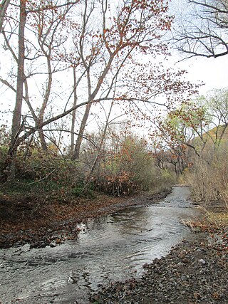
Mayhill is an unincorporated community in Otero County, New Mexico, United States. It is surrounded by the Lincoln National Forest on the eastern slope of the Sacramento Mountains, at the confluence of James Canyon and Rio Penasco, approximately 17 miles (27 km) east of Cloudcroft.
Ojo Sarco is an unincorporated community located in Rio Arriba County, New Mexico, United States. Ojo Sarco is located in the Sangre de Cristo Mountains, 1 mile (1.6 km) from New Mexico State Road 76 and 1.5 miles (2.4 km) west-southwest of Las Trampas. Ojo Sarco had its own post office until June 8, 1996.
Llano, also known as Llano de San Juan is an unincorporated community located in Taos County, New Mexico, United States. The community is located on New Mexico State Road 73, 2.1 miles (3.4 km) south of Peñasco. It was founded in 1796 after governor Fernando Chacon gave permission for settlement in the valley. A post office was operated from 1898 to 1914, and was then reestablished in 1925.
New Mexico State Road 75 is a 20.6 mi (33.2 km) long state highway in Northern New Mexico, located in the Southwestern United States. NM 75 is located on the western slope of the Sangre de Cristo Mountains starting near the Rio Grande, passes through Pircuris Pueblo, and ends as a segment of the High Road to Taos near Peñasco.
Peñasco Independent School District is a school district headquartered in Peñasco, New Mexico. It has two schools: an elementary school and a secondary school. The elementary school is located just off Federal Highway 82, in the desert about 12 miles west of Hope, New Mexico, the nearest community.
References
- ↑ "Desert Rainbows". August 24, 2013.
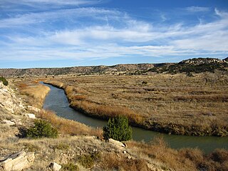
- ↑ "USGS Current Conditions for USGS 08397600 RIO PENASCO NEAR DUNKEN, NM". waterdata.usgs.gov.
- ↑ "Rio Penasco Watershed (HUC8 13060010) Rapid Watershed Assessment" (PDF). www.nrcs.usda.gov. Retrieved 2021-01-15.