Rivière-Ojima is an unorganized territory in the Abitibi-Témiscamingue region of Quebec, Canada. It consists of two non-contiguous areas in the Abitibi-Ouest Regional County Municipality, separated by the municipality of Authier-Nord. The hamlets of Languedoc and Saint-Eugène-de-Chazel are located within its boundaries.

Saint-André-d'Argenteuil is a municipality in the Laurentides region of Quebec, Canada, part of the Argenteuil Regional County Municipality. It is located along the Ottawa River, just south of Lachute.

Lac-Blanc is an unorganized territory in the Capitale-Nationale region of Quebec, Canada, in the north-east of the Portneuf Regional County Municipality. This unorganized territory covers 567.80 km ². The main lake, designated "White Lake" has the shape of a fine, oriented north–south. The discharge of this lake is on the southern tip, where it flows into the White River.

Lac-Ashuapmushuan is an unorganized territory in the Canadian province of Quebec, Canada, located in the regional county municipality of Le Domaine-du-Roy. The region had a population of 140 as of the Canada 2021 Census, and covered a land area of 14,684.28 km2. It is home to the Ashuapmushuan Wildlife Reserve.

Mont-Valin is an unorganized territory in the Canadian province of Quebec. It makes up over 87% of Le Fjord-du-Saguenay Regional County Municipality and is the largest subdivision of the Saguenay–Lac-Saint-Jean region. The territory, named after Mount Valin, had a population of 10 as of the Canada 2021 Census, and covered a land area of 33,540.39 km2.
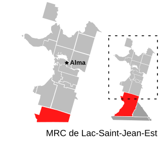
Belle-Rivière is an unorganized territory in the Canadian province of Quebec, located in the regional county municipality of Lac-Saint-Jean-Est. It had a population of 10 in the Canada 2021 Census, and covered a land area of 608.47 km2. The Métabetchouane River forms its western boundary.
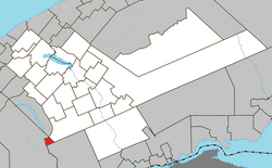
Lac-Achouakan is an unorganized territory in the Canadian province of Quebec, located in the regional county municipality of Lac-Saint-Jean-Est. It had a population of zero in the Canada 2006 Census, and covered a land area of 227.35 km2, entirely within the Laurentides Wildlife Reserve. The western boundary of the territory is Bark River, while Quebec Route 169 forms the eastern boundary.

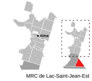
Mont-Apica is an unorganized territory in the Canadian province of Quebec, located in the regional county municipality of Lac-Saint-Jean-Est. It had a population of 0 in the Canada 2011 Census, and covered a land area of 12.68 km2, entirely within the Laurentides Wildlife Reserve.

Rivière-Mistassini is an unorganized territory in the Canadian province of Quebec, located in the regional county municipality of Maria-Chapdelaine. The territory had a population of 27 as of the Canada 2021 Census, and covered a land area of 17,629.74 km2.

Lac-Pikauba is an unorganized territory in the Capitale-Nationale region of Quebec, Canada. It is a large, unpopulated, undeveloped territory that makes up two-thirds of the Charlevoix Regional County Municipality.

Rivière-aux-Outardes is an unorganized territory in the Côte-Nord region of Quebec, Canada. It makes up almost 95% of the Manicouagan Regional County Municipality.
Rivière-Nipissis is an unorganized territory in the Côte-Nord region of Quebec, Canada, part of the Sept-Rivières Regional County Municipality.

Petit-Mécatina is an unorganized territory in the Côte-Nord region of Quebec, Canada, part of Le Golfe-du-Saint-Laurent Regional County Municipality. It was formerly part of the Minganie Regional County Municipality, but transferred to the current MRC in July 2010.
Rivière-Mouchalagane is an unorganized territory in the Côte-Nord region of Quebec, Canada, part of Caniapiscau Regional County Municipality.

Rivière-Bonaventure is an unorganized territory in the Gaspésie–Îles-de-la-Madeleine region of Quebec, Canada.

Rivière-Bonjour is an unorganized territory in the Bas-Saint-Laurent region of Quebec, Canada. A large part of the territory is part of the Matane Wildlife Reserve. Other portions of the territory are partially within the Gaspésie National Park, Rivière-Cascapédia Wildlife Reserve, and Zec de Cap-Chat. Outdoor recreation and forestry are the main activities.

Ruisseau-des-Mineurs is an unorganized territory in the Bas-Saint-Laurent region of Quebec, Canada. It is named after the Miners Creek, a tributary of the Cascapédia River via the Branche du Lac River.

Lac-Casault is an unorganized territory in the Bas-Saint-Laurent region of Quebec, Canada.

Routhierville is an unorganized territory in the Bas-Saint-Laurent region of Quebec, Canada. The territory is bisected by the Matapédia River and Quebec Route 132 that runs parallel to it. There are two hamlets in the territory: the eponymous Routhierville and Milnikek.
Rivière-Vaseuse is an unorganized territory in the Bas-Saint-Laurent region of Quebec, Canada.