The Armed Forces of Bolivia are official organizations responsible for the defence, both of external and internal, of Bolivia and they are constituted by Bolivian Army, the Bolivian Air Force and the Bolivian Navy. All these institutions depend on the Ministry of Defence of this country.

Fenchurch Street railway station, also known as London Fenchurch Street, is a central London railway terminus in the southeastern corner of the City of London. It takes its name from its proximity to Fenchurch Street, a key thoroughfare in the City. The station and all trains are operated by c2c. Services run on lines built by the London and Blackwall Railway (L&BR) and the London, Tilbury and Southend Railway (LTSR) to destinations in east London and south Essex, including Upminster, Grays, Basildon, Southend and Shoeburyness.

Arque is a location in the Cochabamba Department, Bolivia. It is the seat of Arque Province and Arque Municipality. Arque is situated at an elevation of 10,735 ft on the northern bank of Arque River. At the time of census 2001 it had a population of 487.

The Bolivian Army is the land forces component of the Armed Forces of Bolivia. Figures on the size and composition of the Bolivian army vary considerably, with little official data available. It is estimated that the army has between 26,000 to 60,000 men.

Dunkeld & Birnam railway station serves the towns of Dunkeld and Birnam in Perth and Kinross, Scotland. It is located on the Highland Main Line, 15 miles 31 chains (24.8 km) north of Perth and is the first stop on the line north of there. It has a passing loop 28 chains (560 m) long, flanked by two platforms. Platform 1 on the up (southbound) line can accommodate trains having twelve coaches, but platform 2 on the down (northbound) line can only hold ten. When no crossing is to be made, northbound trains are usually routed through platform 1 which is signalled for bi-directional running.

The Bolivian Air Force is part of the Military of Bolivia.
Following is a list of railway stations in Bolivia, categorized by eastern and western networks. The eastern and western networks do not directly connect, except via a roundabout route through Argentina.
Thetford Bridge railway station served the eastern part of Thetford, Norfolk, England between 1875 and 1953.

Asansol Junction railway station is a Division of Eastern Railway Zone in Asansol Sadar subdivision of Paschim Bardhaman district in the Indian state of West Bengal. The station is on the Howrah–Delhi main line. It is the 8th busiest railway station in India in terms of frequency of trains after Kanpur Central, Vijayawada Junction, Delhi Junction, New Delhi, Ambala Cant, Howrah and Patna Junction. Around 171 trains pass through the station daily. It serves Asansol and the surrounding areas.
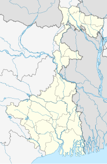
New Gitaldaha railway station is on the broad-gauge Alipurduar–Bamanhat branch line.

Sitarampur Junction, station code STN, is the railway station serving the neighbourhood of Neamatpur and Sitarampur in Asansol, Paschim Bardhaman district in the Indian state of West Bengal. Sitarampur Junction is part of the Asansol Division of the Eastern Railway zone of the Indian Railways. Sitarampur Junction is connected to metropolitan areas of India, Delhi–Kolkata main line via Mugalsarai–Patna route as well as the Grand Chord route. It has an average elevation of 99 metres (325 ft).

Kolkata railway station is the newest of the five intercity railway stations serving Howrah and Kolkata, India; the others are Sealdah station in Kolkata and Howrah station, Shalimar station and Santragachi Junction in Howrah. Kolkata station is situated in the Chitpur locality of North Kolkata.

Durgapur is a model railway station on the Bardhaman–Asansol section. It is located in Paschim Bardhaman district in the Indian state of West Bengal. It serves Durgapur, the third most populous city in West Bengal, and the surrounding industrial areas. It was ranked the third-cleanest railway station in India in 2019.

Barachak is a railway station in Asansol, Paschim Bardhaman district, West Bengal, India. This is a railway station between Asansol and Sitarampur railway stations.
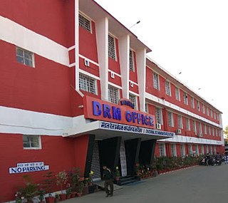
Katihar railway division is one of the five railway divisions under Northeast Frontier Railway zone of Indian Railways. This railway division was formed on 15 January 1958 and its headquarter is located at Katihar in the state of Bihar of India.
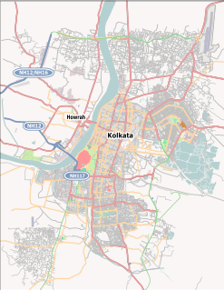
Uttarpara railway station is a Kolkata Suburban Railway station on the Howrah–Bardhaman main line. It is located in Hooghly district in the Indian state of West Bengal. It is under the jurisdiction of Eastern Railway zone. Uttarpara railway station is a small railway stations of Howrah railway division. It serves Uttarpara and surrounding areas. It is 10 km. from Howrah station.

Bally railway station is a Kolkata Suburban Railway station on the Howrah–Bardhaman main line and Howrah–Bardhaman chord line. It is located in Howrah in the Indian state of West Bengal. It is under the jurisdiction of Eastern Railway zone. Bally railway station is a small railway junction of Howrah railway division. It serves Bally and surrounding areas. It is 8 km. from Howrah Station.

Garifa railway station is a railway station on Naihati – Bandel Branch line of Howrah railway division of Eastern Railway zone. It is situated at Hazi Nagar, Ramghat, Garifa in North 24 Parganas district in the Indian state of West Bengal. Garifa is a connecting station of Sealdah main line and Howrah–Bardhaman main line through Sampreeti Bridge and Jubilee Bridge. Number of Passenger and Naihati Bandel EMU locals stop at Garifa railway station.

Santiago de Chiquitos is a small town in Roboré Municipality in Chiquitos Province, Santa Cruz Department, Bolivia. The mission of Santiago de Chiquitos is one of the Jesuit Missions of the Chiquitos.

