
The Umpqua River on the Pacific coast of Oregon in the United States is approximately 111 miles (179 km) long. One of the principal rivers of the Oregon Coast and known for bass and shad, the river drains an expansive network of valleys in the mountains west of the Cascade Range and south of the Willamette Valley, from which it is separated by the Calapooya Mountains. From its source northeast of Roseburg, the Umpqua flows northwest through the Oregon Coast Range and empties into the Pacific at Winchester Bay. The river and its tributaries flow entirely within Douglas County, which encompasses most of the watershed of the river from the Cascades to the coast. The "Hundred Valleys of the Umpqua" form the heart of the timber industry of southern Oregon, generally centered on Roseburg.

The South Santiam River is a tributary of the Santiam River, about 69 miles (111 km) long, in western Oregon in the United States. It drains an area of the Cascade Range into the Willamette Valley east of Corvallis.

The Chewaucan River is part of the Great Basin drainage. It flows 53 miles (85 km) through the Fremont–Winema National Forests, Bureau of Land Management land, and private property in southern Oregon. Its watershed consists of 651 square miles (1,690 km2) of conifer forest, marsh, and rural pasture land. The river provides habitat for many species of wildlife including native Great Basin redband trout a subspecies of rainbow trout.

Quartzville Creek is a 28-mile (45 km) tributary of the Middle Santiam River in Linn County in the U.S. state of Oregon. It is paralleled by the Quartzville Back Country Byway and used for recreation, including camping, fishing, hunting, kayaking, and gold panning. The lower 12 miles (19 km) of the creek, from the Willamette National Forest boundary to Green Peter Reservoir, was designated Wild and Scenic in 1988.

Catherine Creek is a 32.4-mile-long (52.1 km) creek in northeastern Oregon, United States. A tributary of the Grande Ronde River, it is the second-longest stream in the Grande Ronde Valley. Originating in the foothills of the Wallowa Mountains, it flows generally northwest through Catherine Creek State Park and the city of Union before joining the river.

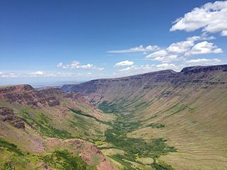
Silver Creek is an 87-mile (140 km) stream of Oregon which drains a portion of the endorheic Harney Basin to Harney Lake. Arising in the Blue Mountains, it flows generally southeast, although much of the stream is intermittent. The Silver Creek Volcanic Field is associated with the creek's watershed.

Trout Creek is a 51-mile (82 km) long tributary of the Deschutes River in the U.S. state of Oregon. It drains approximately 692 square miles (1,792 km2) of Crook, Jefferson, and Wasco counties. Arising in the Ochoco Mountains, it flows north and then west to its confluence with the Deschutes River.

Fifteenmile Creek is a 54-mile (87 km) long tributary of the Columbia River in the U.S. state of Oregon. It drains 373 square miles (966 km2) of Hood River and Wasco counties. Arising in the Cascade Range near Mount Hood, it flows northeast then west to its confluence with the Columbia near The Dalles.

The North Fork Malheur River is a 59-mile (95 km) tributary of the Malheur River in eastern Oregon in the United States. Rising in Big Cow Burn in the Blue Mountains, it flows generally south to join the larger river at Juntura. The upper 25.5 miles (41.0 km) of the river have been designated Wild and Scenic. This part of the river basin offers camping, hiking, and fishing opportunities in a remote forest setting. The lower river passes through Beulah Reservoir, which stores water for irrigation and has facilities for boaters.
Rock Creek is an 82-mile (132 km) tributary of the John Day River in the U.S. state of Oregon. The source of the creek is at an elevation of 4,351 feet (1,326 m) in the Umatilla National Forest, while the mouth is at an elevation of 404 feet (123 m) east of Wasco. Rock Creek has a 507-square-mile (1,310 km2) watershed.
West Little Owyhee River is a 63.1-mile-long (101.5 km) tributary of the Owyhee River in the U.S. state of Oregon. The source of the river is at an elevation of 6,508 feet (1,984 m) near McDermitt, while the mouth is at an elevation of 4,373 feet (1,333 m) in the Owyhee Desert. West Little Owyhee River has a 310-square-mile (800 km2) watershed.
Kiger Creek is a tributary of Swamp Creek in Harney County in the U.S. state of Oregon. It originates on Steens Mountain and flows generally north through Kiger Gorge to meet Swamp Creek near the unincorporated community of Diamond. The combined streams flow into Diamond Swamp and the Malheur National Wildlife Refuge.

Whychus Creek is a tributary of the Deschutes River in Deschutes and Jefferson counties in the U.S. state of Oregon. Formerly named Squaw Creek, considered derogatory in the 21st century, it was renamed in 2006. Explorer John C. Frémont camped along the stream in 1843 but did not identify it by name. Robert S. Williamson, a surveyor who camped there in 1855, said its Indian name was Why-chus.

Granite Creek is a 38-mile (61 km) tributary of the Verde River in the U.S. state of Arizona. It flows generally north-northeast from the Bradshaw Mountains of west-central Arizona through the city of Prescott and the Granite Dells to meet the river at the north end of the Little Chino Valley east of Sullivan Lake.

The Catlow Valley is a basin in Harney County, Oregon, United States. It is a remote valley at the northwestern corner of North America's Basin and Range Province. The valley is named after a pioneer rancher, John Catlow. The area was used by Native Americans for thousands of years before European explorers arrived in the 19th century. Today, cattle ranching is the main commercial activity in the valley. The public land in the Catlow Valley is administered by the Bureau of Land Management. This public land offers a number of recreational opportunities including hiking, hunting, fishing, bird watching, and wildlife viewing.

French Pete Creek is a tributary of the South Fork McKenzie River in Lane County, in the U.S. state of Oregon. It flows generally west through the Three Sisters Wilderness to the south end of Cougar Reservoir, about 11 miles (18 km) from the larger river's confluence with the McKenzie River. The creek has two named tributaries—Olallie Creek and, further downstream, Pat Creek—both of which enter from the right.
The South Fork Salmon River is a tributary of the Salmon River in Clackamas County in the U.S. state of Oregon. Arising near Plaza Lake, it flows generally northeast along the east side of Salmon Mountain to meet the Salmon 11 miles (18 km) upstream of the larger stream's confluence with the Sandy River at Brightwood.

Big Creek is a stream that enters the Pacific Ocean along the coast of Lane County in the U.S. state of Oregon. Beginning at Saddle Mountain Spring in the Central Oregon Coast Range, it flows generally west through the Siuslaw National Forest to the ocean north of Heceta Head. Near its mouth, it passes under Big Creek Bridge, which carries U.S. Route 101.
The East Fork Coquille River is a tributary, about 34 miles (55 km) long, of the North Fork Coquille River in the U.S. state of Oregon. It begins near Bennett Rock in Douglas County in the Southern Oregon Coast Range.

Pass Creek is a tributary of Elk Creek in the Umpqua River basin of the U.S. state of Oregon. It begins at Divide between the Coast Fork Willamette River watershed and the Umpqua watershed along Interstate 5 (I-5) in Lane County. It flows west into Douglas County and continues generally southwest to meet Elk Creek at the city of Drain, 24 miles (39 km) upstream of Elk Creek's confluence with the Umpqua.


