A post office called Rockbridge has been in operation since 1863.[4] The community was named after a nearby natural sandstone arch, which stretches approximately 100 feet (30m) in length and 10 to 20 feet (3.0 to 6.1m) in width. In the 19th century, the arrival of the Hocking Canal and later the railroad increased visitation to the area. In 1977, the land surrounding the arch was sold to the state, and in 1978 it was designated as the Rockbridge State Nature Preserve.[5]
The Rockbridge Network, a political advocacy group formed during a 2019 conference at an inn near Rockbridge, was named after the town.[6]
Geography
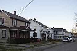
Rockbridge is located in eastern Good Hope Township at the junction of U.S. Route 33 and State Route 374, approximately 40 miles (64km) southeast of Columbus. The area lies within the Hocking Hills region of the Allegheny Plateau, known for its rugged topography, sandstone cliffs, and forested valleys.[7]
Rockbridge State Nature Preserve
The Rockbridge State Nature Preserve spans 182 acres and protects the Rockbridge Natural Arch, Ohio's largest natural bridge. The arch is carved from Mississippian Black Hand Sandstone and formed by erosion over millions of years. It is approximately 100 feet (30m) long, 10 to 20 feet (3.0 to 6.1m) wide, and 3 to 5 feet (0.91 to 1.52m) thick, arching about 50 feet (15m) above a ravine on a tributary of the Hocking River. The preserve includes about 2.75 miles (4.43km) of hiking trails, including one leading directly to the bridge and another forming a longer loop.[8]
Recreation and tourism
Rockbridge serves as a gateway to the Hocking Hills region and hosts numerous tourist attractions including zip-lining (such as Hocking Hills Canopy Tours), antique shops, cabin rentals, and canoe outfitters. The nearby Clear Creek Metro Park offers additional hiking trails, birdwatching, and naturalist programs. Rockbridge’s proximity to U.S. Route 33 makes it a common stop for visitors heading into Hocking Hills.[9]
Transportation
The community is centered around the interchange of U.S. Route 33 and State Route 374. Historically, both the Hocking Canal and railroads played a significant role in bringing tourists and settlers to the area.[10]
This page is based on this Wikipedia article Text is available under the CC BY-SA 4.0 license; additional terms may apply. Images, videos and audio are available under their respective licenses.