
London is an unincorporated community in northeastern Kimble County, Texas, United States. According to the Handbook of Texas, the community had an estimated population of 180 in 2000.
Kimble County is a county located on the Edwards Plateau in the U.S. state of Texas. As of the 2020 census, its population was 4,286. Its county seat is Junction. The county was created in 1858 and organized in 1876. It is named for George C. Kimble, who died at the Battle of the Alamo.

The Rough Riders was a nickname given to the 1st United States Volunteer Cavalry, one of three such regiments raised in 1898 for the Spanish–American War and the only one to see combat. The United States Army was small, understaffed, and disorganized in comparison to its status during the American Civil War roughly thirty years prior. Following the sinking of USS Maine, President William McKinley needed to muster a strong ground force swiftly, which he did by calling for 125,000 volunteers to assist in the war. The U.S. had gone to war in opposition to Spanish colonial policies in Cuba, which was then torn by a rebellion. The regiment was also nicknamed "Wood's Weary Walkers" for its first commander, Colonel Leonard Wood. This reflected their dissatisfaction that despite being cavalry, they ended up fighting in Cuba as infantry, since their horses were not sent there with them.

The Battle of San Juan Hill, also known as the Battle for the San Juan Heights, was a major battle of the Spanish–American War fought between an American force under the command of William Rufus Shafter and Joseph Wheeler against a Spanish force led by Arsenio Linares y Pombo. The battle proved to be one of the most significant battles of the war and, along with the Siege of Santiago, a decisive battle in deciding the fate of the United States Army campaign in Cuba. The American forces, outnumbering the Spanish defenders 16-to-one, charged upon the heights and dispersed the Spanish after suffering heavy casualties.

Fort Assinniboine was a United States Army fort located in present-day north central Montana. It was built in 1879 and operated by the Army through 1911. The 10th Cavalry Buffalo Soldiers, made up of African-American soldiers, were among the units making up the garrison at the fort. Determining that this fort was no longer needed after the end of the Indian Wars, the US Army closed and abandoned it.
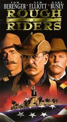
Rough Riders is a 1997 American television miniseries directed and co-written by John Milius about future President Theodore Roosevelt and the regiment known as the 1st US Volunteer Cavalry; a.k.a. the Rough Riders. The series prominently shows the bravery of the volunteers at the Battle of San Juan Hill, part of the Spanish–American War of 1898. It was released on DVD in 2006. The series originally aired on TNT with a four-hour running time, including commercials, over two consecutive nights during July 1997. It is, as of 2022, John Milius' last directorial credit for a film.

Alexander Oswald Brodie was an American military officer and engineer. Earning his initial reputation during the Indian wars, he came to prominence for his service with the Rough Riders during the Spanish–American War. His friendship with Theodore Roosevelt then led to Brodie being appointed Governor of Arizona Territory from 1902 to 1905.

William Owen "Buckey" O'Neill was a sheriff, newspaper editor, miner, politician, Georgist, gambler and lawyer, mainly in Arizona. His nickname came from his tendency to "buck the tiger" at faro or other card games. He later became a captain in Theodore Roosevelt's Rough Riders, and died in battle.

Hamilton Fish II was a wealthy New Yorker who was a member of a prominent Fish family. During the Spanish–American War he joined the Rough Riders in the invasion of Cuba, where he died in the Battle of Las Guasimas.

Telegraph is a ghost town on State Highway 377, 13 miles (20 km) southwest of Junction, in Kimble County, Texas, United States.

Thomas Harbo Rynning was an officer in the United States Army who served with Theodore Roosevelt's Rough Riders during the Spanish–American War. He was also the captain of the Arizona Rangers, warden of Yuma Territorial Prison, and a United States Marshal in San Diego, California.
Captain Allyn K. Capron was the first United States Army officer to die in the Spanish–American War.
Jules Garesche "Gary" Ord was a United States Army First Lieutenant who was killed in action after leading the charge of Buffalo Soldiers of the 10th U.S. Cavalry up San Juan Hill. History now records that Ord was responsible for the "spontaneous" charge that took the San Juan Heights during the Spanish–American War in Cuba on July 1, 1898.
The 1st Regiment New Mexico Cavalry was a volunteer cavalry regiment in the Union Army during the American Civil War.

The Rough Riders Memorial is a memorial in Arlington National Cemetery in Arlington County, Virginia, in the United States that commemorates those members of the "Rough Riders" who died in the Spanish–American War in 1898. The grey granite shaft was erected by surviving members of the Rough Riders and their friends and supporters. Although Arlington National Cemetery, a number of secondary sources, and even the bronze plaque on the memorial say the monument was dedicated in 1906 and one source says 1905, contemporary newspaper accounts show the memorial was dedicated on April 12, 1907.
Henry W. Nash, was an Arizona pioneer who served as a Sergeant in Theodore Roosevelt's Rough Riders during the Spanish–American War. Later, he was one of the first Thomasites sent by the U.S. government to establish an English language-based public education system in the Philippines in the early 1900s.

Benjamin Franklin Daniels was an Arizona pioneer, best known for serving as a lawman in rough Western towns and the sheriff of Pima County shortly before his death in 1923. He was also a member of the Rough Riders, superintendent of the Yuma Territorial Prison, United States Marshal for the Territory of Arizona and a miner.

Allen Depot was established in 1876 in the central ward of Allen, Texas. The train depot served as a water stop for the Galveston and Red River Railway chartered by Ebenezer Allen in 1848. By 1856, the Southeast Texas to Red River railroad would transition to the Houston and Texas Central Railway.
Roosevelt Park in San Antonio, Texas is named for President Theodore Roosevelt. The origins of the park date to 1888, when it was known as the International Fair Grounds. The name was changed to Roosevelt Park in 1920. Its current layout and design was created by the architectural firm of Hare & Hare, and for a brief time was known as Lambert Park, before returning the name to Roosevelt Park


