Rosebud Creek (Yukon)

Last updated

Rosebud Creek is a creek in eastcentral Yukon, Canada.

Yukon Territory of Canada

Yukon is the smallest and westernmost of Canada's three federal territories. It has the smallest population of any province or territory in Canada, with 35,874 people. Whitehorse is the territorial capital and Yukon's only city.

Canada Country in North America

Canada is a country in the northern part of North America. Its ten provinces and three territories extend from the Atlantic to the Pacific and northward into the Arctic Ocean, covering 9.98 million square kilometres, making it the world's second-largest country by total area. Canada's southern border with the United States is the world's longest bi-national land border. Its capital is Ottawa, and its three largest metropolitan areas are Toronto, Montreal, and Vancouver. As a whole, Canada is sparsely populated, the majority of its land area being dominated by forest and tundra. Consequently, its population is highly urbanized, with over 80 percent of its inhabitants concentrated in large and medium-sized cities, many near the southern border. Canada's climate varies widely across its vast area, ranging from arctic weather in the north, to hot summers in the southern regions, with four distinct seasons.

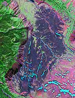
The landscape surrounding Rosebud Creek lies in the Fort Selkirk Volcanic Field of the Northern Cordilleran Volcanic Province. During the Pliocene period, a basaltic lava flow from the Fort Selkirk field engulfed the Rosebud Creek area. Remnants of this lava flow are exposed along both sides of Rosebud Creek in the area of the confluence of Rosebud and Grand Valley creeks. [1]

Northern Cordilleran Volcanic Province

The Northern Cordilleran Volcanic Province (NCVP), formerly known as the Stikine Volcanic Belt, is a geologic province defined by the occurrence of Miocene to Holocene volcanoes in the Pacific Northwest of North America. This belt of volcanoes extends roughly north-northwest from northwestern British Columbia and the Alaska Panhandle through Yukon to the Southeast Fairbanks Census Area of far eastern Alaska, in a corridor hundreds of kilometres wide. It is the most recently defined volcanic province in the Western Cordillera. It has formed due to extensional cracking of the North American continent—similar to other on-land extensional volcanic zones, including the Basin and Range Province and the East African Rift. Although taking its name from the Western Cordillera, this term is a geologic grouping rather than a geographic one. The southmost part of the NCVP has more, and larger, volcanoes than does the rest of the NCVP; further north it is less clearly delineated, describing a large arch that sways westward through central Yukon.

The Pliocene Epoch is the epoch in the geologic timescale that extends from 5.333 million to 2.58 million years BP. It is the second and youngest epoch of the Neogene Period in the Cenozoic Era. The Pliocene follows the Miocene Epoch and is followed by the Pleistocene Epoch. Prior to the 2009 revision of the geologic time scale, which placed the four most recent major glaciations entirely within the Pleistocene, the Pliocene also included the Gelasian stage, which lasted from 2.588 to 1.806 million years ago, and is now included in the Pleistocene.

Basalt A magnesium- and iron-rich extrusive igneous rock

Basalt is a mafic extrusive igneous rock formed from the rapid cooling of magnesium-rich and iron-rich lava exposed at or very near the surface of a terrestrial planet or a moon. More than 90% of all volcanic rock on Earth is basalt. Basalt lava has a low viscosity, due to its low silica content, resulting in rapid lava flows that can spread over great areas before cooling and solidification. Flood basalt describes the formation in a series of lava basalt flows.

See also

Related Research Articles

Tuya volcanic field mountain in Canada

The Tuya volcanic field is a volcanic field of tuyas located in far northern British Columbia, Canada, near the border with the Yukon Territory and focused on the area of the Tuya Range, a subrange of the Stikine Ranges of the Cassiar Mountains, though some vents are in the Kawdy Plateau, the northernmost part of the Stikine Plateau. Several small shield volcanoes, and postglacial lapilli cones and lava flows have been reported in this area. The only nonglacial volcanoes in the field are Gabrielse Cone and the West Tuya lava field.

Tuya Butte is a tuya in the Tuya Range of north-central British Columbia, Canada. It is a bit less isolated from other ranges than neighbouring Mount Josephine. Some of the other volcanoes in the area include South Tuya, Ash Mountain, and Mathews Tuya.

Atlin Volcanic Field mountain range

The Atlin Volcanic Field, also called the Llangorse Volcanic Field and the Surprise Lake Volcanic Field, is a group of late-Pleistocene to Holocene cinder cones that lies on the Teslin Plateau east of Atlin Lake, Canada. The largest volcanic feature is the 1880-m-high Ruby Mountain which has been partially dissected by Pleistocene and post-Wisconsin glaciation. Two basaltic cinder cones at the heads of Cracker Creek and Volcanic Creek lie within glacially dissected U-shaped valleys and may be of postglacial age.

Cracker Creek Cone is a small cinder cone in northwestern British Columbia. A large lava flow that partly filled Ruby Creek may have originated from this cone. The lower west side of the cone appears to be partly covered by glacial till suggesting that the cone is older than the most recent glacial advances down Ruby Creek. Cracker Creek Cone is in the Northern Cordilleran Volcanic Province and is one of the three young volcanic cones in the Atlin Volcanic Field.

Volcano Mountain mountain in Canada

Volcano Mountain is a cinder cone in central Yukon Territory, Canada, located a short distance north of Fort Selkirk, near the confluence of the Pelly and Yukon Rivers. Volcano Mountain is called Nelrúna in the Northern Tutchone language.

The Desolation Lava Field is a volcanic field associated with the Mount Edziza volcanic complex in British Columbia, Canada. It covers 150 km2 (58 sq mi) on the northern end of the Mount Edziza volcanic complex and is the largest area of the youngest lava flows. The longest lava flow from the field and the volcanic complex, is about 12 km (7.5 mi) long. Eve Cone, in the middle of the field, is one of the most symmetrical and best preserved cinder cones in Canada.

The Fort Selkirk volcanic field is a monogenetic volcanic field in the Northern Cordilleran Volcanic Province, Yukon Territory, Canada. It is the northernmost Holocene age volcanic field in Canada, located close to the connection of the Yukon and Pelly rivers. The youngest eruptions within the field are unknown. However, the youngest volcano Volcano Mountain produced lava flows that appear to be only a few hundred years old.

Ne Ch'e Ddhawa is a volcano located 7 km (4.3 mi) upstream from Fort Selkirk in the Fort Selkirk Volcanic Field of central Yukon, Canada. It has been described as a cinder cone or a subglacial mound. The volcano erupted subglacially during the late Pleistocene, erupting hyaloclastite tuffs, breccias, and pillow breccias.

Snowshoe Lava Field

The Snowshoe Lava Field is a volcanic field associated with the Mount Edziza volcanic complex in northern British Columbia, Canada. It is on the southern end of the Big Raven Plateau and is an area of young lava flows.

Volcanology of Northern Canada

Volcanology of Northern Canada includes hundreds of volcanic areas and extensive lava formations across Northern Canada. The region's different volcano and lava types originate from different tectonic settings and types of volcanic eruptions, ranging from passive lava eruptions to violent explosive eruptions. Northern Canada has a record of very large volumes of magmatic rock called large igneous provinces. They are represented by deep-level plumbing systems consisting of giant dike swarms, sill provinces and layered intrusions.

The Minto is the name of a lava flow located in Yukon that was erupted during the Holocene period in the Fort Selkirk Volcanic Field of the Northern Cordilleran Volcanic Province.

The Wolverine Formation is a geological formation in central Yukon, Canada. It consists of a lava flow in the Fort Selkirk Volcanic Field of the Northern Cordilleran Volcanic Province that was erupted during the Pleistocene period.

Holbrook Creek is a creek in east central Yukon, Canada.

Fort Selkirk Vent is a geological name for a cinder cone in central Yukon, Canada, located just east of Fort Selkirk along the Yukon River.

Mess Lake Lava Field

The Mess Lake Lava Field is a volcanic field associated with the Mount Edziza volcanic complex of the Northern Cordilleran Volcanic Province in northwestern British Columbia, Canada. It lies northwest of the Spectrum Range on the Kitsu Plateau and consists of young basaltic lava flows and tephra. The source for the basaltic lava and tephra was three cinder cones, including Mess Lake Cone and The Ash Pit, which may be the youngest volcanic feature of the Mount Edziza volcanic complex.

Walkout Creek Cone is a cinder cone in northwestern British Columbia, Canada. It is one of the volcanoes that produced young basaltic lava flows in the central portion of the Mount Edziza volcanic complex in the past 10,000 years. These basaltic lava flows form a volcanic field called the Snowshoe Lava Field.

The Volcano (British Columbia) mountain in Canada

The Volcano, also known as Lava Fork volcano, is a small cinder cone in the Boundary Ranges of the Coast Mountains in northwestern British Columbia, Canada. It is located approximately 60 km (40 mi) northwest of the small community of Stewart near the head of Lava Fork. With a summit elevation of 1,656 m (5,433 ft) and a topographic prominence of 311 m (1,020 ft), it rises above the surrounding rugged landscape on a remote mountain ridge that represents the northern flank of a glaciated U-shaped valley.

Volcanic history of the Northern Cordilleran Volcanic Province

The volcanic history of the Northern Cordilleran Volcanic Province presents a record of volcanic activity in northwestern British Columbia, central Yukon and the U.S. state of easternmost Alaska. The volcanic activity lies in the northern part of the Western Cordillera of the Pacific Northwest region of North America. Extensional cracking of the North American Plate in this part of North America has existed for millions of years. Continuation of this continental rifting has fed scores of volcanoes throughout the Northern Cordilleran Volcanic Province over at least the past 20 million years and occasionally continued into geologically recent times.

References

Coordinates: 63°16′52.9″N138°25′56.9″W / 63.281361°N 138.432472°W / 63.281361; -138.432472

Geographic coordinate system Coordinate system

A geographic coordinate system is a coordinate system that enables every location on Earth to be specified by a set of numbers, letters or symbols. The coordinates are often chosen such that one of the numbers represents a vertical position and two or three of the numbers represent a horizontal position; alternatively, a geographic position may be expressed in a combined three-dimensional Cartesian vector. A common choice of coordinates is latitude, longitude and elevation. To specify a location on a plane requires a map projection.