 | |
|---|---|
| Ruta 13 | |
| Location | |
| Country | Bolivia |
| Highway system | |
| |
Route 13 is a National Road in the South American Andean state of Bolivia.
| | |
|---|---|
| Ruta 13 | |
| Location | |
| Country | Bolivia |
| Highway system | |
| |
Route 13 is a National Road in the South American Andean state of Bolivia.
Route 13 has a length of 370 kilometers [1] and crosses the northern part of the Bolivian lowland from west to east, from the border with the Brazilian state of Acre to the flood plain of the Beni River. The entire length of the road crosses the Departments of Pando and Beni and leads for the most part through intact tropical rainforest, only in a narrow strip next to the road is slash-burned pasture land. The road begins in the northwest as an extension of the Brazilian "Estrada de Pacífico" (BR-317) in Cobija and ends in the east at El Triangulo on the Route 8, the follows the Beni River from Yucumo in the south to Guayaramerín in the northeast.
The first 33 kilometers of Route 13 in the northwest are paved, the remaining 337 kilometers from Porvenir to El Triangulo are unpaved. The road crosses on its way five large rivers, three of which have to be crossed by ferry: with a ferry of the Madre de Dios River and the Manupare River at Sena and with a second of the Beni River, which forms the border between the departments of Pando and Beni. There are bridges over the Orthon River at Puerto Rico and the Geneshuaya River, the easternmost of the five rivers. But it is also planned to build via the Beni River and the Madre de Dios and Manupare Rivers, so that ferries are no longer necessary. [2]
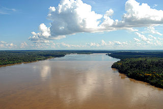
The Madeira River is a major waterway in South America. It is estimated to be 1,450 km (900 mi) in length, while the Madeira-Mamoré is estimated near 3,250 km (2,020 mi) or 3,380 km (2,100 mi) in length depending on the measuring party and their methods. The Madeira is the biggest tributary of the Amazon, accounting for about 15% of the water in the basin. A map from Emanuel Bowen in 1747, held by the David Rumsey Map Collection, refers to the Madeira by the pre-colonial, indigenous name Cuyari.
The River of Cuyari, called by the Portuguese Madeira or the Wood River, is formed by two great rivers, which join near its mouth. It was by this River, that the Nation of Topinambes passed into the River Amazon.

The geography of Bolivia includes the Eastern Andes Mountain Range which bisects Bolivia roughly from north to south. To the east of that mountain chain are lowland plains of the Amazon Basin, and to the west is the Altiplano which is a highland plateau where Lake Titicaca is located. Bolivia's geography has features similar to those of Peru which abuts Bolivia's northwest border; like Bolivia, Peru is bisected from north to south by the Eastern Andes Mountains, and these two countries share Lake Titicaca which is the highest navigable lake on Earth. Unlike Peru, however, Bolivia is one of the two landlocked countries in South America, the other being Paraguay which is located along Bolivia's southeast border.

Beni, sometimes El Beni, is a northeastern department of Bolivia, in the lowlands region of the country. It is the second-largest department in the country, covering 213,564 square kilometers, and it was created by supreme decree on November 18, 1842, during the administration of General José Ballivián. Its capital is Trinidad.

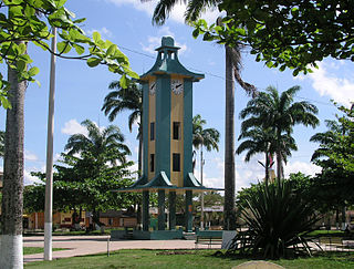
Pando is a department in Northern Bolivia, with an area of 63,827 square kilometres (24,644 sq mi), in the Amazon Rainforest, adjoining the border with Brazil and Perú. Pando has a population of 154,355. Its capital is the city of Cobija.

Madre de Dios is a department and region in southeastern Peru, bordering Brazil, Bolivia and the Peruvian departments of Puno, Cusco and Ucayali, in the Amazon Basin. Its capital is the city of Puerto Maldonado. It is also the third largest department in Peru, after Ucayali and Loreto. However, it is also the least densely populated department in Peru, as well as its least populous department. It has one of the lowest poverty rates in Peru.
Puerto Maldonado is a city in southeastern Peru in the Amazon rainforest 55 kilometres (34 mi) west of the Bolivian border, located at the confluence of the Tambopata and Madre de Dios rivers. The latter river joins the Madeira River as a tributary of the Amazon. This city is the capital of the Department of Madre de Dios.

Abel Iturralde is one of the twenty provinces of the Bolivian La Paz Department. It is situated in its northern part. Its name honors Abel Iturralde Palacios, a Bolivian politician. Madidi National Park is partially in this province.

José Manuel Inocencio Pando Solares was a Bolivian soldier and explorer who served as the 25th President of Bolivia from 1899 to 1904. During his government, the Acre War (1899-1903) began, in which Bolivia clashed with Brazil.

Riberalta is a town in the Beni Department in northern Bolivia, situated where the Madre de Dios River joins the Beni River. Riberalta is on the south bank of the Beni River.

The Llanos de Moxos, also known as the Beni savanna or Moxos plains, is a tropical savanna ecoregion of the Beni Department of northern Bolivia.

The following outline is provided as an overview of and topical guide to Bolivia:

Madre de Dios is one of the five provinces of the Bolivian Pando department and is situated in the southern parts of the department. Its name derives from Madre de Dios River on the northern border of the province.

Manuripi is one of the five provinces of Pando Department in Bolivia and is situated in the northwest of the department. Its name is derived from the Manuripi River, which passes through the province from west to east.
El Triunfo Lake is a lake in the Beni Department, Bolivia.
San Ramón is a small town in the Beni Department in Bolivia.
Puerto Pailas is a canton and town in the Santa Cruz Department in the South American Andean Republic of Bolivia.

Puerto Rico is a small town in Pando, northern Bolivia, with an associated airport. It is located in the Manuripi-Heath Amazonian Wildlife National Reserve. Founded on May 18, 1890, it was the first departamental capital, before Cobija. It is located at the Confluence of the Manuripi and Tahuamanu Rivers. Every year, in the month of June, the International Recreational Fishing Championship of Puerto Rico takes place at the river confluence, where the two rivers combine to form the river the River Orthon. This river then flows 410 km before it converges with the River Beni.
Ese Ejja, also known as Tiatinagua (Tatinawa), is a Tacanan language of Bolivia and Peru. It is spoken by Ese Ejja people of all ages. Dialects are Guacanawa (Guarayo/Huarayo), Baguaja, Echoja, and possibly extinct Chama, Chuncho, Huanayo, Kinaki, and Mohino. Chunene is "similar" to Ese Ejja, though whether a dialect or a separate language is not clear.
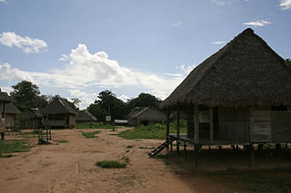
The Ese Ejja are an indigenous people of Bolivia and Peru, in the southwestern Amazon basin. 1,687 Ese Ejja live in Bolivia, in the Pando and Beni Departments, in the foothills along the Beni and the Madre de Dios Rivers. In Peru, they live along the Tambopata and Heath Rivers, near Puerto Maldonado.
Route 3 is a National Road in Bolivia. It connects La Paz to Trinidad via Cororico, Caranavi, Yucumo, and San Ignacio de Moxos.
| National Roads | ||
|---|---|---|
| | This article about transport in Bolivia is a stub. You can help Wikipedia by expanding it. |